
Clearing, cold Monday night; rain Wednesday
Clouds continue to decrease; Tuesday will be brighter and a little warmer
Go Deeper.
Create an account or log in to save stories.
Like this?
Thanks for liking this story! We have added it to a list of your favorite stories.


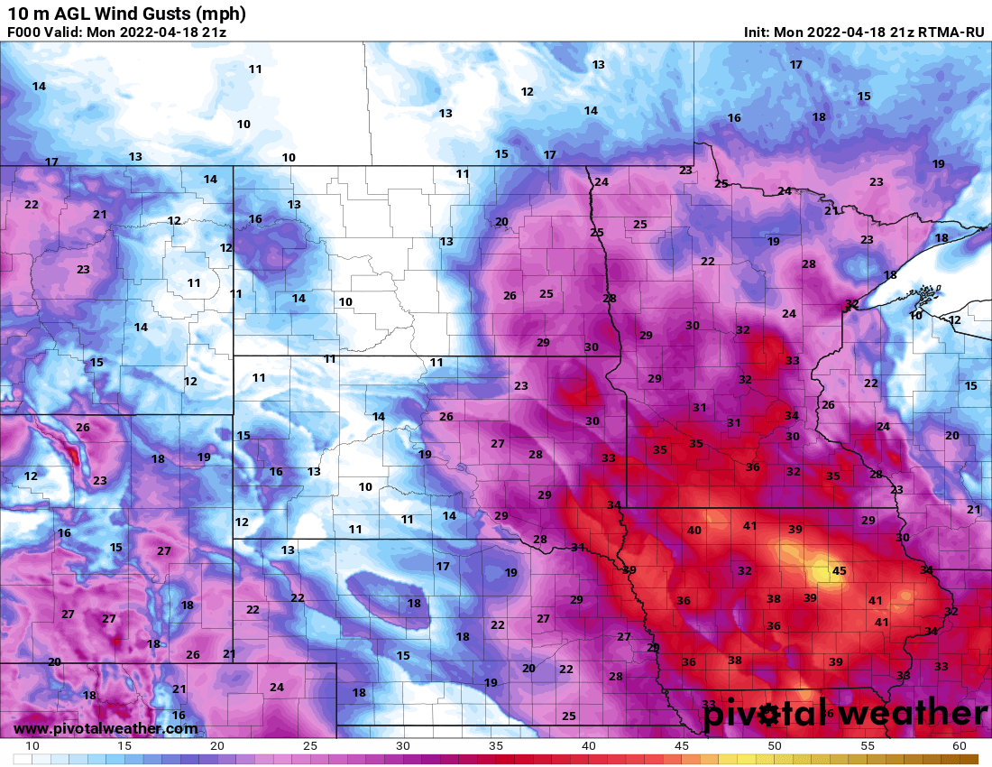
Clouds and blustery winds will decrease through the evening and overnight but that will also lead to a chilly night. Tuesday will bring sun the first half of the day before clouds increase.
A clearing, chilly night
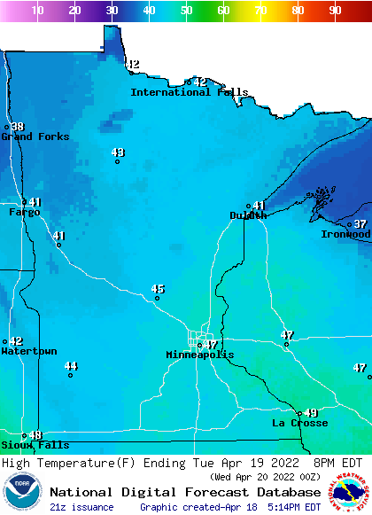
Much of northern Minnesota saw fresh snow; some spots over a half foot along the north shore. My previous post discusses just how much snowier and colder it’s been in northern Minnesota this month. The system that brought the snow is exiting now and while the decrease in cloud cover will be welcome, it will lead to a frigid night for much of Minnesota. Temperatures will dip into the teens across northern Minnesota and 20s in the south.

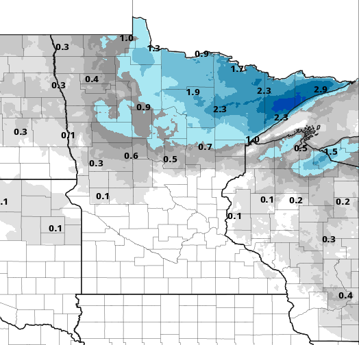
We should have sun the first half of Tuesday before afternoon clouds already increase ahead of the next round of showers Wednesday. High temperatures will be warmer with more widespread 40s. Pockets of northwest and northeast Minnesota will stay in the upper 30s.
It’s not your imagination, its been windy
Winds will be lighter Tuesday under the grips of some short-lived high pressure but it’s been a windy stretch. In fact, April is averaging at least 16% more wind than the normal. It marks the fourth consecutive month of windier than normal conditions.
Turn Up Your Support
MPR News helps you turn down the noise and build shared understanding. Turn up your support for this public resource and keep trusted journalism accessible to all.

More rain but also warmth ahead
Rain and even snow showers (north) develop midday across Minnesota once again with the next disturbance.

We could be talking 1 to 3 inches more snow in northern Minnesota with potentially more deep into the arrowhead into Wednesday evening/night.
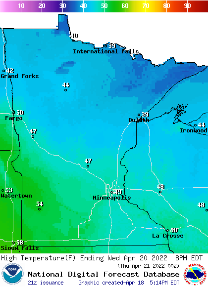
Despite the rain, we’ll be close to 50 in the Twin Cities and points south Wednesday.
We will stay in the 50s and even see more 60s Friday. We have an increasing likelihood of our first 70 for the Twin Cities on Saturday.
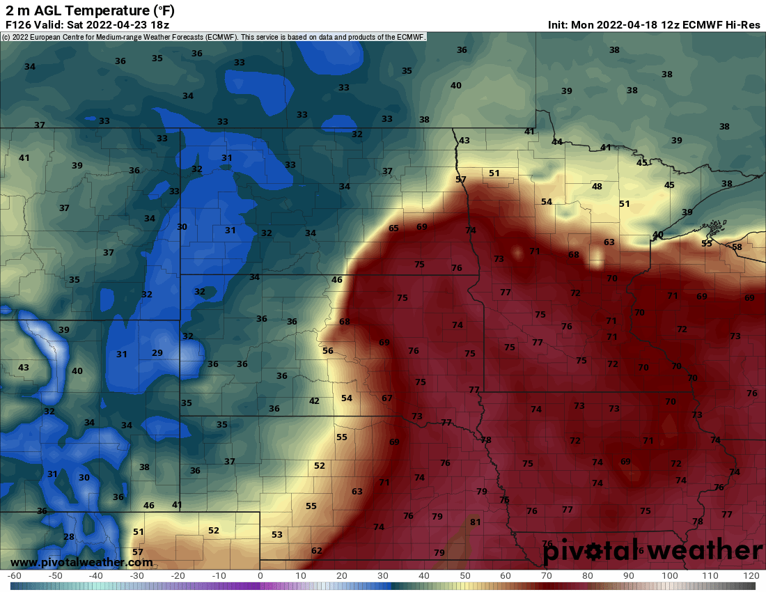
Along with the warmth we’ll see a decent chance of some thunderstorms Friday and Saturday- some of which could be strong to severe in southwestern Minnesota. We’ll need to keep an eye on that set up.

