Wet but warmer later this week
Lingering snow showers, brighter Tuesday, warmer Wednesday
Go Deeper.
Create an account or log in to save stories.
Like this?
Thanks for liking this story! We have added it to a list of your favorite stories.


Lingering snow showers and clouds Monday morning give way to some afternoon sun in western Minnesota. It’ll be windy, with gusts up to 40 to 45 mph.
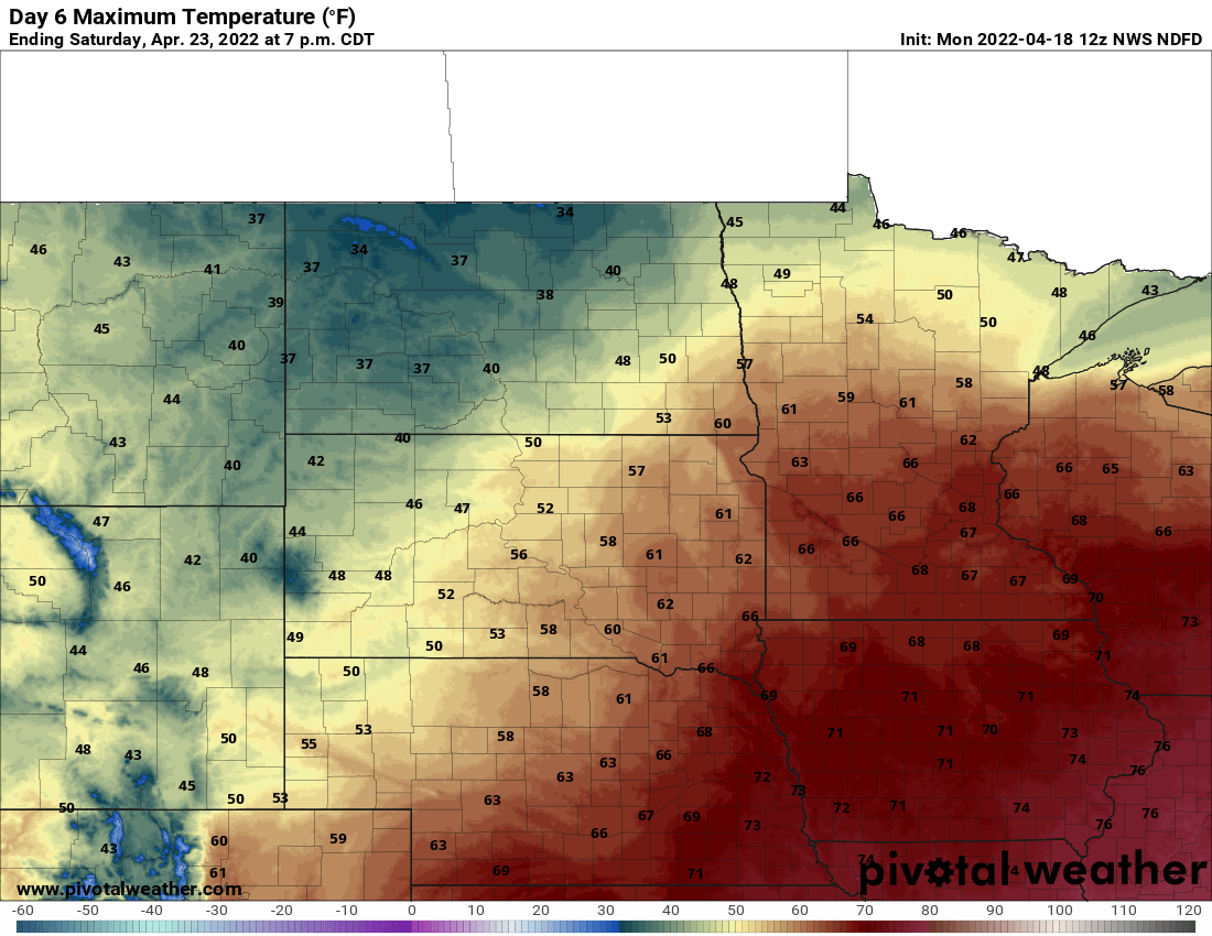
Expect rainy weather during the week, but temperatures Wednesday should top 50 degrees in the southern half of the state. By the weekend, it will be well into the 60s with the year’s first 70-degree reading possible on Saturday.
Cold snow showers
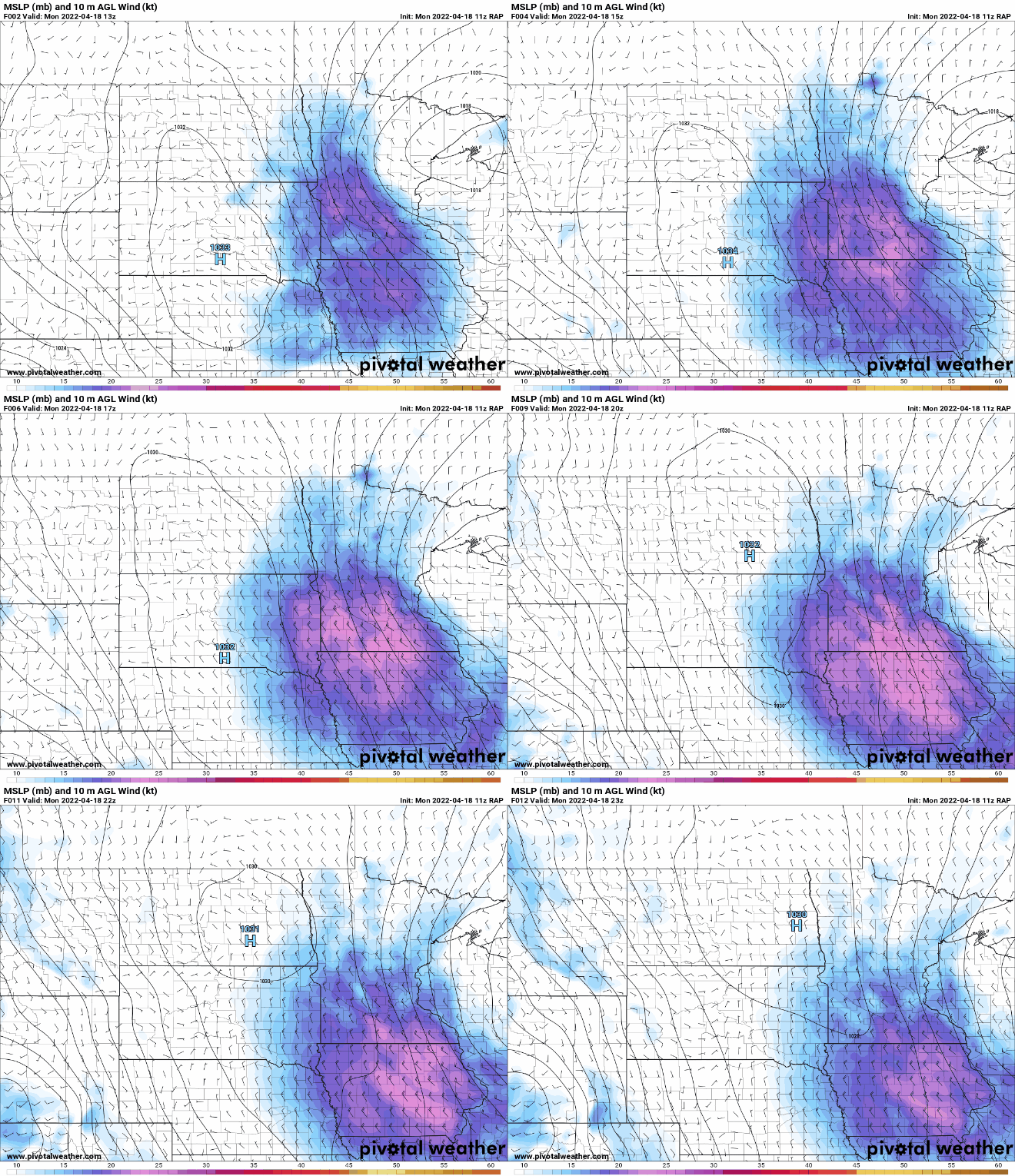
Our latest disturbance is keeping clouds around Monday morning and even some scattered snow showers. On the back side of the system we also have a lot of wind once again. Winds will be from the northwest at 10 to 25 mph with gusts over 40 mph for most.
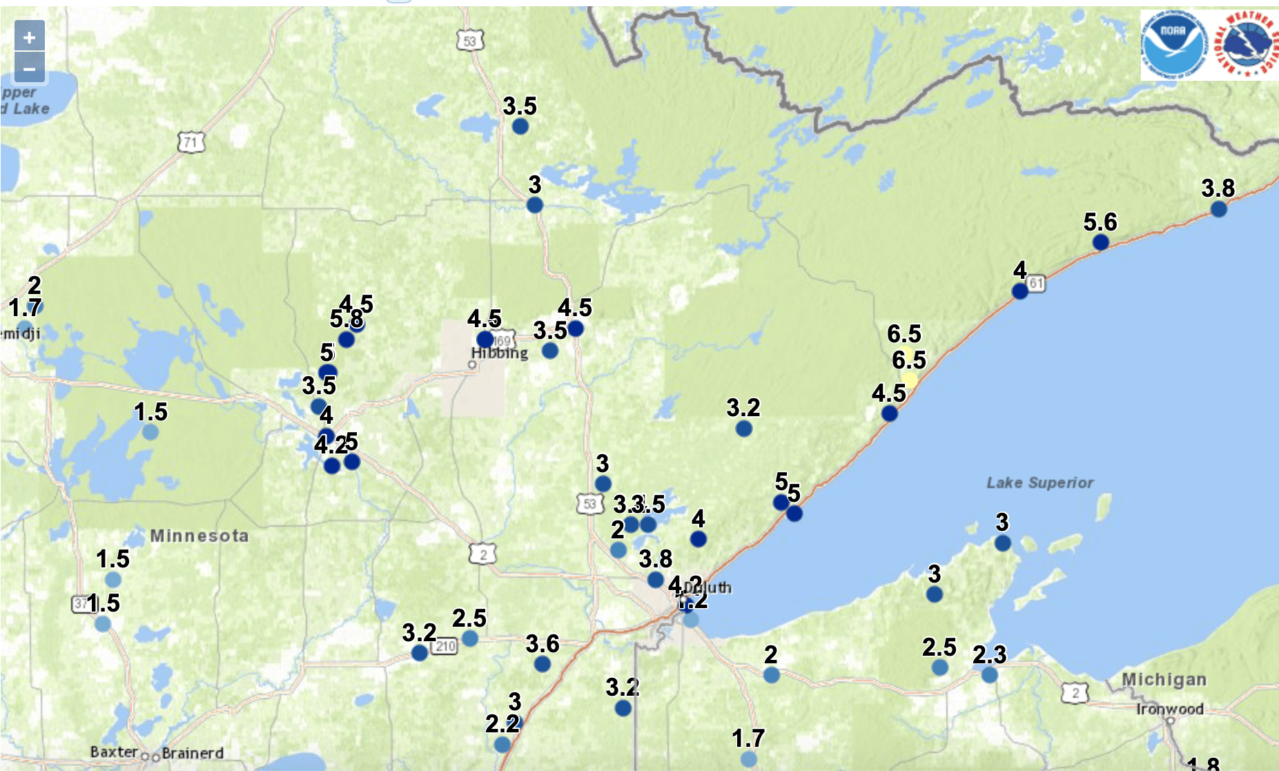
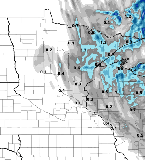
Of course, many areas saw a fresh coating of snowfall, especially in the northern half of Minnesota. Finland, in the Arrowhead region, is up to 6.5 inches and counting.
Turn Up Your Support
MPR News helps you turn down the noise and build shared understanding. Turn up your support for this public resource and keep trusted journalism accessible to all.
Some areas along the North Shore could see another 1 to 3 inches through midafternoon Monday. There’s a winter storm warning through 3 p.m. Monday.
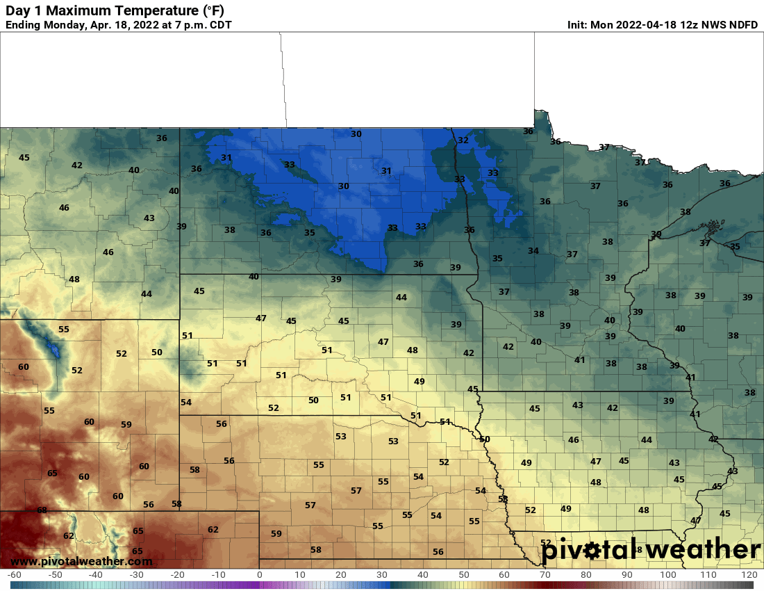
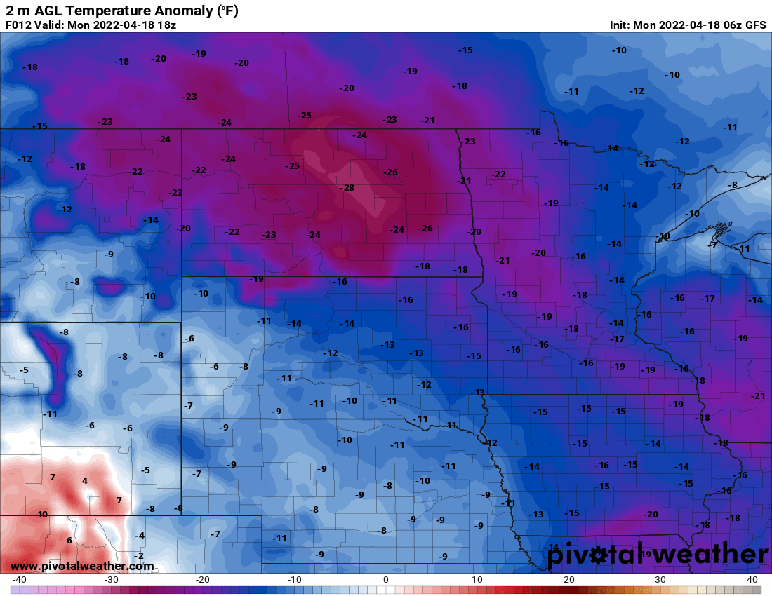
Temperatures continue to be well below normal Monday and Tuesday with highs mainly in the 30s and 40s Monday afternoon.
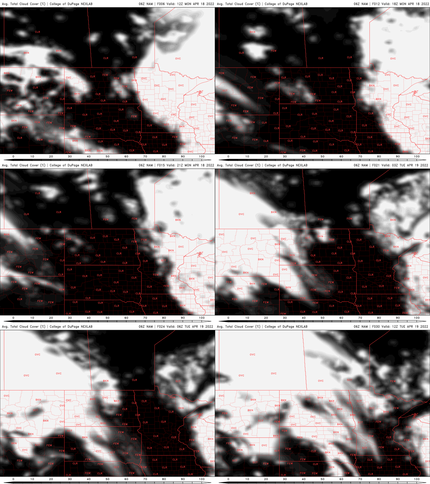
We’ll see clouds decrease through the day with western Minnesota seeing some afternoon sunshine Monday. We may see the last couple hours of sun in the east but brighter skies break out for the first half of Tuesday.
A wet week, but different
We’ll then be focused on the next system coming in Wednesday. It will bring rain afternoon showers in the south and more rain and snow showers north.

Overall, it will be a wet week again but from three different systems rather than one big, slow moving storm.
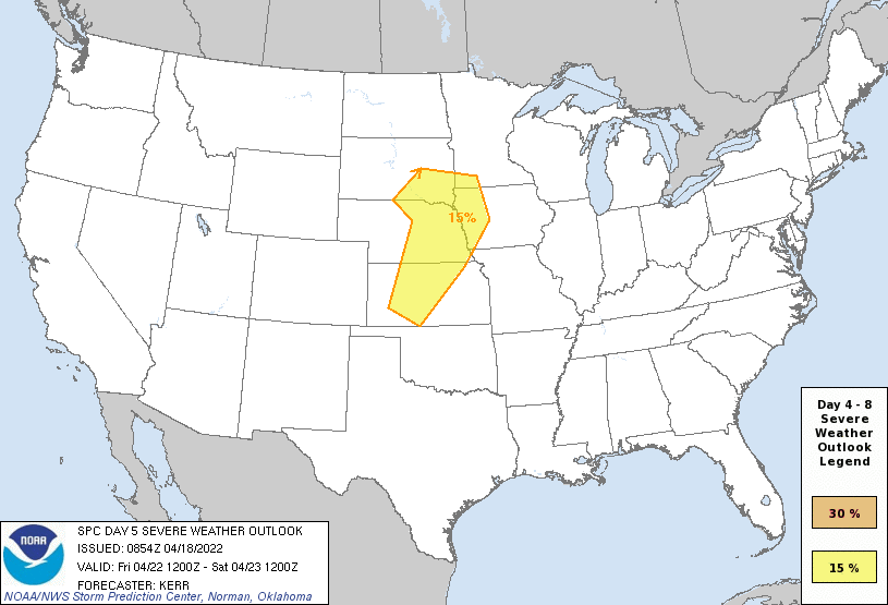
As warmer air moves in later this week, we’ll see the set up for more thunderstorms by Friday and Saturday. In fact, we may need to watch for possible severe storms.
Warmer late week
Temperatures should surpass 50 in the southern half of the state Wednesday and by the weekend will be well into the 60s with even our first possible 70 Saturday.