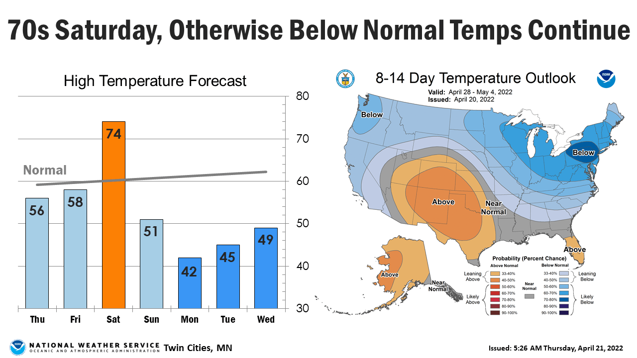
Some sun Thursday; showers possible Friday; 70s Saturday
Brighter skies Thursday then more unsettled Friday and Saturday
Go Deeper.
Create an account or log in to save stories.
Like this?
Thanks for liking this story! We have added it to a list of your favorite stories.


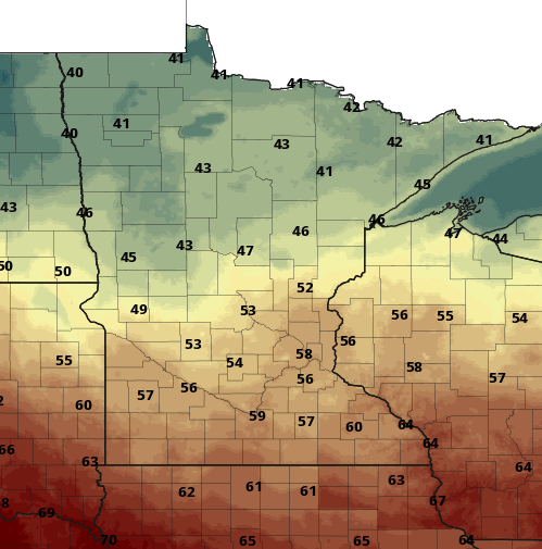
The southern half of Minnesota will see more sun than clouds Thursday while northern Minnesota will be cloudier. Temperatures will reflect this divide with 50s south and 40s north.
Moisture and warmth surge north over the next 24 to 48 hours. This will push temperatures to normal and above but also create the conditions for some thunderstorms.
Moisture roundup
The Twin Cities area saw some of the highest precipitation amounts, with most stations reporting between one-half and eight-tenths of an inch from Wednesday.
Our April total is now nearly 2.5 inches. That’s 41 percent more precipitation than normal to date for April and our spring total is now up to 5.43 inches, more than 1.5 times normal.
Turn Up Your Support
MPR News helps you turn down the noise and build shared understanding. Turn up your support for this public resource and keep trusted journalism accessible to all.
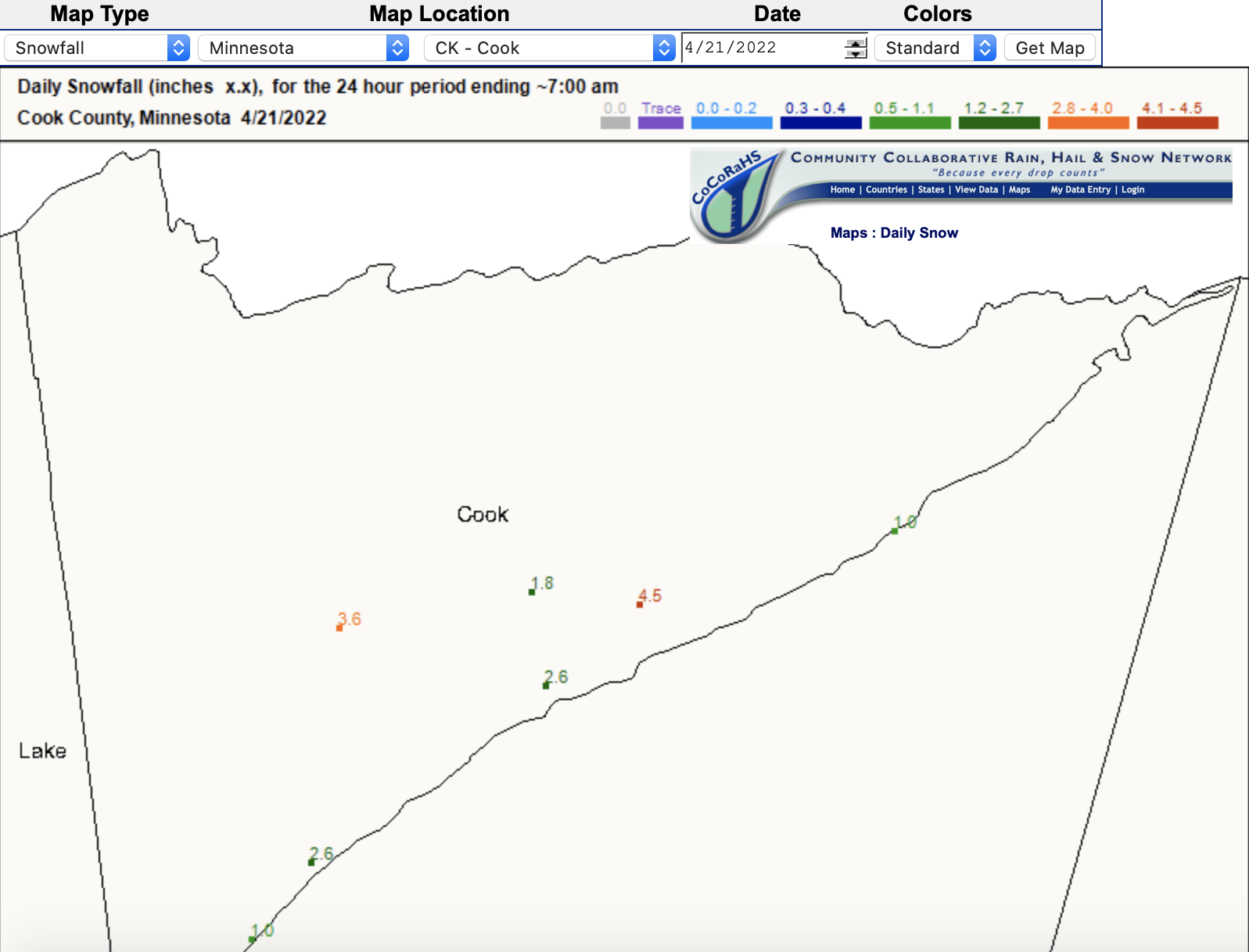
To the north it was snow. Bemidji saw 5 inches. Around Grand Marais, about 4.5 inches fell.
Clouds from northern Minnesota will attempt to drift south, so we could see some midday increase in cloud cover. Overall, though, there will be more sun than clouds for the southern half of Minnesota through Thursday.
High temperatures Thursday will reflect the north south divide in clouds.

Warmer but also more unsettled
Moisture and warmth surge north over the next 24 to 48 hours. This will push temperatures to normal and above but also create the conditions for some thunderstorms.
Winds just 3,500 to 4,000 feet up will roar at 60 mph or more late Thursday night. This is what we call a low-level jet, and it will transport warmth and higher dew points
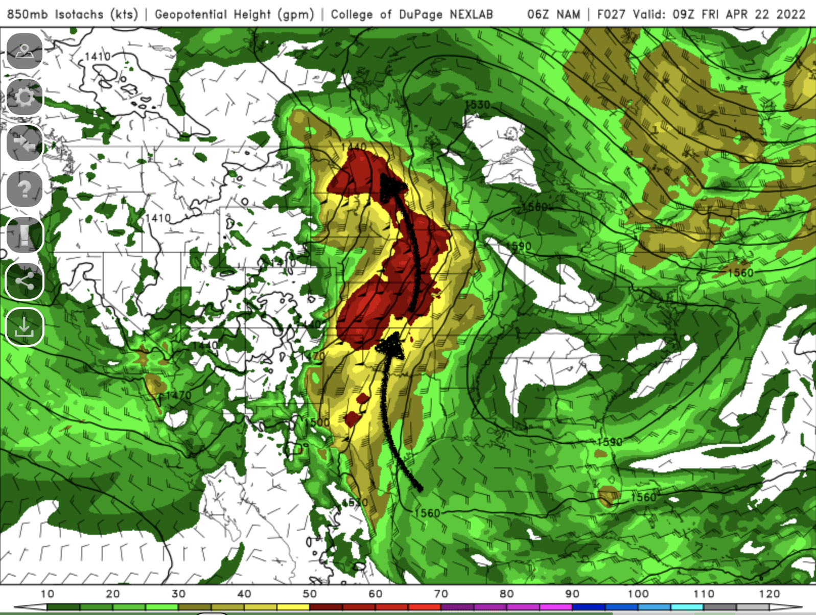
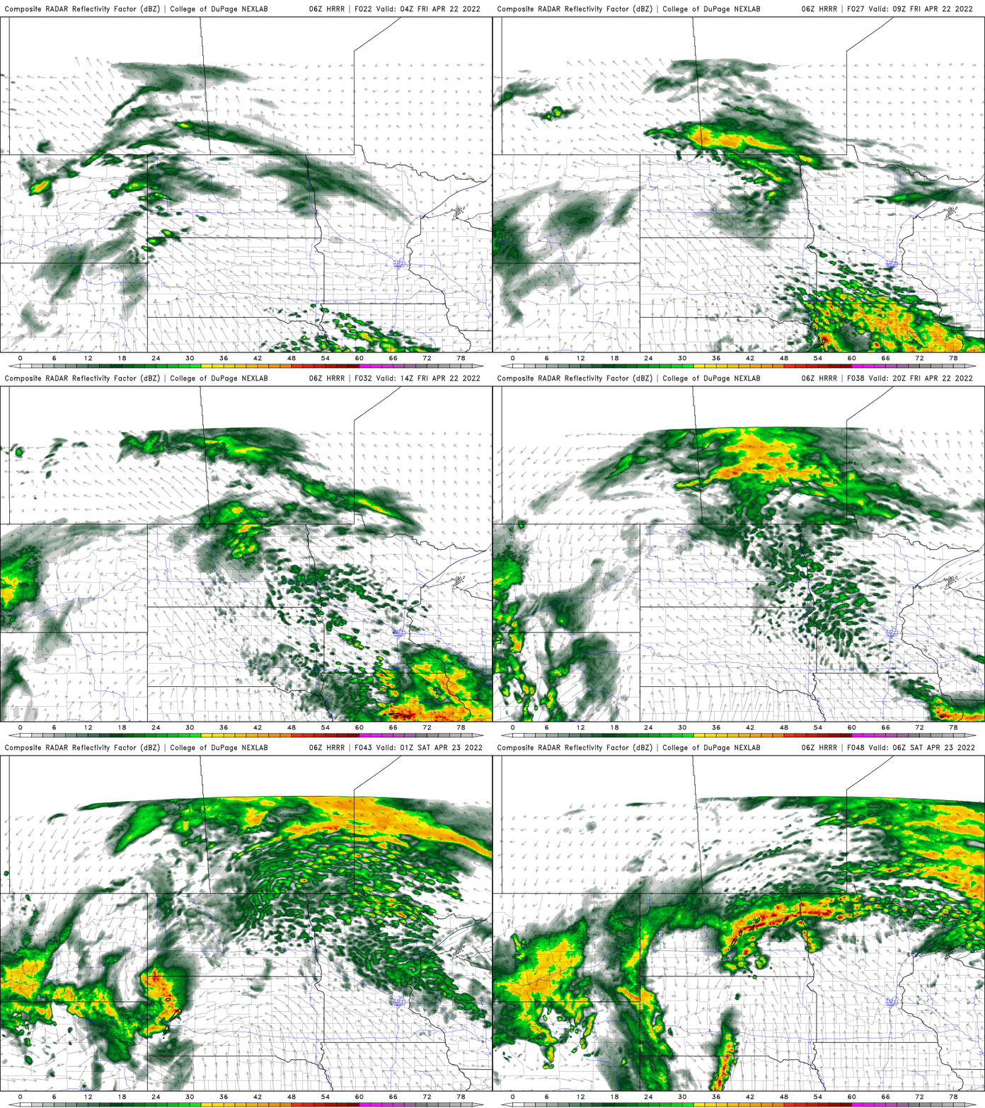
That will create the potential for some showers and thunderstorms in the morning Friday. We’ll then see a mainly dry midday and afternoon with lingering clouds.
More storms will develop to the west in South Dakota and Nebraska. What’s left of that activity could drift into Minnesota Friday night.
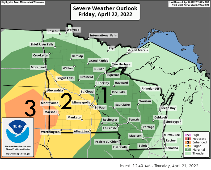
The National Oceanic and Atmospheric Administration Storm Prediction Center extends a slight risk, mainly for possible hail, into portions of Minnesota Friday night.
High temperatures Saturday soar into the 70s for much of central and southern Minnesota for the first time this season. We last saw 70 in the Twin Cities Oct. 19, so this will end a 186-day stretch below that mark. That’s nearly three weeks longer than we usually have to wait.

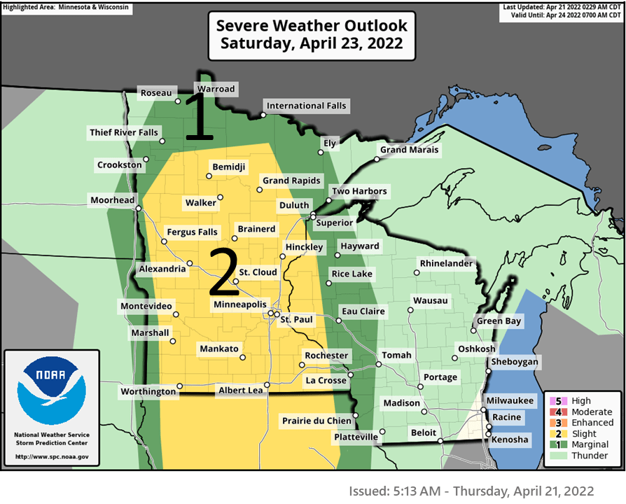
A cold front will touch off the possibility of more thunderstorms late Saturday; some of those could be strong. There’s a slight risk for severe storms.
Temps Sunday drop again into the 40s and 50s behind the cool front.