
Scattered showers, thunder; 70s Saturday
Unsettled couple of days but warmer before cooling off Sunday

Go Deeper.
Create an account or log in to save stories.
Like this?
Thanks for liking this story! We have added it to a list of your favorite stories.


A return to overcast skies with some scattered showers Friday. Temps warm into the 70s for much of Minnesota Saturday with storms possible before cooling down again Sunday.
Back to clouds and showers
Warmer air and moisture are surging north creating areas of showers and even some thunder in southwest Minnesota early Friday. Expect scattered showers Friday and isolated thunder. It will not rain continuously all day however.
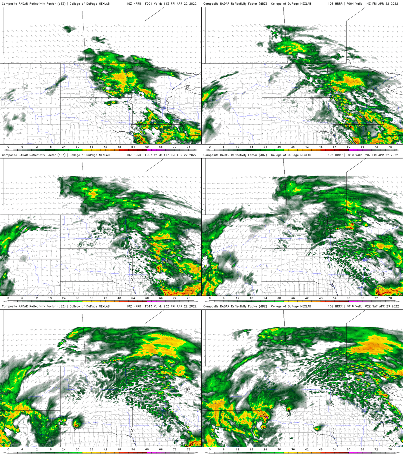
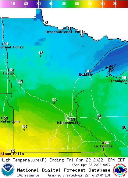
With the clouds and showers half of the day, temperatures won’t warm as much as they could but will still be in the 50s for the southern half of Minnesota; 40s north. Some spots in southwest Minnesota could reach the 60s given some peeks of sunshine.
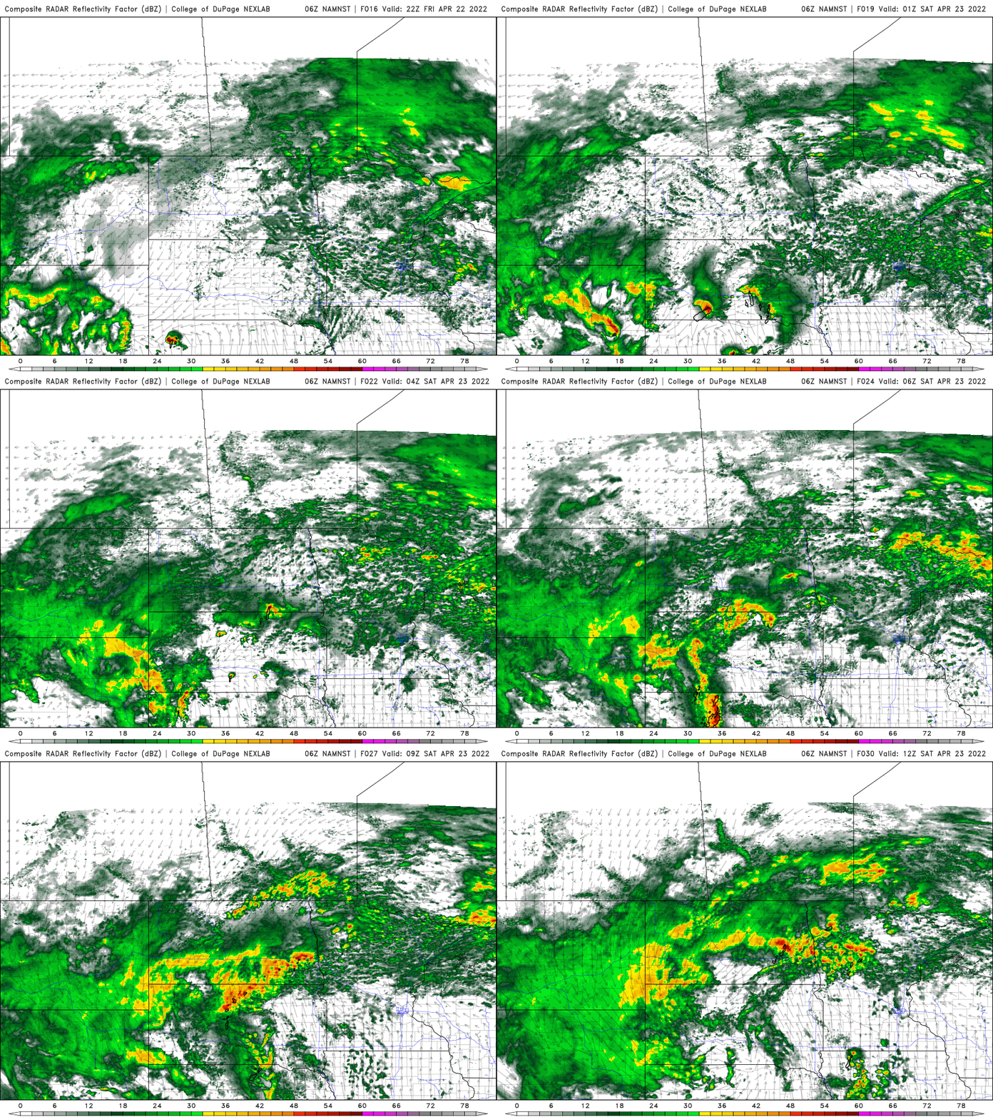
Storms will develop in South Dakota and Nebraska and largely fizzle before reaching Minnesota Friday night. One or two thundershowers could hold together however.
Turn Up Your Support
MPR News helps you turn down the noise and build shared understanding. Turn up your support for this public resource and keep trusted journalism accessible to all.
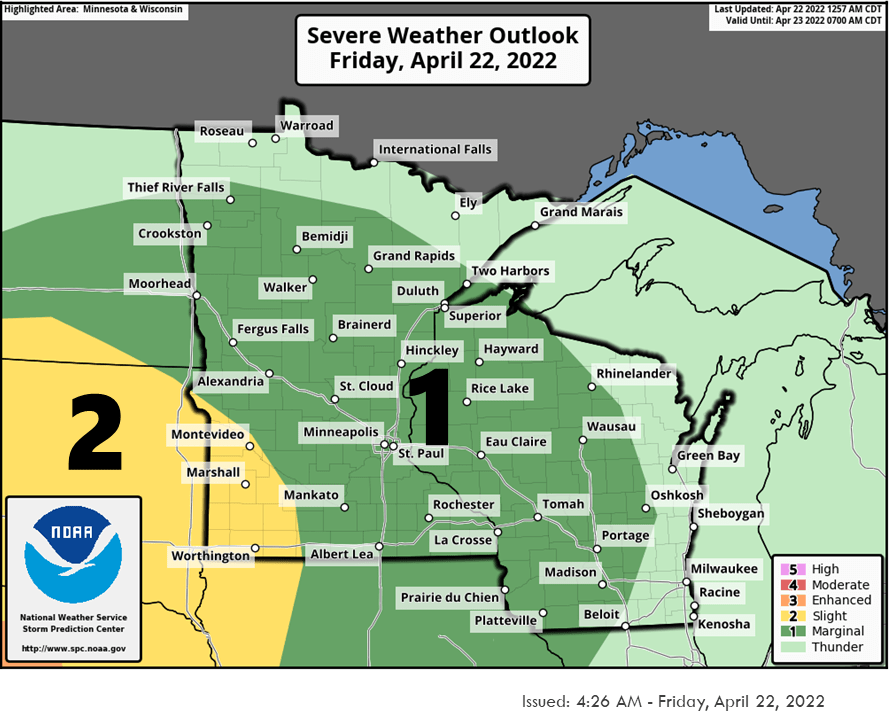
Whatever storms may hold together could be strong if they reach southwest Minnesota.
One day of real warmth; thunder
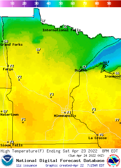
Saturday will bring one real spike in our temperatures with widespread 70s across central and southern Minnesota. You can bet it will be cooler in northeastern Minnesota and especially near Lake Superior.
A cold front will make its way across Minnesota late Saturday and be the focus for possible thunderstorm development.
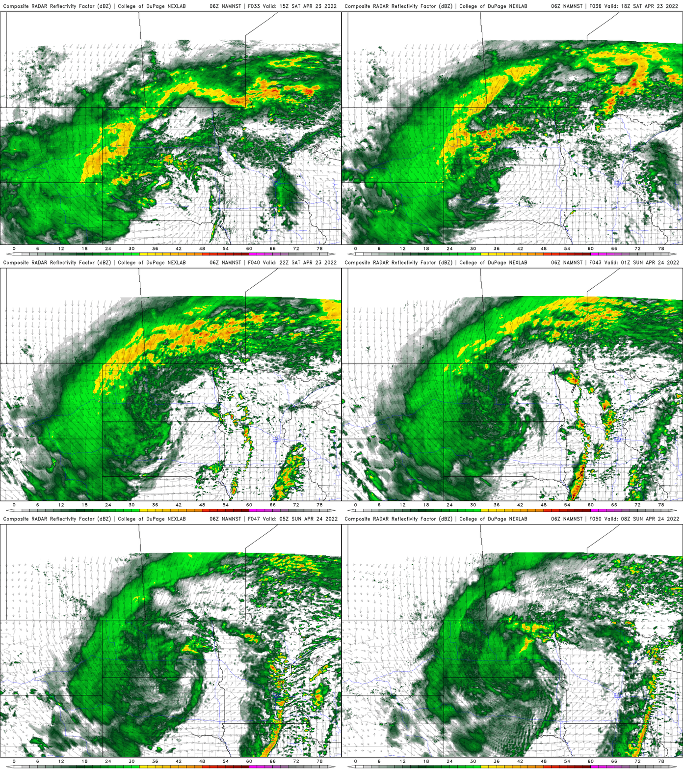
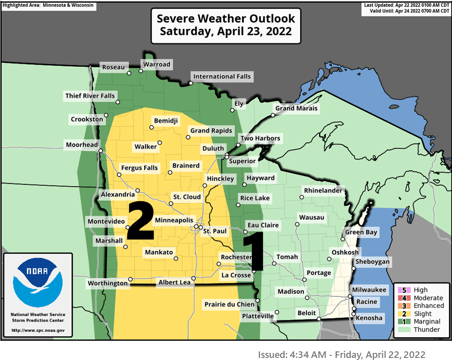
Whatever storms do develop could be strong to severe.
Beyond that — you guessed it — we’ll be much cooler Sunday into early next week with highs back in the 40s.

