
Scattered showers, storms Friday; warm Saturday, then chilly again
Go Deeper.
Create an account or log in to save stories.
Like this?
Thanks for liking this story! We have added it to a list of your favorite stories.


Mainly cloudy skies with scattered showers and a few thunderstorms Friday will keep temperatures in the 40s and 50s for most, although southwestern Minnesota could be warmer.
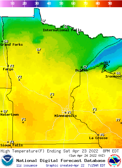
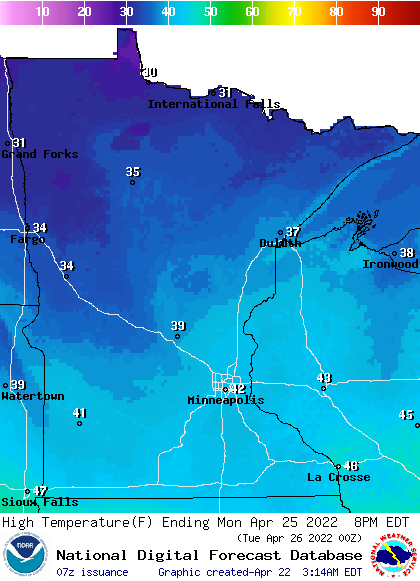
Highs Saturday will be well into the 70s across central and southern Minnesota. By Monday, though, temps retreat to the 30s and 40s.
Warmer and occasionally stormy
Finally some warmth is pushing north but with it comes moisture and instability. Ahead of the main push of warm air widespread scattered showers and even some thunderstorms move through Friday.
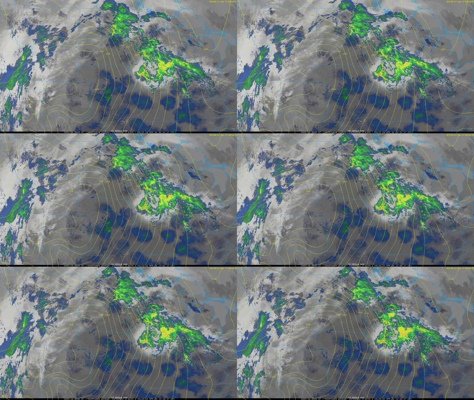
Most of the activity will be Friday morning, but there will still be a few showers around in the afternoon-evening and still mainly overcast. Storms will redevelop in South Dakota and Nebraska late Friday.
Turn Up Your Support
MPR News helps you turn down the noise and build shared understanding. Turn up your support for this public resource and keep trusted journalism accessible to all.
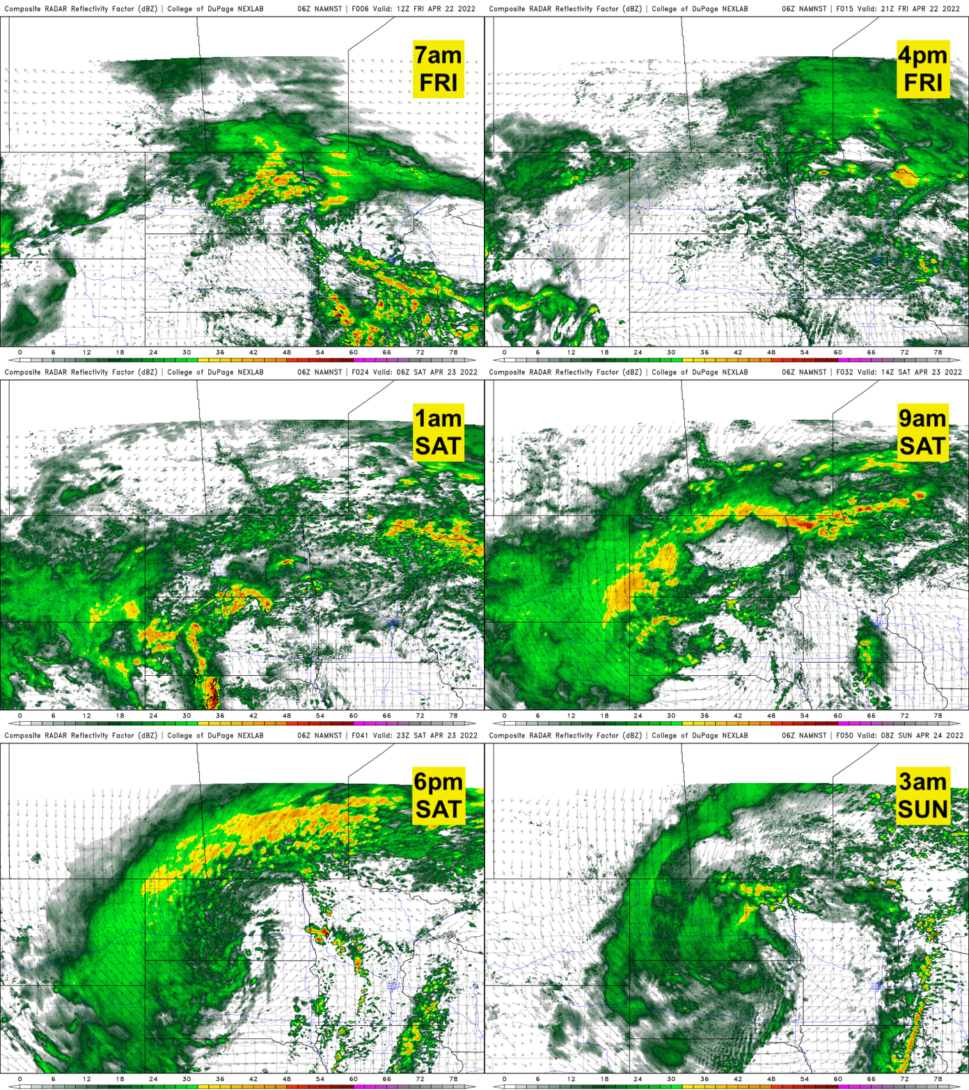
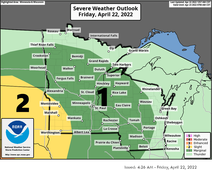
Most of that activity will fall apart, but a few rogue storms could make their way into southwest Minnesota. Because of this, the National Oceanic Atmospheric Administration’s Storm Prediction Center has a slight risk of severe storms in southwestern Minnesota.
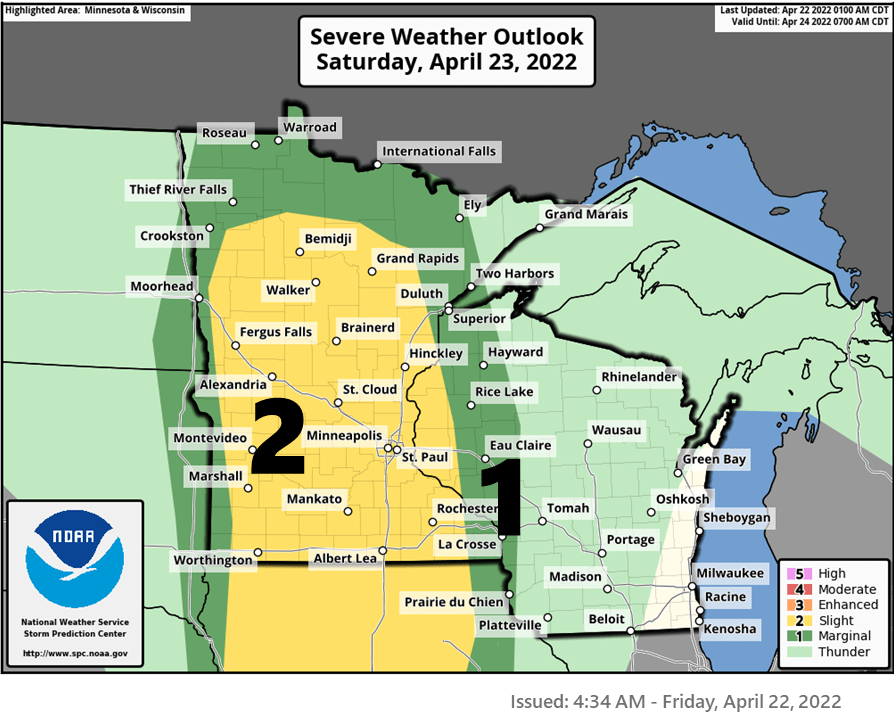
That risk moves east Saturday after a warm day. A cold front will spawn late afternoon storms in western Minnesota that will move east into the evening Saturday. Some of those could be strong to severe.
Highs Saturday will be well into the 70s across central and southern Minnesota.
It will not last however, by Monday temps will only be in the 30s and 40s!
Happy Earth Day!
Since the first Earth Day in 1970, the actual date itself in the Twin Cities has warmed 3.8 degrees Fahrenheit. It’s a similar story for Mankato in southern Minnesota. Duluth has warmed even more, in line with the fact that northern Minnesota is warming faster than southern Minnesota.

Overall, our annual temperature in the Twin Cities has warmed 2 degrees, which doesn’t sound like a lot but that’s a whole standard deviation!
To put that in perspective, what would have been a once in a generation event (1 in 42 years) now becomes a 1 in 6 year event. That is the key take away from climate change: small changes have an exponential impact on extremes. It also means what would have been a more common cold extreme suddenly disappears from possibility.
Dreaming of summer?
I know many people have been complaining about the cold spring but maybe think twice. The latest outlook for summer from the National Oceanic Atmospheric Administration’s Climate Prediction Center calls for a hot summer across most of the lower 48 of the United States.


