Brighter skies return Tuesday after a cold Monday
A chance to dry out, though cold
Go Deeper.
Create an account or log in to save stories.
Like this?
Thanks for liking this story! We have added it to a list of your favorite stories.


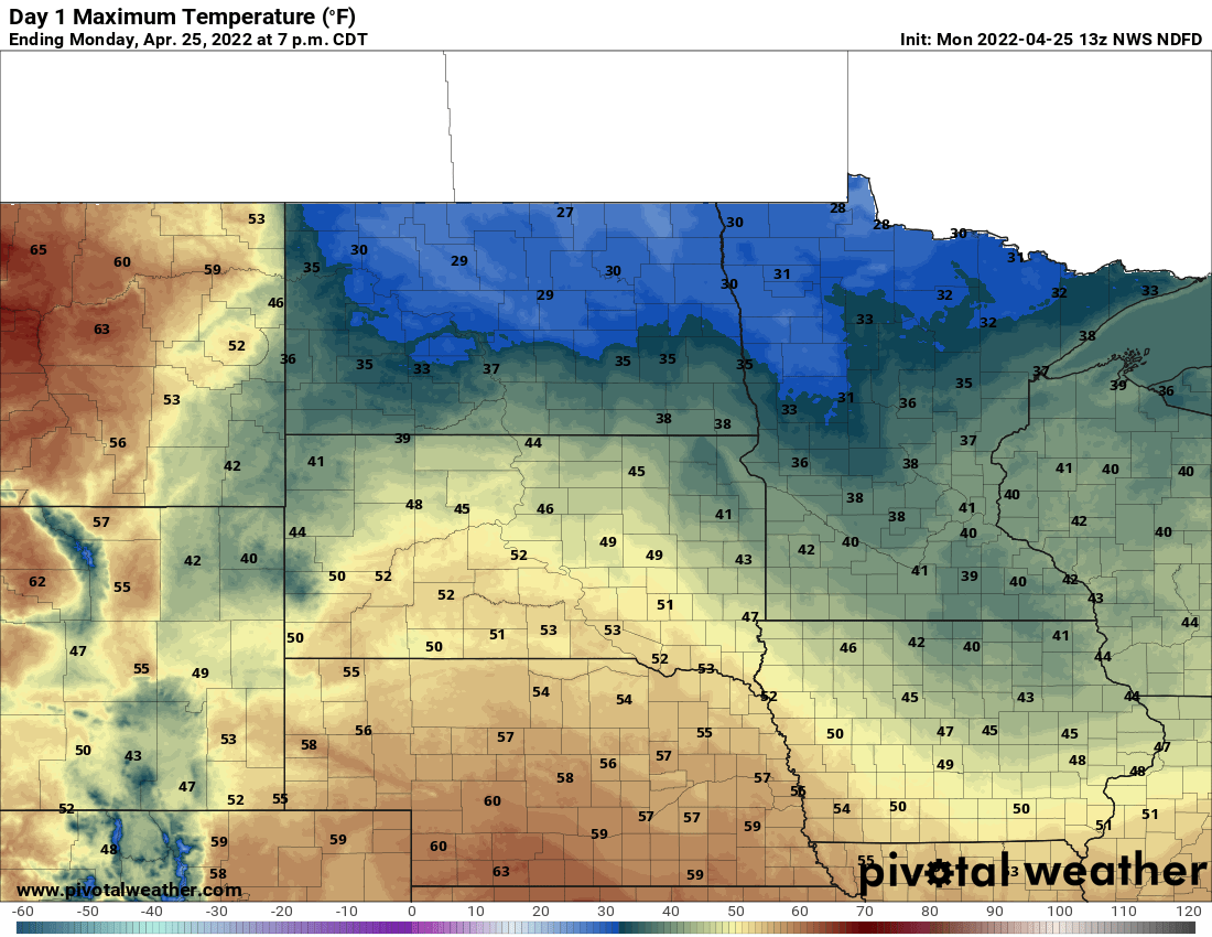
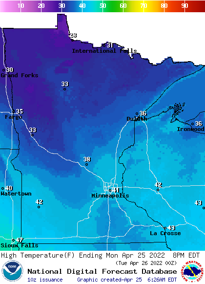
Expect close to record cold highs Monday, with 30s and 40s across Minnesota. Tuesday brings sun and lighter winds.
A wacky weekend of weather
We had our first 70s for many locations Saturday but we also saw some eventful weather. Severe storms struck northwestern and southeastern Minnesota with flooding rains in the northwest. The Grand Forks, N.D., and Crookston, Minn., areas saw up to 3 to 4 inches of rainfall Saturday.
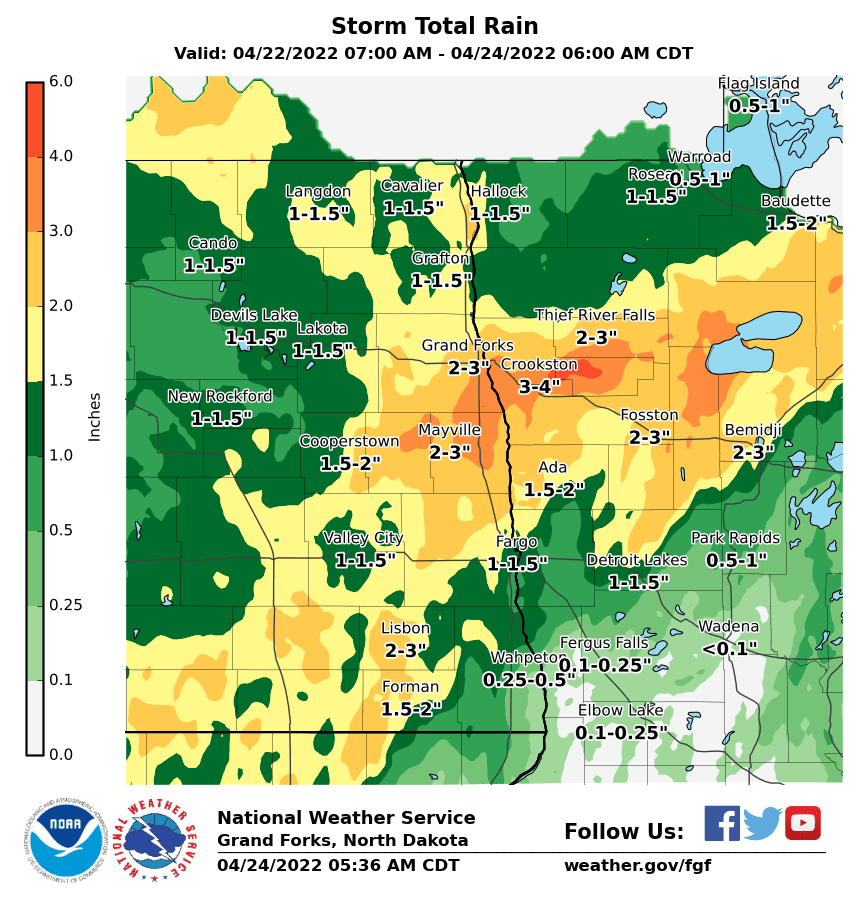
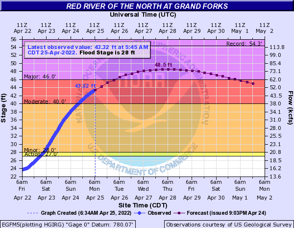
That heavy rain in a short period of time combined with recent snow melt has the Red and Red Lake rivers on a rapid rise. The Red River at Grand Forks is expected to crest at nearly 21 feet above flood stage early Thursday.
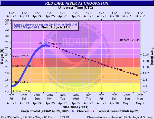
The Red Lake River at Crookston is expected to continue to go down Monday and Tuesday.
Turn Up Your Support
MPR News helps you turn down the noise and build shared understanding. Turn up your support for this public resource and keep trusted journalism accessible to all.
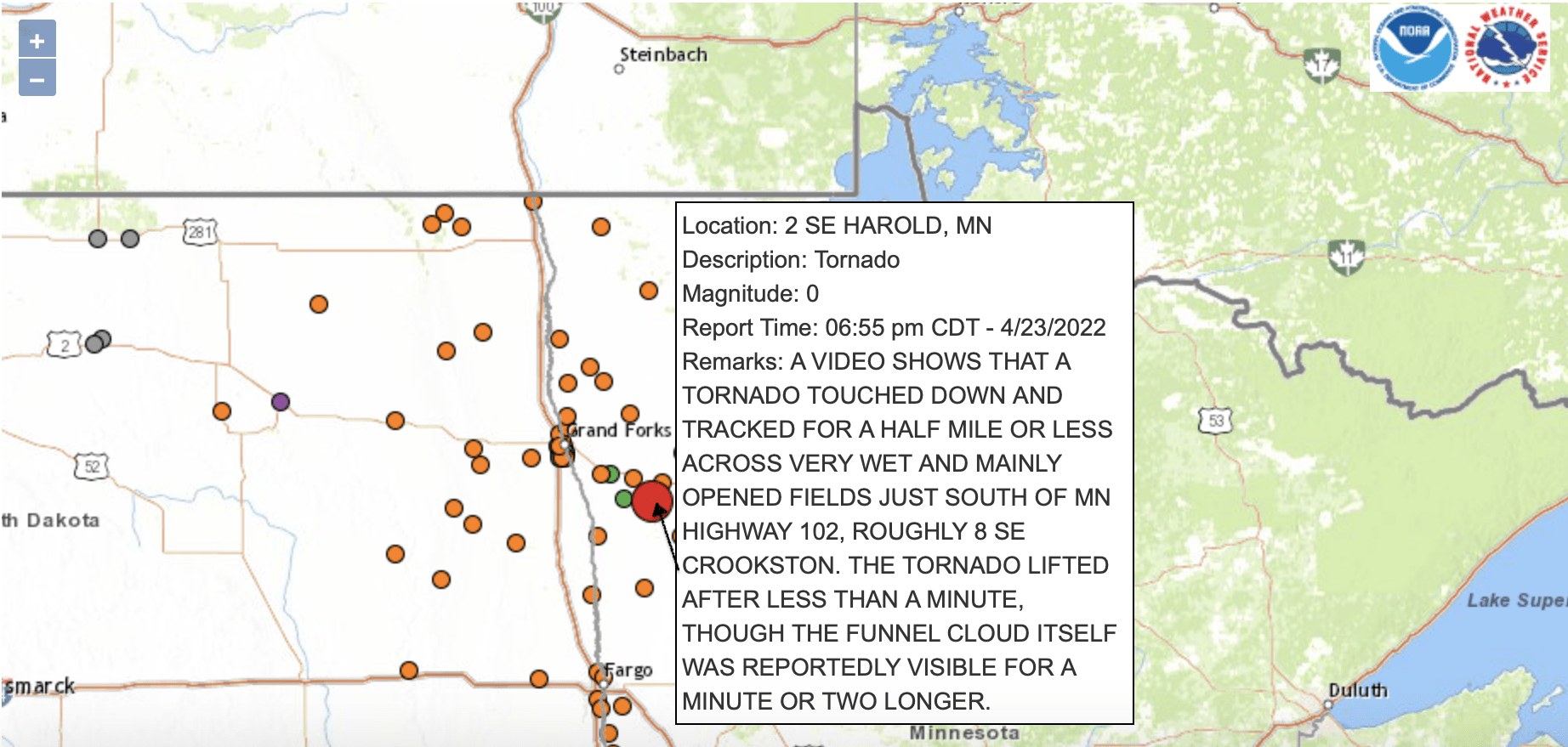
The same storms that brought all that rain also was responsible for a brief tornado touchdown Saturday afternoon outside of Crookston.
Almost record cold highs Monday
It’ll be a cold one Monday. Temperatures will be just shy of record cold highs for most. We’ll be mainly in the 30s and low 40s with blustery northwest winds still at 10-20 mph, gusting to 25-35.
Tuesday brings a return of sunshine and lighter winds but it will still be chillier than normal. We’ll see mainly 40s, some low 50s southwest but also pockets of 30s north.

More rains ahead to close out April
We’ll need to keep a close eye on a significant system that will bring the potential for heavy rain Friday night into Saturday. While the Red Lake River will have come down significantly by then, the Red River will still be at very high levels.
Rainfall amounts could top out over 1 inch for much of Minnesota.
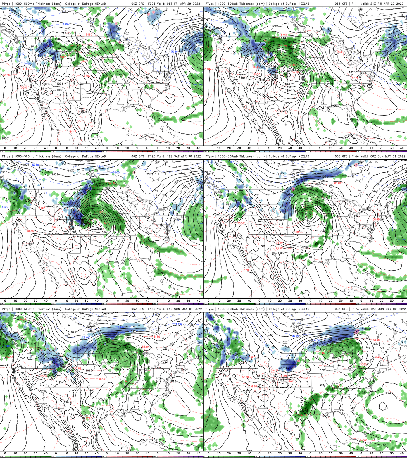
A more minor system moves through Thursday, bringing more scattered showers and lighter amounts before that.

Closer to normal ahead?
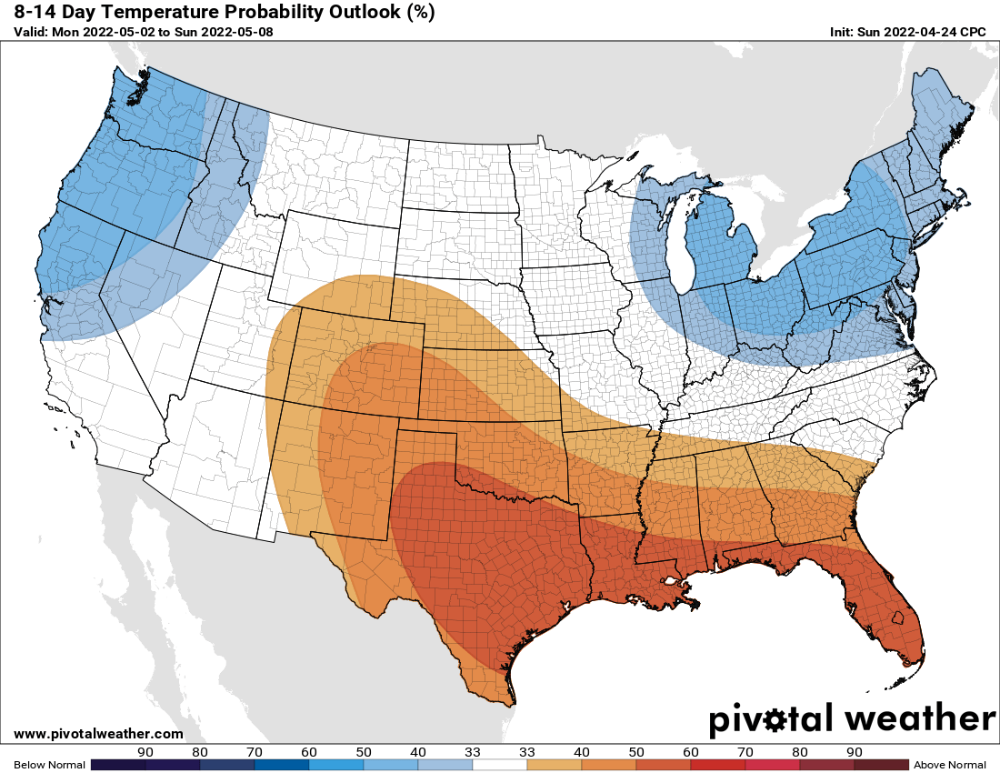
While this week will be mainly below normal, temperatures are near normal by the weekend and as we head into the first week of May. The National Oceanic Atmospheric Administration’s Climate Prediction Center forecasts equal chances of above or below normal temperatures next week.