Gradual clearing Tuesday; more rain Thursday
Still below normal Tuesday but becoming brighter, warmer
Go Deeper.
Create an account or log in to save stories.
Like this?
Thanks for liking this story! We have added it to a list of your favorite stories.


A cold start with gradual clearing Tuesday will yield a warmer afternoon, although still below the normal highs in the 50s and low 60s. Clouds increase again Wednesday.
No records but still cold
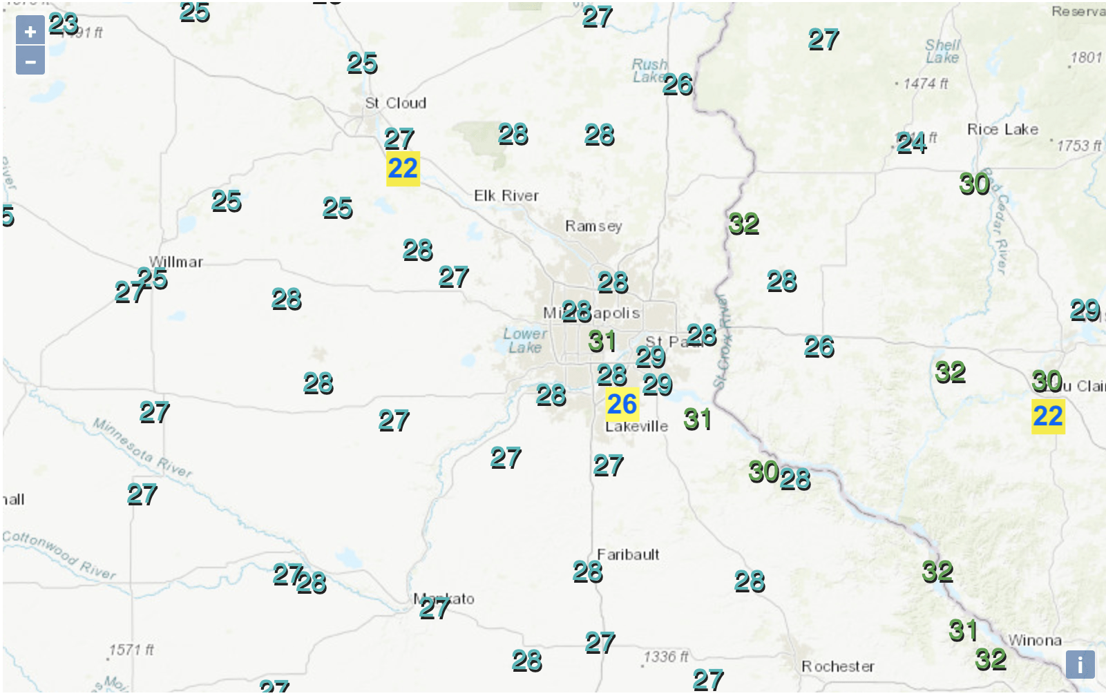
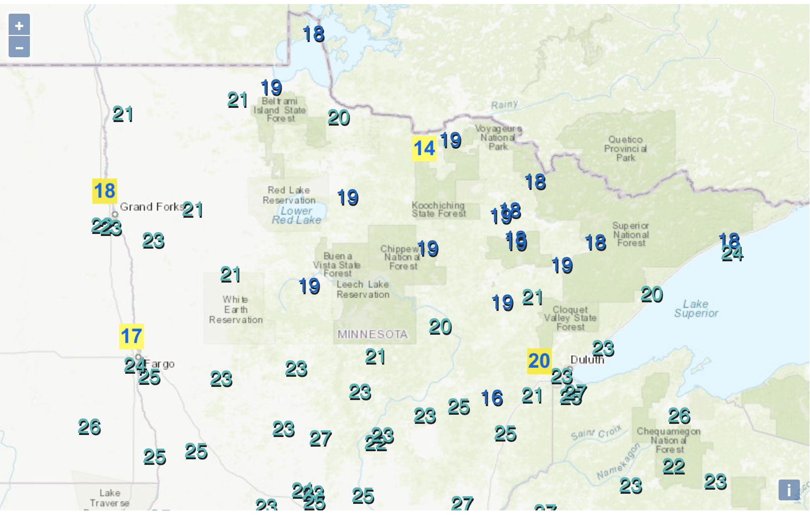
It was definitely a cold start to the morning early Tuesday but no one broke records. Below you’ll see the morning lows and in yellow boxes. I put the record low for the date for select cities and towns.
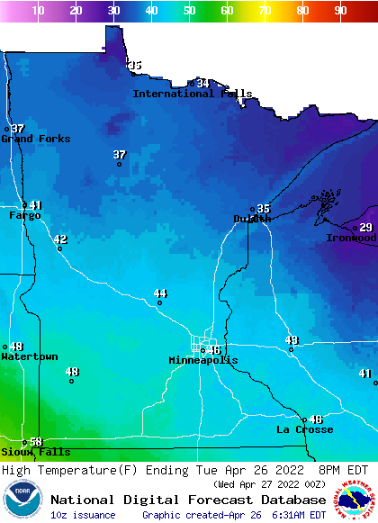
We’ll see gradual clearing Tuesday, which will help warm temperatures up slightly but still well below normal.
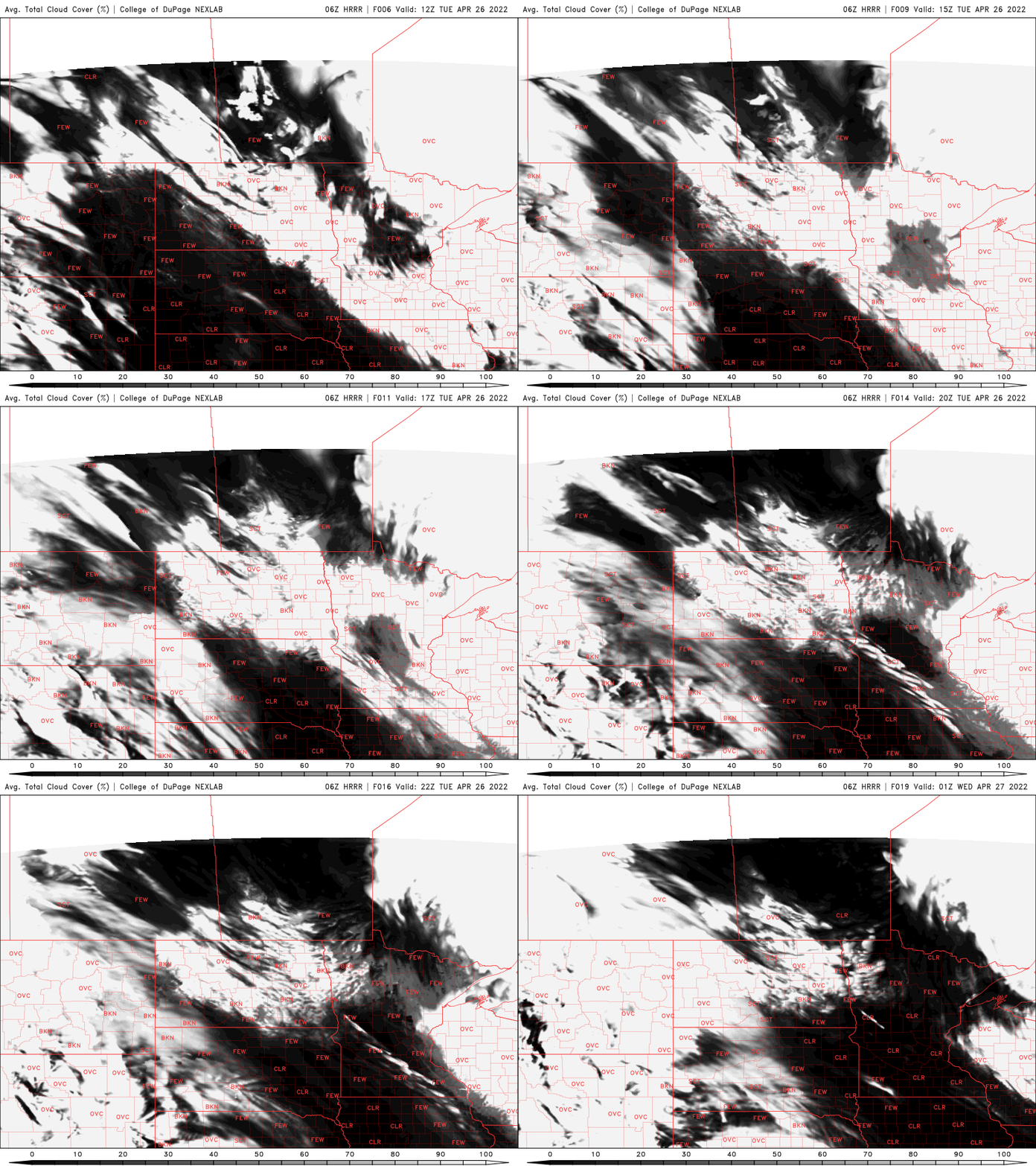
The normal high in southern Minnesota is in the low 60s while in northern Minnesota it’s in the low 50s. Highs Tuesday will range from the 30s in the north to some low 50s in southwestern Minnesota but most of us will be in the 40s.
Turn Up Your Support
MPR News helps you turn down the noise and build shared understanding. Turn up your support for this public resource and keep trusted journalism accessible to all.
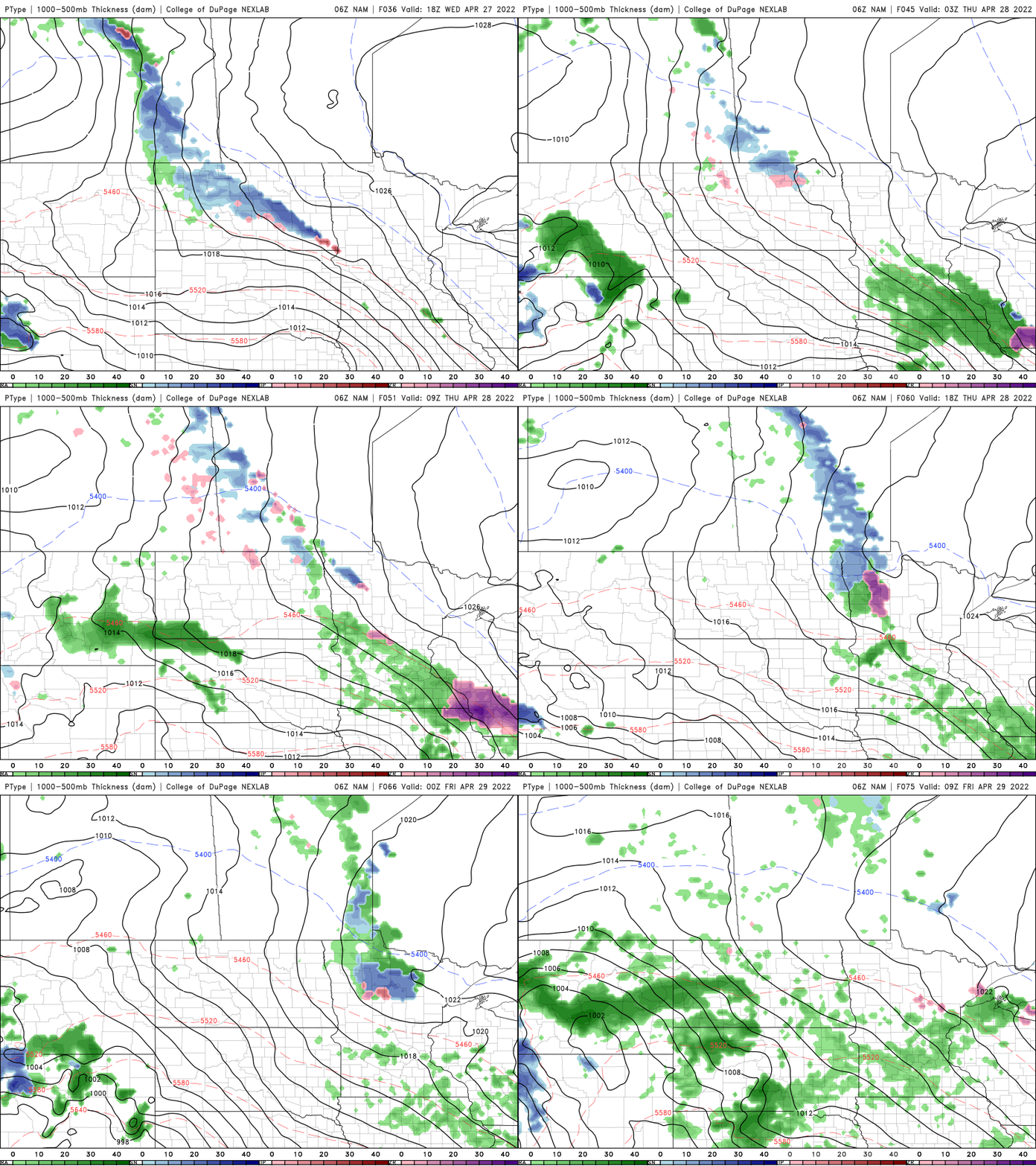
Clouds increase Wednesday again ahead of the next disturbance, which will bring some rain showers Thursday to the region. Most places should see less than one-quarter inch of rainfall.
Weekend’s a little warmer, soggy
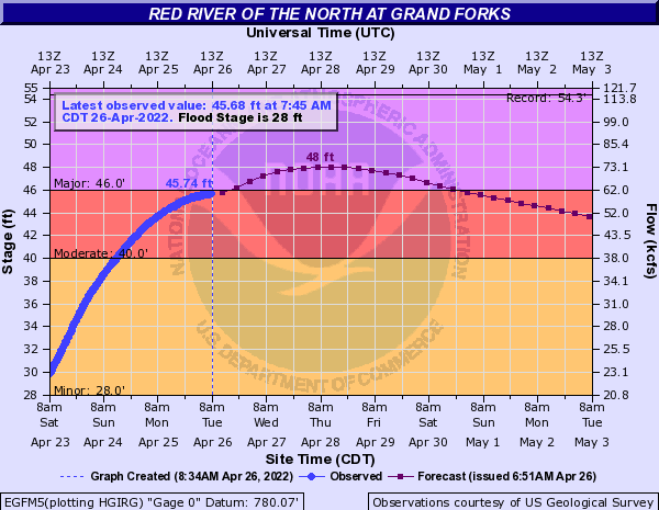
A bigger storm is still developing for late Friday into the weekend and that storm is of particular concern as it could dump heavier rainfall amounts. River levels are expected to remain at major flood stage near Grand Forks, N.D.
This model doesn’t take into account additional precipitation so that could push levels higher over the weekend.
With the potential of 1 inch or more of precipitation over the next seven days, that could affect conditions there.
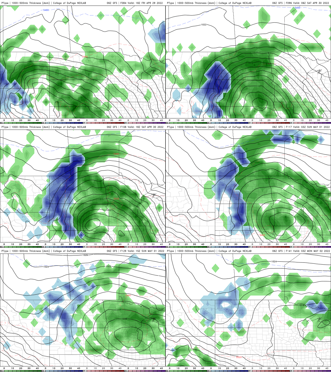
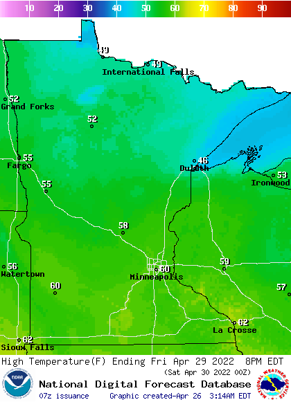
We’ll see temperatures finally reach close to 60 degrees Friday ahead of that weekend system and remain a little more consistently closer to 60 into next week.