
Clouds increase Wednesday; showers on Thursday
One more dry day before more rain develops
Go Deeper.
Create an account or log in to save stories.
Like this?
Thanks for liking this story! We have added it to a list of your favorite stories.


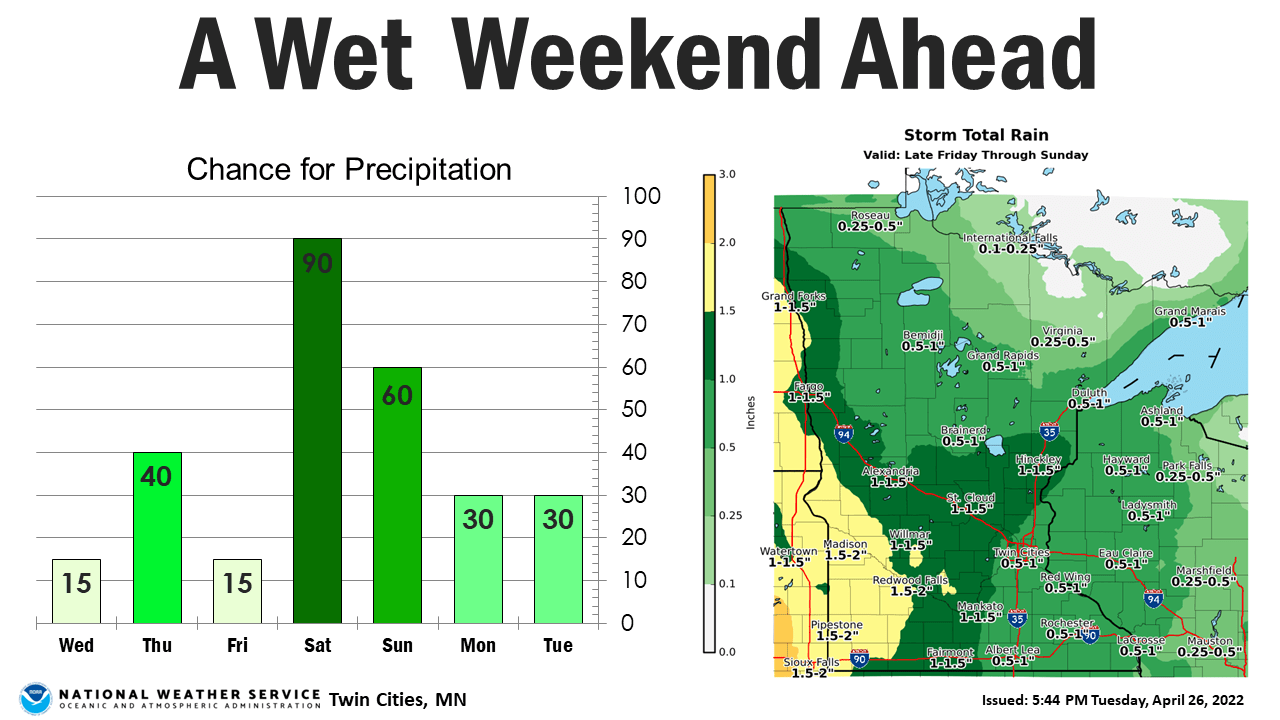
Clouds will increase through the day Wednesday and temperatures will remain below normal. More rain is on the way Thursday and another more significant round Friday night.
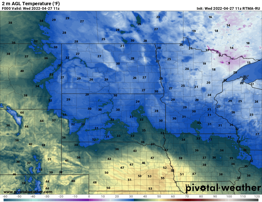
Another frigid morning
We have yet another cold start to the day Wednesday though records for this particular date are colder than yesterday’s so they’ll stay ‘safe.’ The record low today ranges from 21 in the Twin Cities to 12 in International Falls. We do have 20s and some teens north yet again.
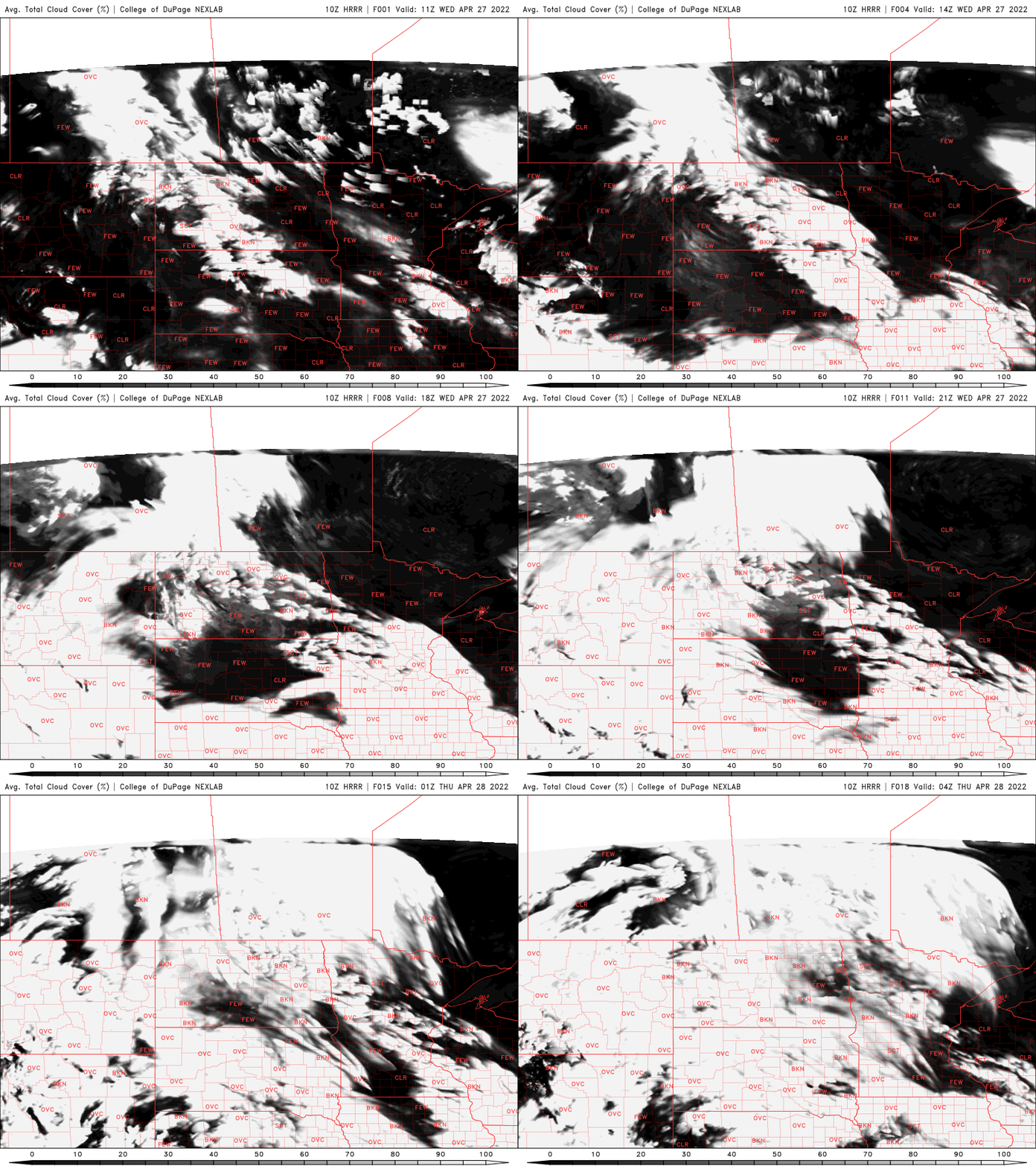
Clouds will be on the increase Wednesday but we’ll still see some hazy filtered sun through mid-level clouds.
High temperatures will likely be a few degrees warmer than Tuesday’s; more widespread 40s with some 50s southwest

Prepare for more rain
The first of two systems brings rain showers once again for Wednesday night into Thursday. Showers will gradually fill in and be scattered late Wednesday night.
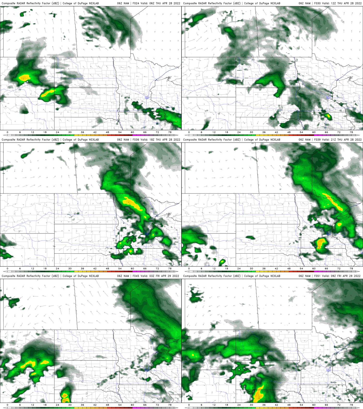
Another, bigger system moves in late Friday but we’ll squeeze in some milder temps First Friday.

The weekend at this point looks pretty crummy with the return of more significant rainfall and also wind.
Turn Up Your Support
MPR News helps you turn down the noise and build shared understanding. Turn up your support for this public resource and keep trusted journalism accessible to all.

