Clouds increase, showers develop late
Evening showers with a break Friday before more rain
Go Deeper.
Create an account or log in to save stories.
Like this?
Thanks for liking this story! We have added it to a list of your favorite stories.


We’ll sneak in some sunshine early Thursday before clouds increase and thicken up ahead of some showers by late in the day. Friday will be milder before more rain moves in for the weekend.
Showers develop later
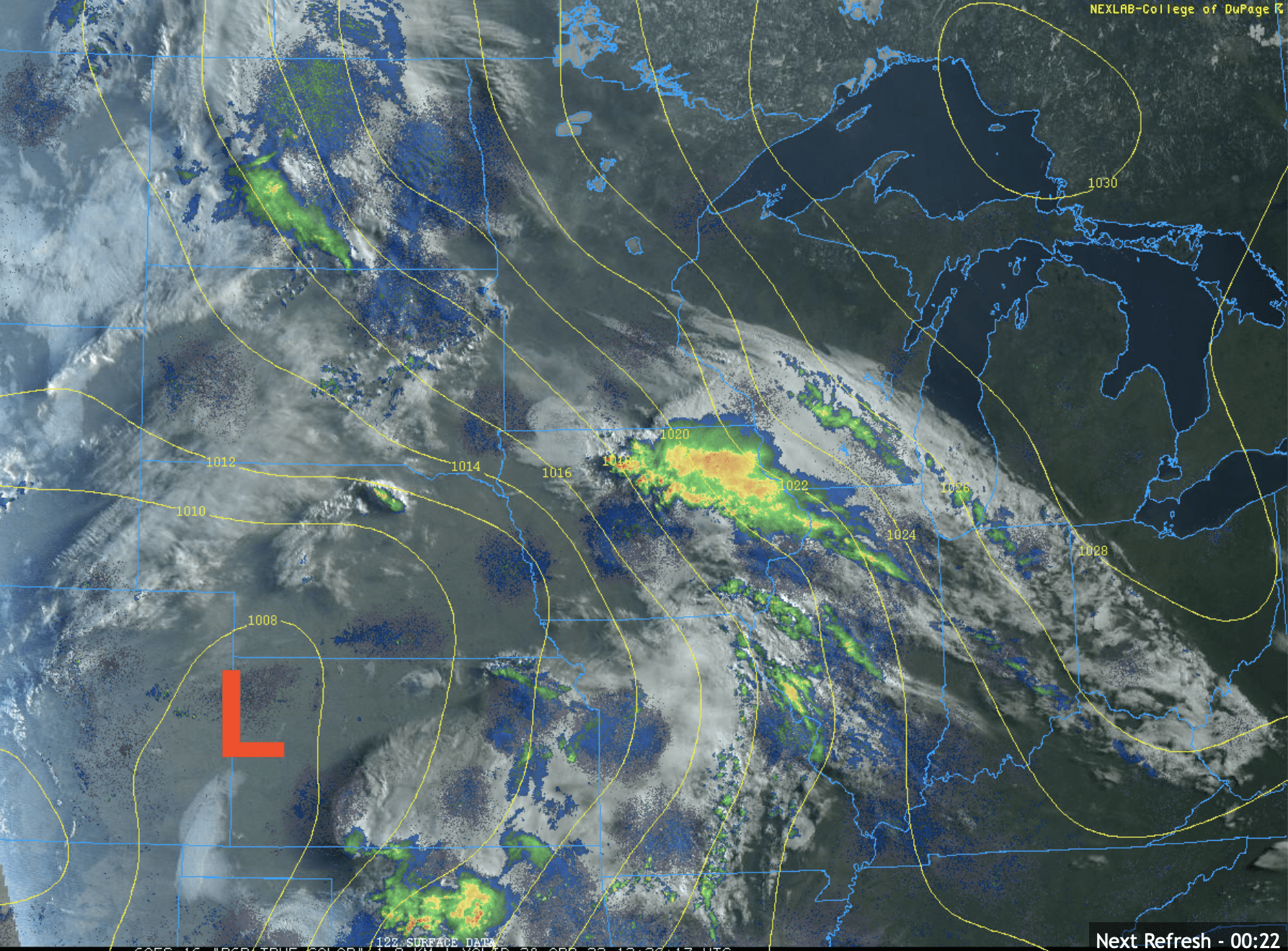
We’re seeing a little surprise sunshine to start Thursday, but it won’t last. Clouds will thicken up ahead of some scattered showers late Thursday.
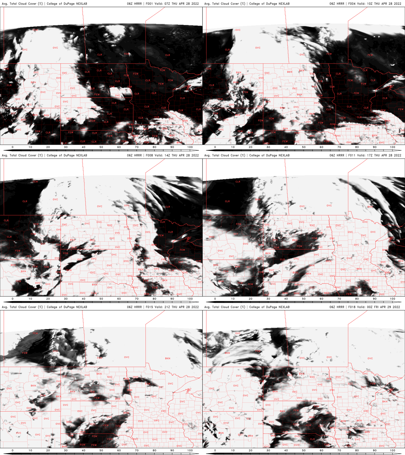
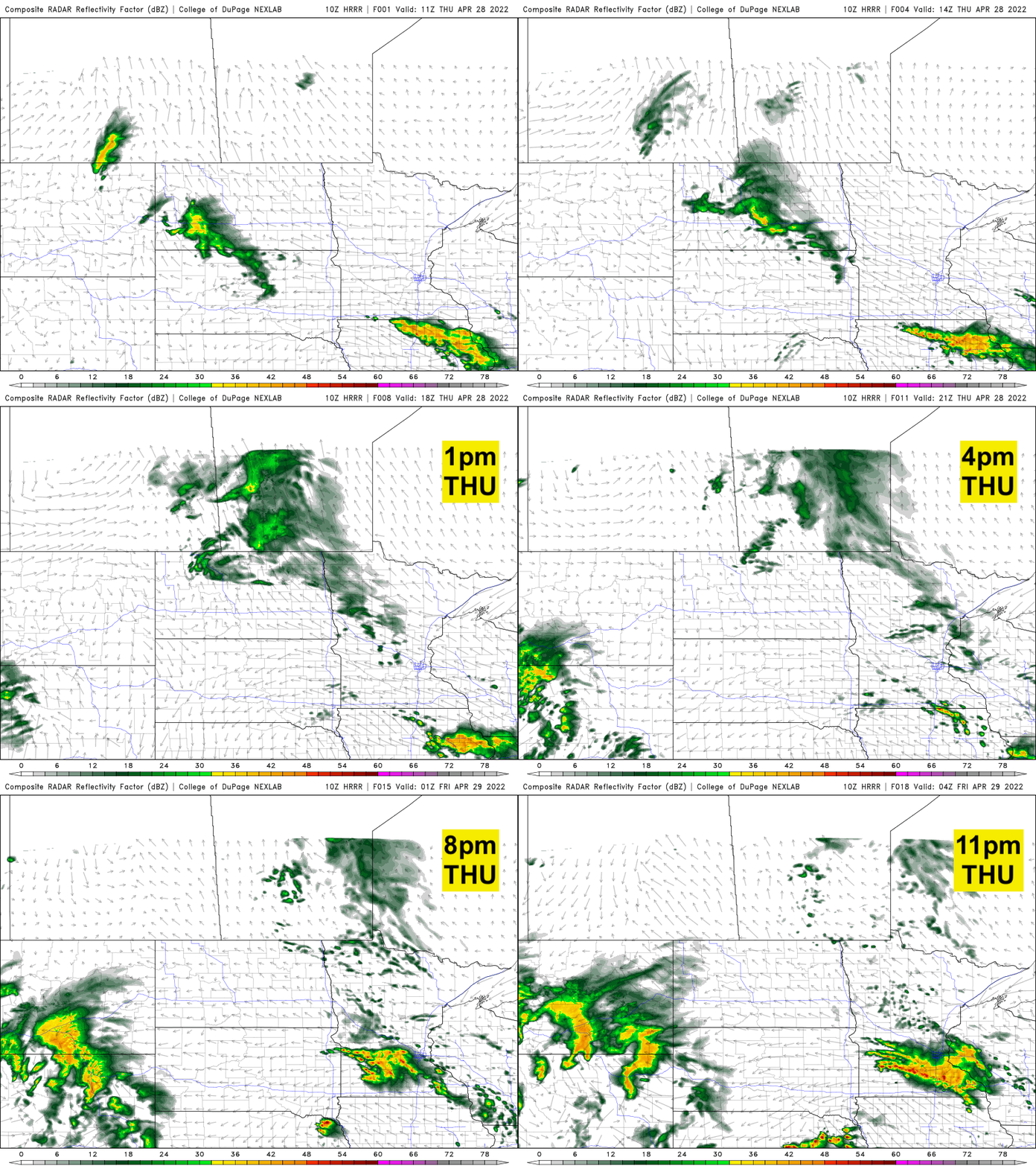
Most of Thursday will remain dry for most of the state. The southernmost counties will see some showers. For most of central and southern Minnesota, we’ll see scattered showers and even some thunder develop during the evening.
It will be breezy Thursday also with winds at 10-15 mph but gusts will be about 20-30 mph.
Turn Up Your Support
MPR News helps you turn down the noise and build shared understanding. Turn up your support for this public resource and keep trusted journalism accessible to all.
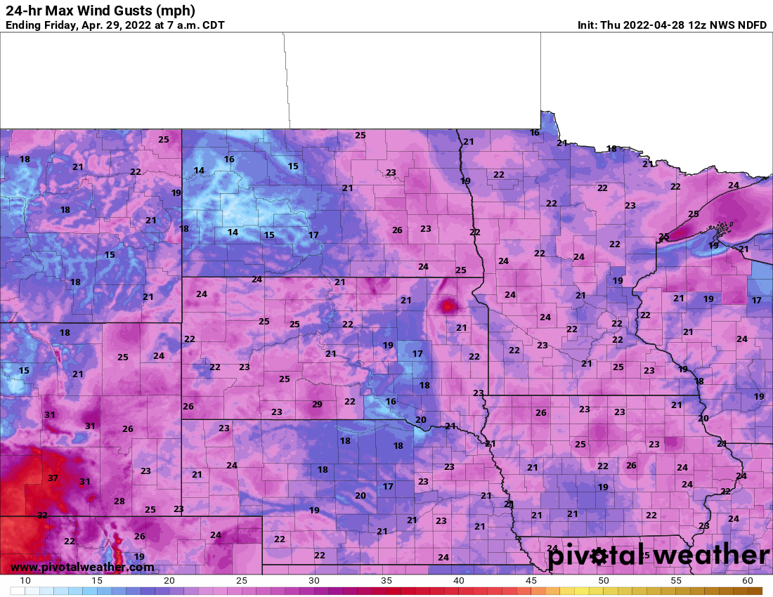
Milder Friday; wet weekend
We’ll squeeze in a mainly dry Friday with milder temperatures. Several spots could hit 60 in southern Minnesota Friday.

Winds will increase late Friday into the weekend as the next more potent storm system moves in. Gusty winds will be with us for a few days.
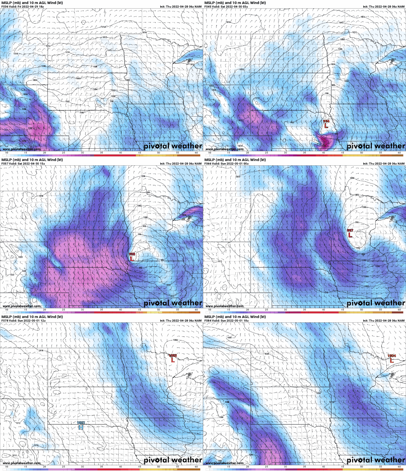
We’ll have scattered showers and some thunderstorms Friday night into Sunday with most of the rain falling Saturday.

It still looks like portions of southern and western Minnesota could see over one inch of precipitation.
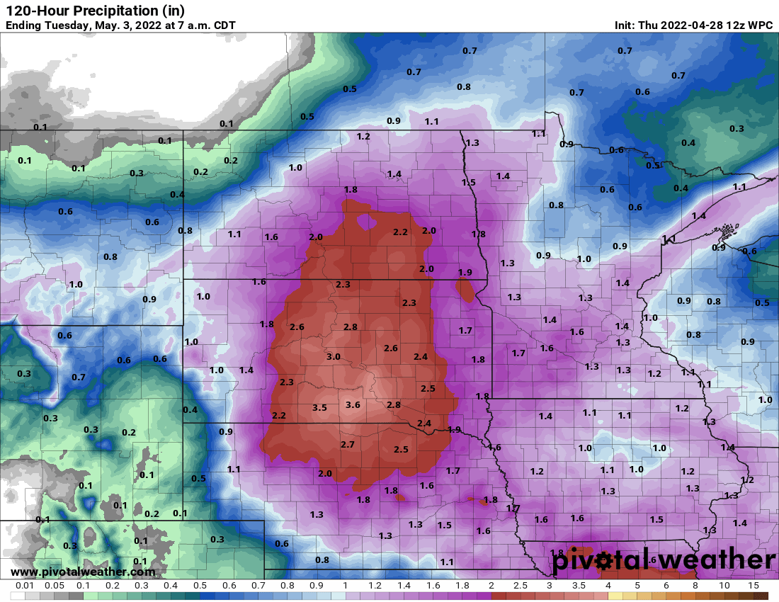
Unfortunately, much of this heavier rainfall falls along the Red River where most locations are above flood stage.

Not a record but definitely a wet spring so far
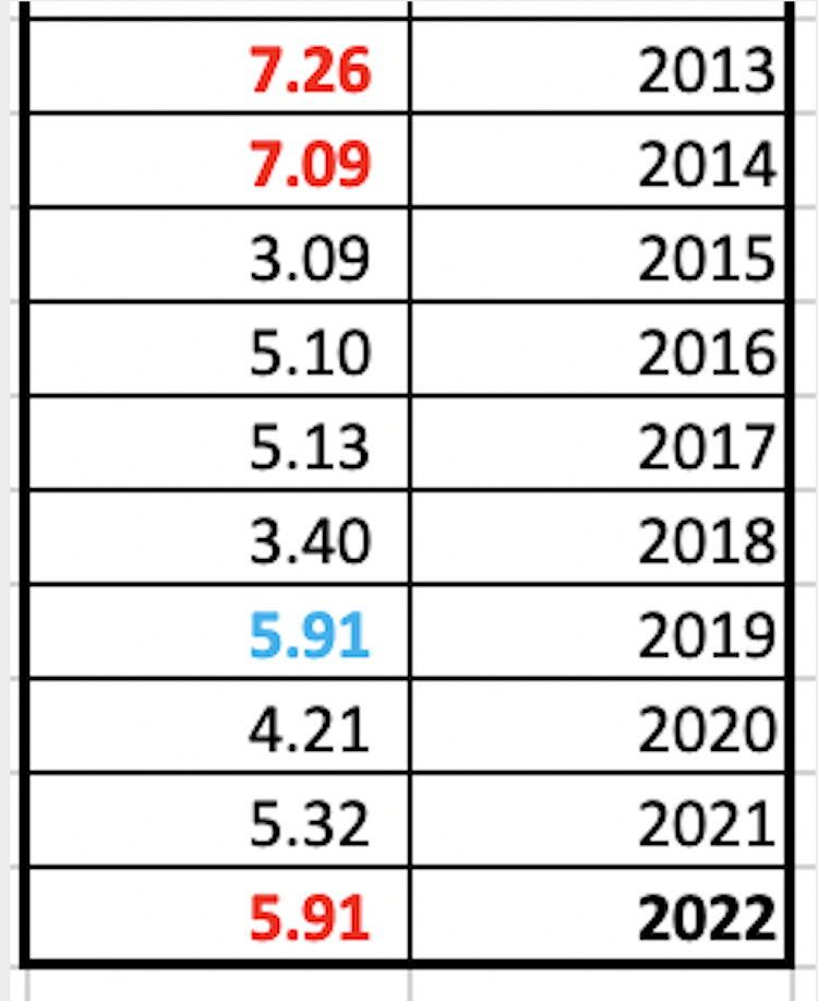
Our total precipitation in the Twin Cities so far since March 1 sits at 5.91 inches. This ties for 2019 (which ended up being our wettest year on record) but with showers Thursday night and certainly Saturday, we’ll easily surpass that.
This makes this spring the wettest in 8 years, going back to 2014. If we get more than 1.35 inches of precipitation between now and during the weekend that would make this spring the wettest in 21 years! Most models keep us under that amount at this point.