
Wet, warmer weekend starts Friday night
Milder, windy Friday ahead of more showers and thunder
Go Deeper.
Create an account or log in to save stories.
Like this?
Thanks for liking this story! We have added it to a list of your favorite stories.


Southern Minnesota will be mainly dry during the day Friday while scattered showers will persist north. Temperatures across the state will be milder, with low 60s south and 50s north.
More rain develops Friday evening. Expect waves of rain and thunder Saturday, which looks to be the wettest day of the weekend.
Mild, windy Friday
Winds will be blustery from the east ahead of the developing low pressure at 10-20 mph with gusts of 30-40 mph. Winds will remain high through the weekend.

We’ll also see our warmest day this week as our next storm system pulls in a warmer air mass. We may even see peeks of sunshine in southern Minnesota while some scattered showers will persist in northern Minnesota.
Turn Up Your Support
MPR News helps you turn down the noise and build shared understanding. Turn up your support for this public resource and keep trusted journalism accessible to all.

Quite a bit of rainfall this weekend
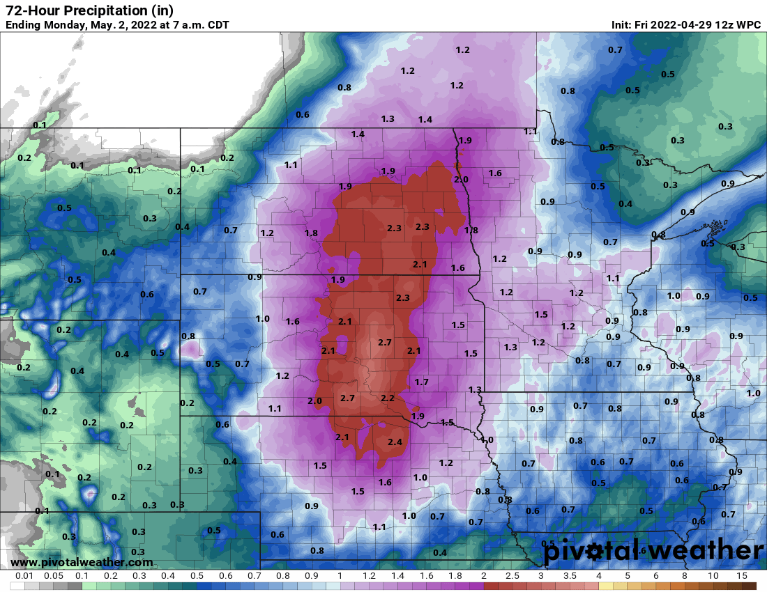
Showers and thunder will develop Friday evening into Friday night. Expect waves of rain and thunder Saturday, which looks to be the wettest day. Much of Minnesota could see near 1 inch or more of total precipitation.

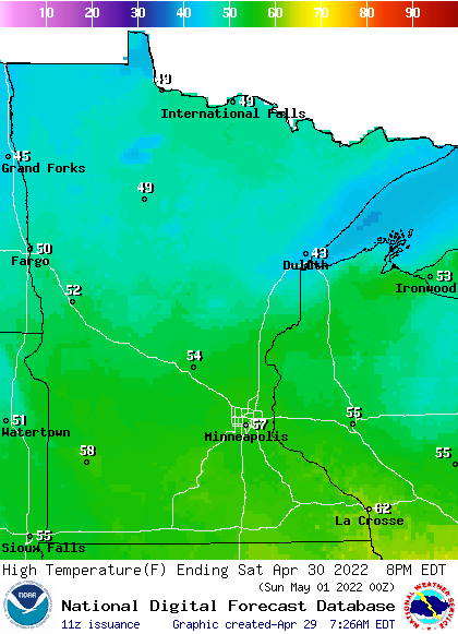
Saturday won’t be particularly cold however. High temperatures will be in the 50s and 40s mainly which means no snow for Minnesota this go-around.
Showers will be more widely scattered Sunday as the system winds down and pushes east. Of particular concern is the fact that some of the heaviest precipitation may fall on the Red River basin, which is at or above flood stage for many locations.
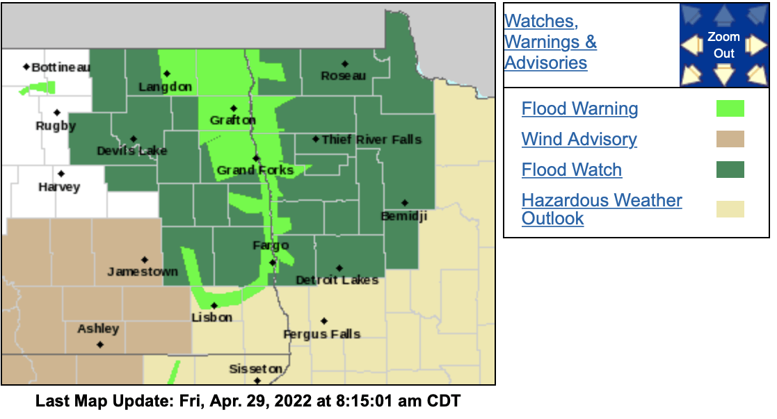
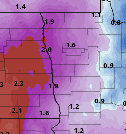
Up to 1 to 2 inches of rainfall could fall in these areas through Sunday.
Signs of warmth?
We’re all seeking warm or at least normal temperatures this spring. The National Oceanic Atmospheric Administration’s Global Forecast System model is offer some hope that warmer temps may be near.
The model creates what we call an omega blocking pattern during the second week of May, which would push anomalous warmth into the Upper Midwest. It’s called an omega block because it looks like the Greek letter in the upper flow of the atmosphere which resembles an English language W.
Minnesota will be in the middle arch of this pattern with cold air in the upper levels and storm systems in the west and the east.
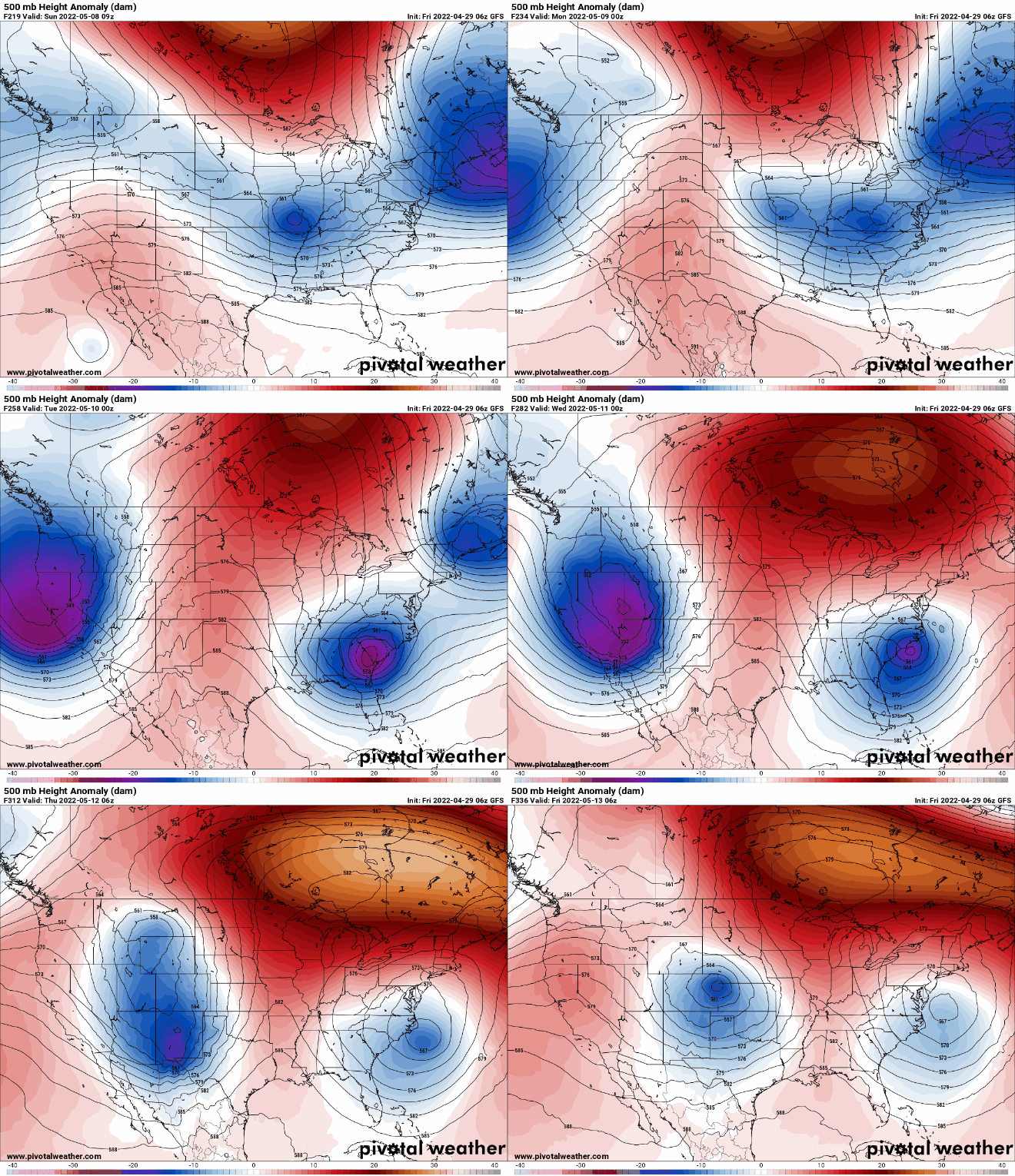
While temperature anomalies early this upcoming week will be below normal, temperature anomalies in the second week of May shift to warmer than normal.
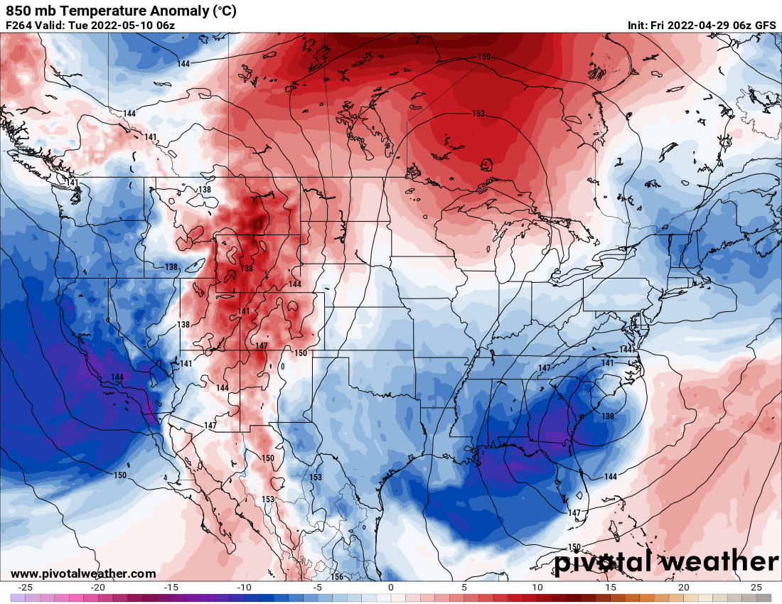
Of course nothing is set in stone and this forecast pattern is still more than seven to 10 days away, but we’ll take any signs of hope we can.

