Sun returns Tuesday after cool, gray Monday
Onward and upward with warming temperatures this week
Go Deeper.
Create an account or log in to save stories.
Like this?
Thanks for liking this story! We have added it to a list of your favorite stories.


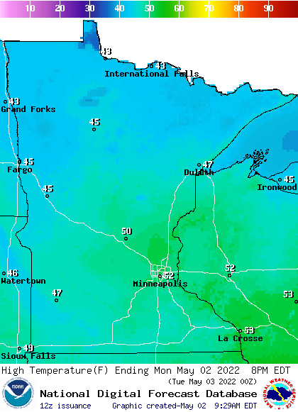
Monday will remain cool and mostly cloudy but with lighter winds. Sunshine returns Tuesday and we’ll see consistent warmth develop this week. We should see highs consistently in the 60s and even 70s starting Friday.
A cold and wet April completed
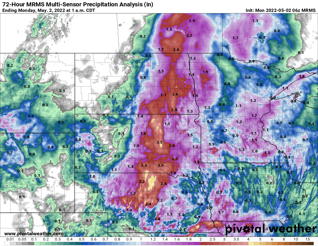
We picked up an additional 1.12 inches of rainfall over the weekend in the Twin Cities putting us up to 7.04 inches for meteorological spring (since March 1). That makes this the 13th wettest spring and the wettest since 2014.
April finished rather cold (no surprise) at nearly 6 degrees colder than normal. Parts of northwestern Minnesota were 8 degrees colder than the average.
It was not a top 10 coldest April though for most. We ended up 16th coldest in the Twin Cities. We technically tied with three other Aprils all at precisely 41degrees for a monthly average, making up the 13th to 16th rankings.
Turn Up Your Support
MPR News helps you turn down the noise and build shared understanding. Turn up your support for this public resource and keep trusted journalism accessible to all.
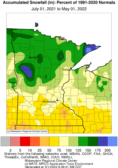
We’re mostly done with seasonal snowfall. It was below normal in the south while the north was much above.
Here’s a look at the percentage of normal snowfall across Minnesota:
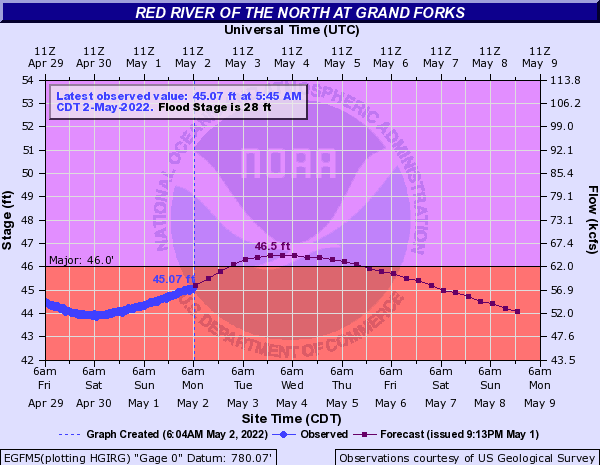
All that extra rain and snow of course has kept the Red River high. While it started to drop late last week, the weekend rain is pushing it back up. The Red River at Grand Forks, N.D., is expecting a second crest this week.
Overall dry and warming up
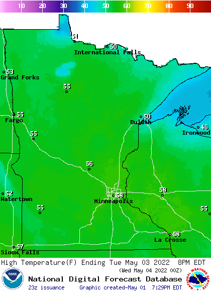
Monday will be the last real dreary, chilly day. Highs will mainly be in the 40s with a few low 50s south. The rest of the week looks mainly quiet as we see sunshine break out by Tuesday afternoon. That will push temperatures up well into the 50s with some low 60s south.
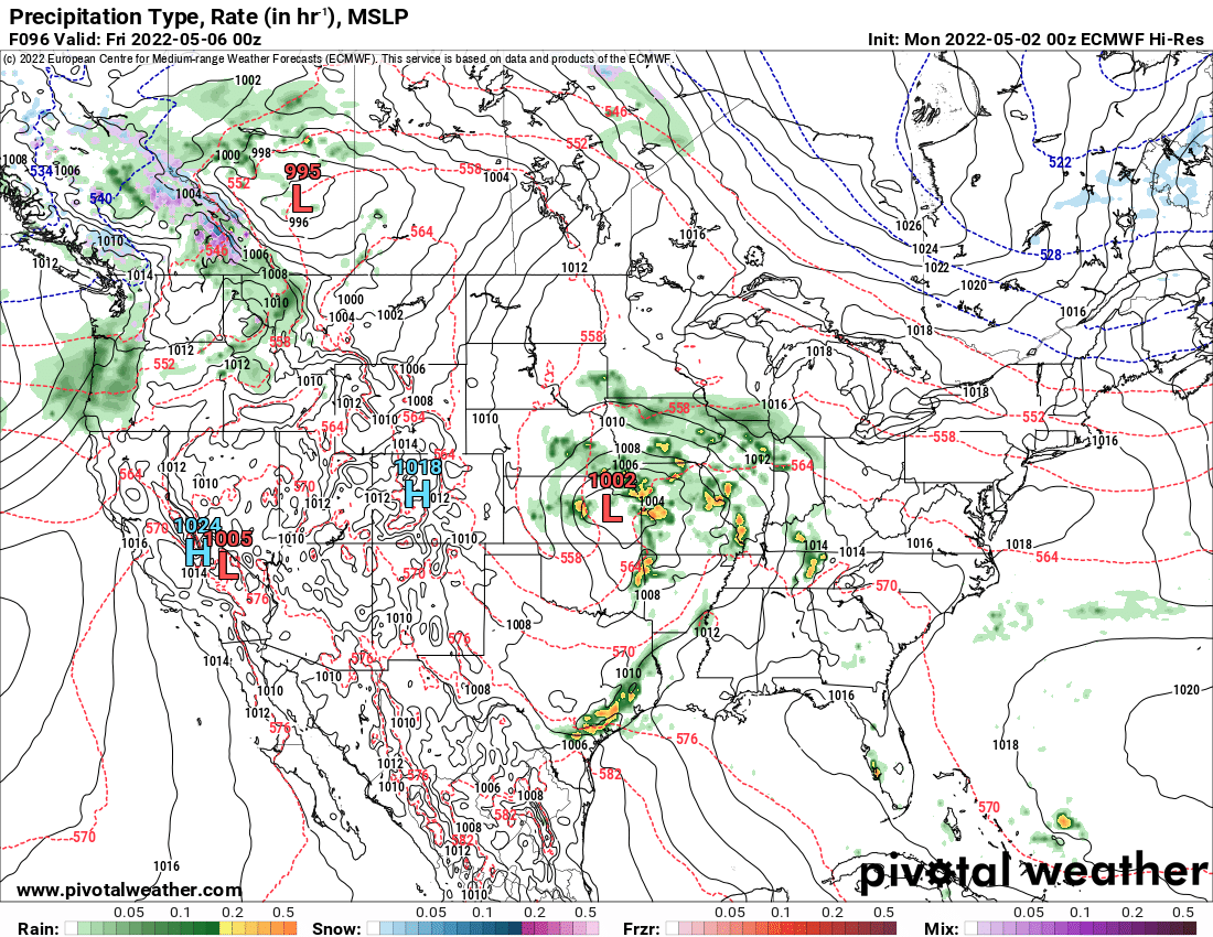
The only real chance of precipitation this week comes Thursday with a system that will mainly move south of Minnesota abut could clip far southern Minnesota with a few showers.
We should see highs consistently in the 60s and even 70s starting Friday. The models are now trending toward a potential first 80 early to midweek next week as a pronounced ridge develops in the central part of North America.
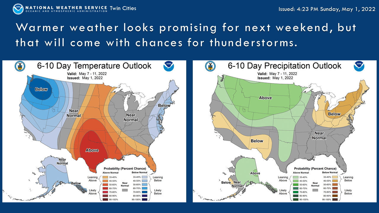
The outlook for next week is above-normal temperatures and above normal precipitation: