Sunny, warmer Tuesday; dry weather will ease Red River levels
Warming trend continues through the week
Go Deeper.
Create an account or log in to save stories.
Like this?
Thanks for liking this story! We have added it to a list of your favorite stories.


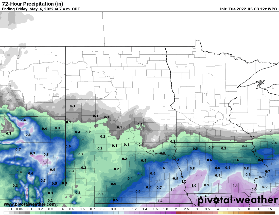
Increasing amounts of sun Tuesday will push temperatures nearly 10 degrees warmer than Monday. Dry weather for most and a warming trend continues this week.
Mostly dry weather for most of Minnesota
A tug of war of sorts is taking place across southern Minnesota between a storm system which is clipping far southeast Minnesota with showers Tuesday and an area of high pressure settling in from the north, decreasing cloud cover.
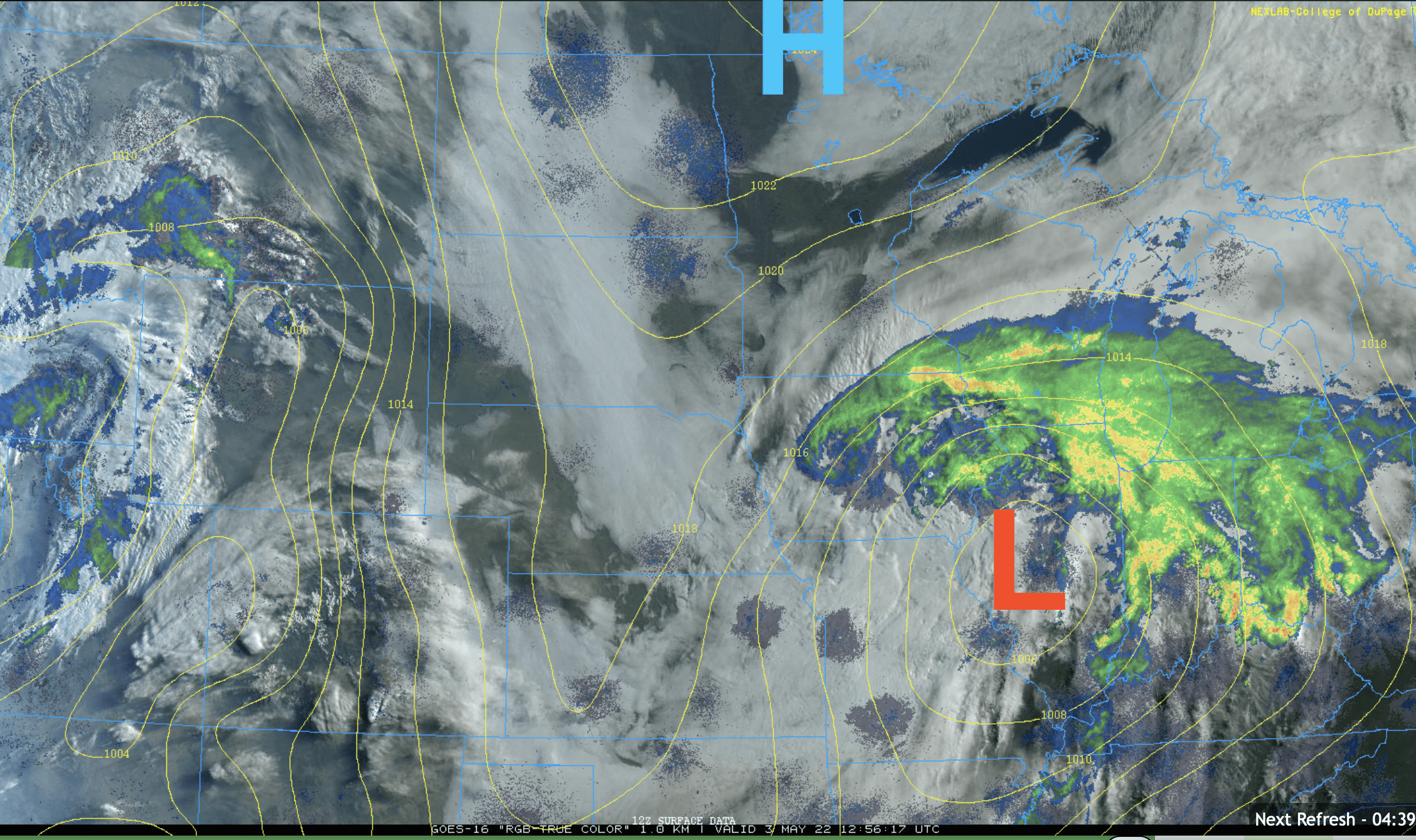
High temperatures Tuesday will be warmer as most of us see more sunshine.

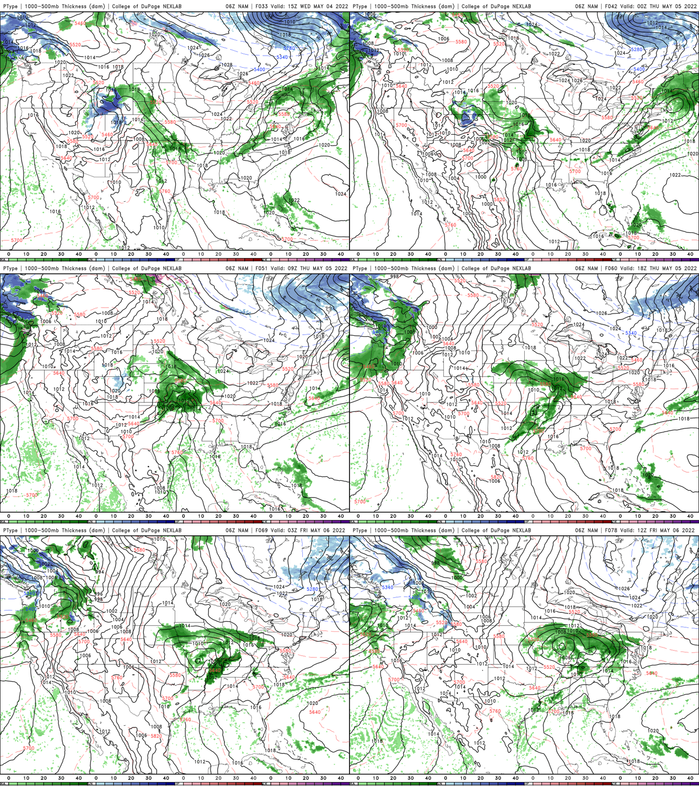
Another storm system will clip southern Minnesota Thursday but again, most of Minnesota will remain dry.
Turn Up Your Support
MPR News helps you turn down the noise and build shared understanding. Turn up your support for this public resource and keep trusted journalism accessible to all.
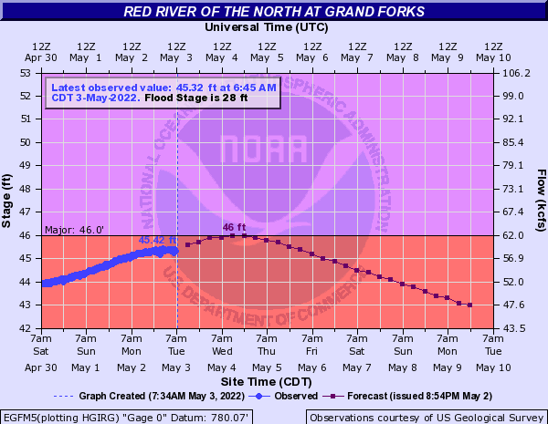
The dry weather, especially north is very welcome as river levels are rising yet again after the wet weekend. The Red River at Grand Forks, N.D., should see a second crest late Tuesday at near 46 feet.
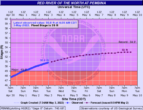
That water is still moving north. The Red River at Pembina, N.D., near the Canadian border is expected to rise yet into the weekend.
Some have asked about lake levels which suffered after last year’s drought. One of the more accurate and real-time measurements is on Lake Minnetonka, which is up a foot from last fall. Most of that rise has come this spring!

Warming trend continues; perhaps some heat?
We often joke about how Minnesota skips spring and goes directly from winter to summer. This year may be one of those years.
The European Centre for Medium-Range Weather Forecasts model pushes southern Minnesota to 90 degrees next Tuesday and brings in our first bout of 70-degree dew points. In case you’re curious, that would create a heat index in the mid to upper 90s.
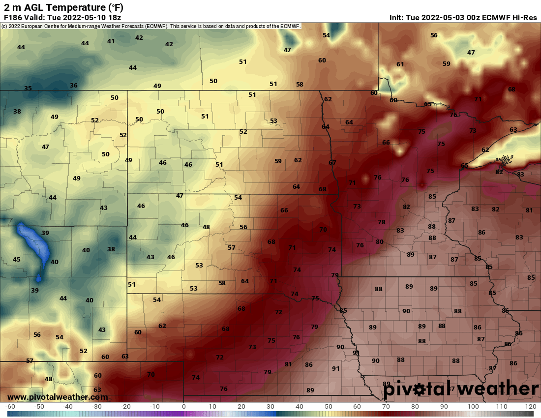
While the European model may be on the higher end of solutions, all the models bring in a surge of 70s and 80s for the first part of next week. The pattern could also yield some strong storms.
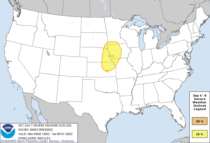
The very early look from the Storm Prediction Center for Monday brings some risk to southern Minnesota.