Warmer Wednesday; taste of summer next week?
A chilly start but warming quickly
Go Deeper.
Create an account or log in to save stories.
Like this?
Thanks for liking this story! We have added it to a list of your favorite stories.


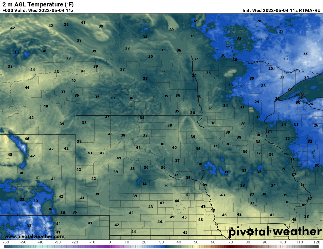
A chilly start early Wednesday will lead to a mild afternoon thanks to sunshine, filtered through high clouds.
A chilly start but warming up
The sunshine was great yesterday but those clear skies are leading to some chilly temperatures to start out Wednesday. It’s below freezing even in northern Minnesota. We’ll warm up quickly however with more sun on Wednesday, though it will be filtered somewhat through high cirrus clouds.

A storm system moves mainly south of Minnesota again Thursday into Friday but could clip southern Minnesota with a few showers.
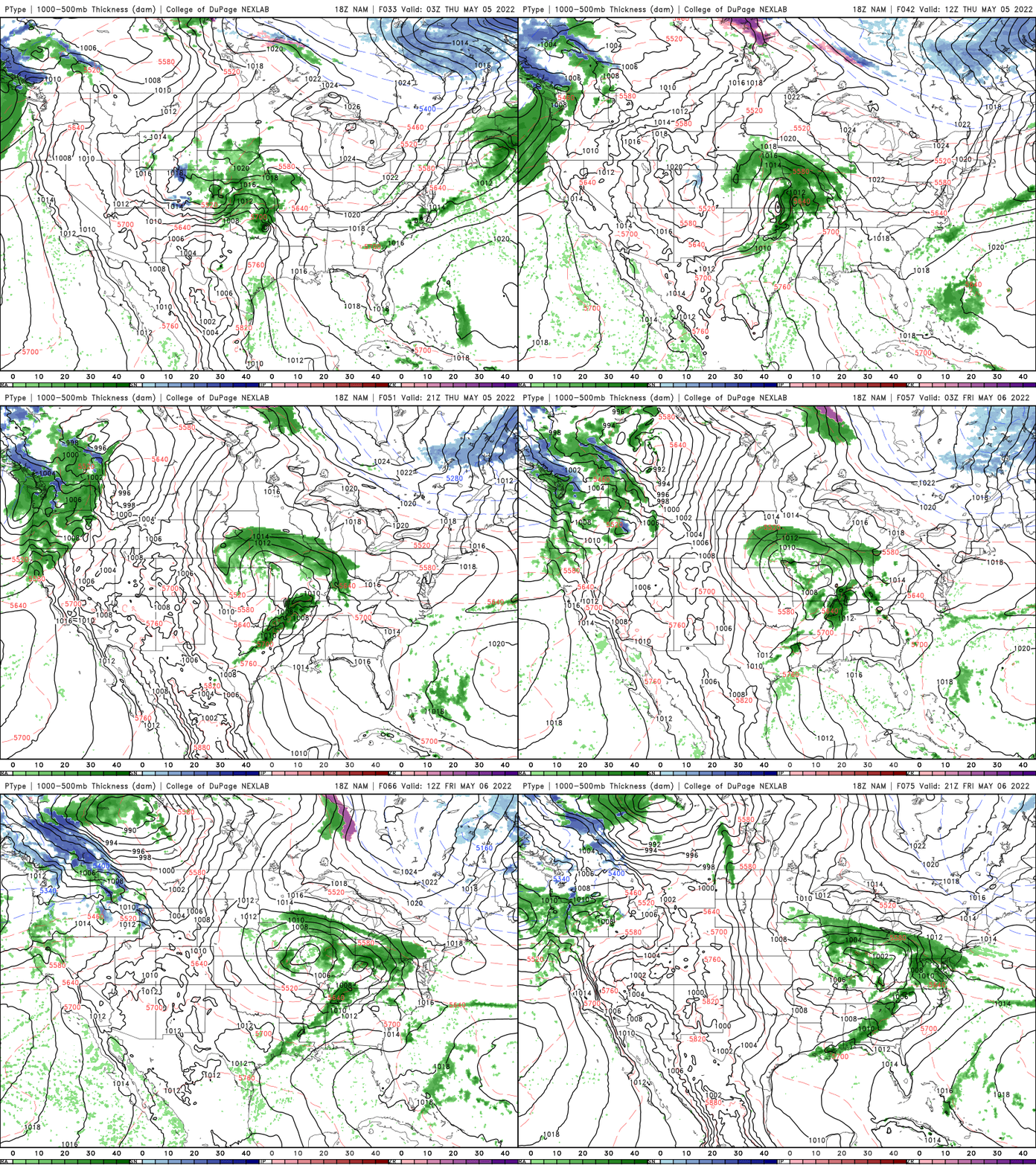
We’re then set to see a taste of potential summer like weather next week with temps in the 70s, maybe even 80s and more humid. That will lead to the possibility of storms too.
Turn Up Your Support
MPR News helps you turn down the noise and build shared understanding. Turn up your support for this public resource and keep trusted journalism accessible to all.
The flood waters of the Red River are influencing weather
The National Weather Service office in Grand Forks tweeted this observation Tuesday afternoon.
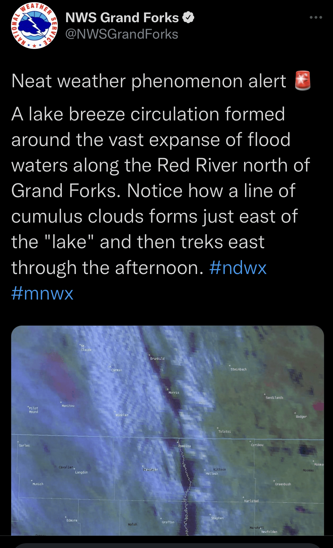
The floodwaters are wide enough to have created some local weather effects Tuesday afternoon. The Red River is up to 8 miles wide in some places! That’s definitely large enough to have an effect on the weather when that water is cold (likely upper 30s to low 40s) and temperatures on land warmed well into the 50s. The VIIRS satellite instrument can detect the floodwater, denoted as yellow and orange below.

Basically, as the surrounding land heated up, the air rose and the cold air blew off the water to to replace that air and that pushed away the instability cumulus clouds that had developed. The flow was the opposite of the overall flow from the east as the cold, dense air outweighed the influence of the high pressure to the northeast.
This is much the same way a sea breeze operates. The temporarily wider Red River acts as a mini cold front. You can see this on the visible satellite loop below.