
Quiet, calm Tuesday; more storms late Wednesday
Cooler but still warm Tuesday; heating up Wednesday
Go Deeper.
Create an account or log in to save stories.
Like this?
Thanks for liking this story! We have added it to a list of your favorite stories.


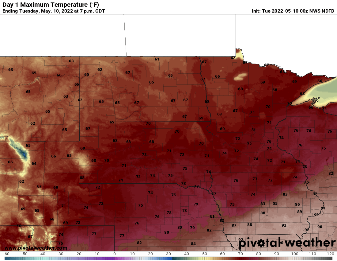
We’ll have cooler temperatures (but still above normal) Tuesday with abundant sunshine and lower dew points (humidity) across the state. More storms are possible late Wednesday.
A hot and stormy Monday recap
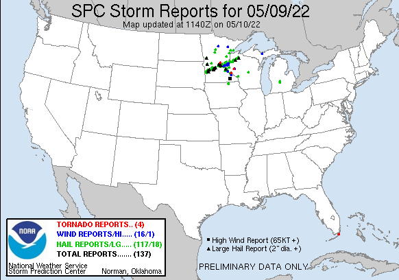
Monday saw two rounds of severe storms with lots of hail reports and even three tornado reports; Gilman (Benton County), Stockholm (Pepin County, Wis.), and Cedar Falls (Dunn County, Wis.).
Monday also brought the warmest temperatures of the season with our first 80s and 90s for some. Fairmont topped out at 91 and a few other places reached 90: Waseca, Mankato and Owatonna.
Much quieter Tuesday with sunshine
After a stormy Monday, we’ll see a calmer Tuesday with slightly cooler temperatures and much less humid conditions.
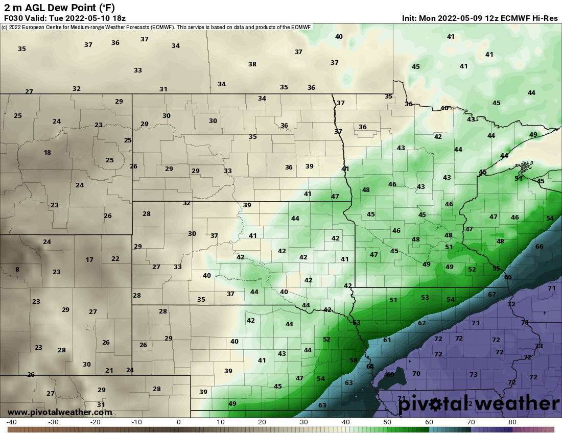
Most noticeable may be the dew points. We experienced our first real bout of ‘heat’ and humidity. Tuesday’s dew points will be mainly in the 40s, down from the 60s to near 70 many experienced yesterday afternoon. That 20-degree drop in dew points equates to about half the water in the air. That also means we can expect lots of sunshine.
Humidity will again increase Wednesday along with temperatures heating up. Record highs Wednesday and Thursday are 88 and 90 respectively and at least one of those could be in jeopardy.
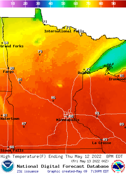
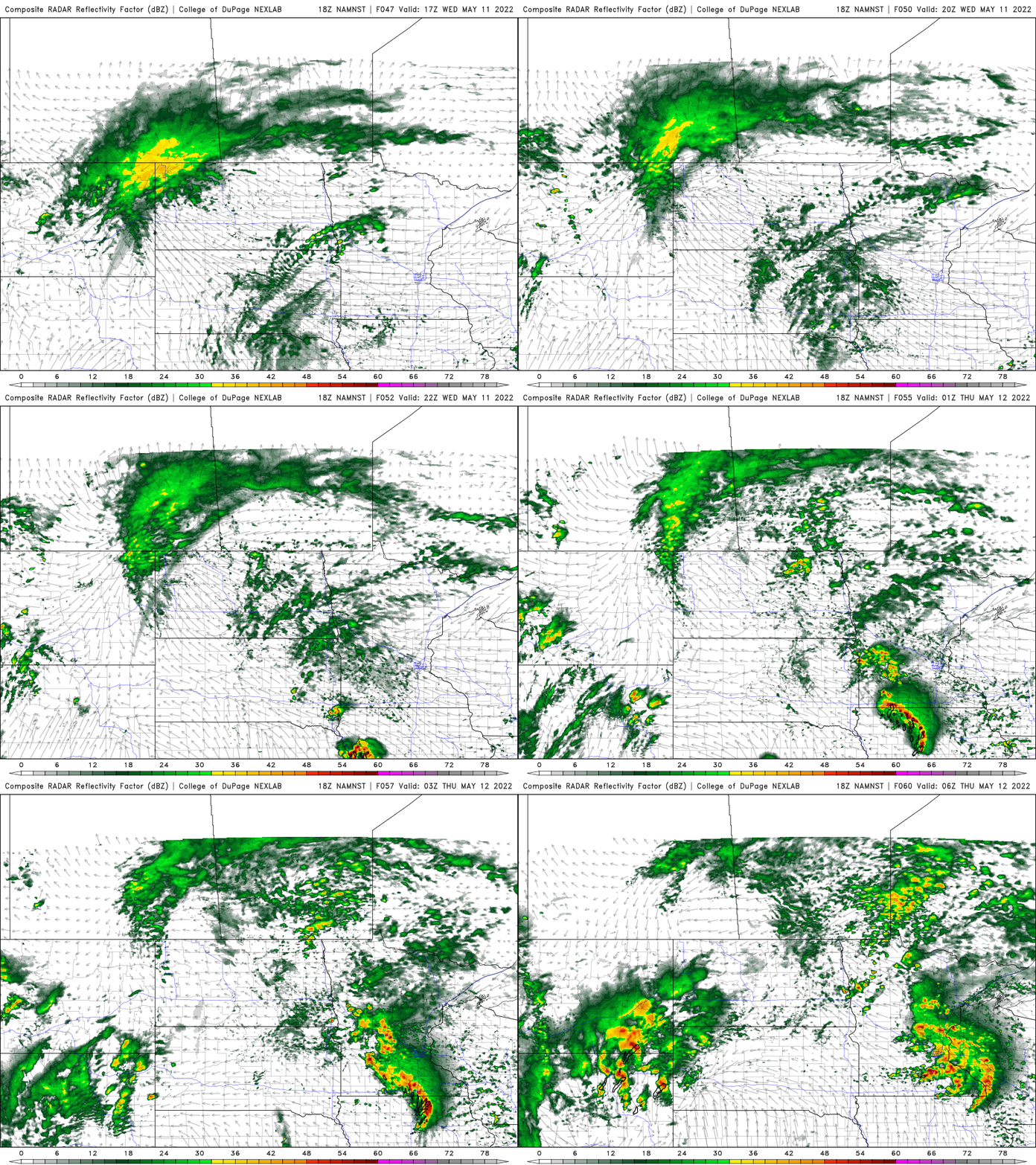
Thunderstorms, some possibly severe, also move into the picture again late Wednesday and Thursday.
Turn Up Your Support
MPR News helps you turn down the noise and build shared understanding. Turn up your support for this public resource and keep trusted journalism accessible to all.

