
Isolated shower Friday, more rain Saturday; hot next week
More clouds around Friday

Go Deeper.
Create an account or log in to save stories.
Like this?
Thanks for liking this story! We have added it to a list of your favorite stories.


It’s a little more unsettled Friday, which will lead to more clouds and an isolated shower or two, especially in central and southern Minnesota. More showers-thunder develop overnight Friday night across much of Minnesota into Saturday morning.
Scattered showers Friday and Saturday
An area of fizzling showers and clouds across central Minnesota will slowly move south through the day Friday.

This area of instability will be the focus for a few pop-up showers again later in the day Friday across central-southern Minnesota.
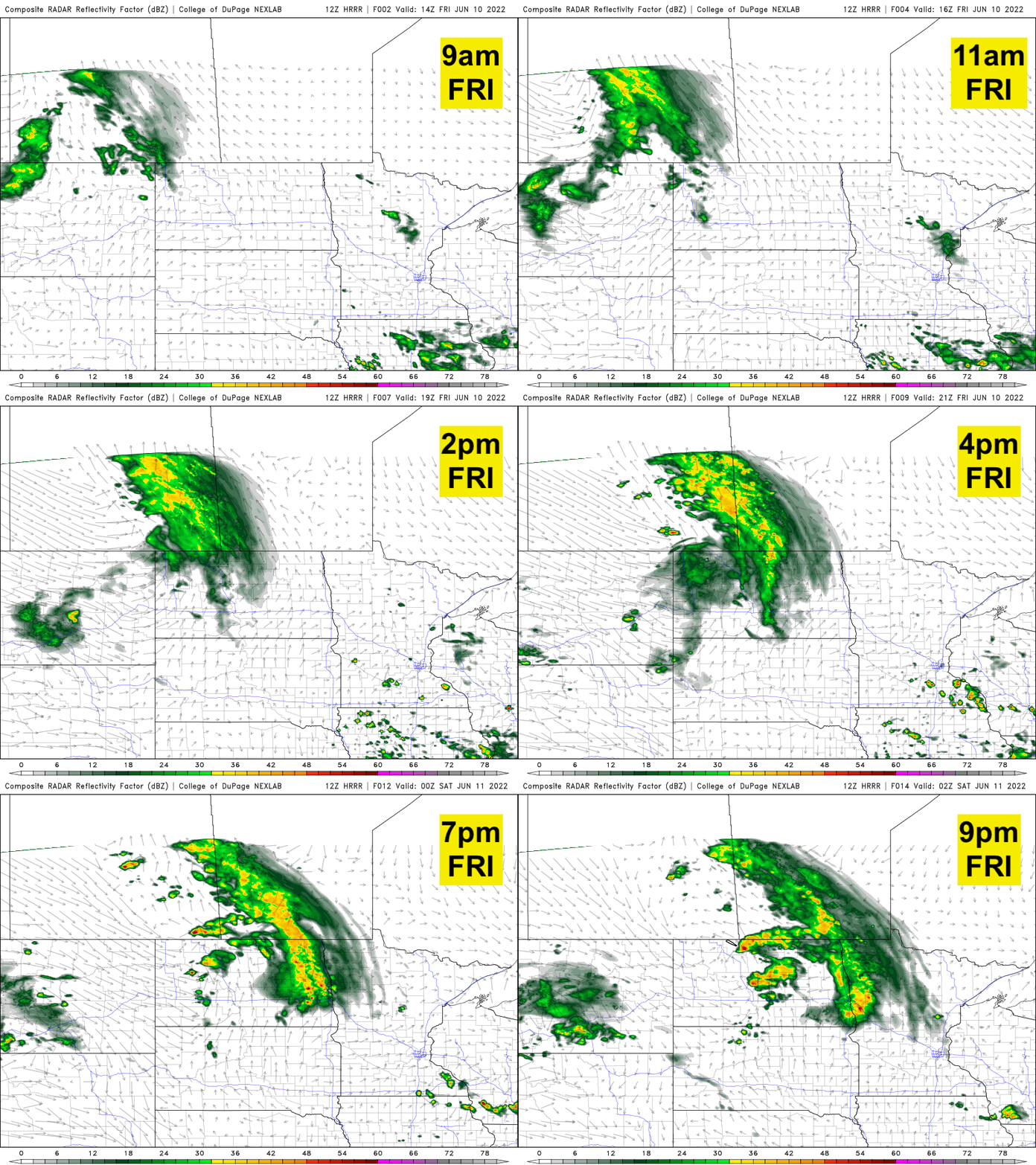
More rain moves in overnight Friday night into primarily Saturday morning.
Turn Up Your Support
MPR News helps you turn down the noise and build shared understanding. Turn up your support for this public resource and keep trusted journalism accessible to all.
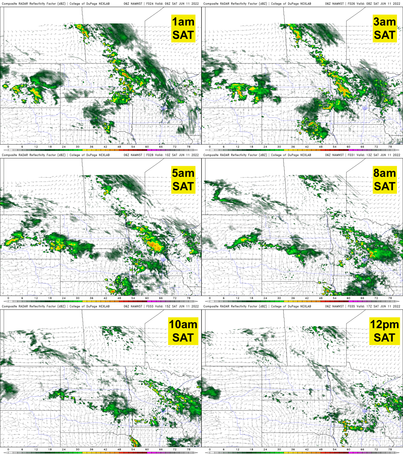
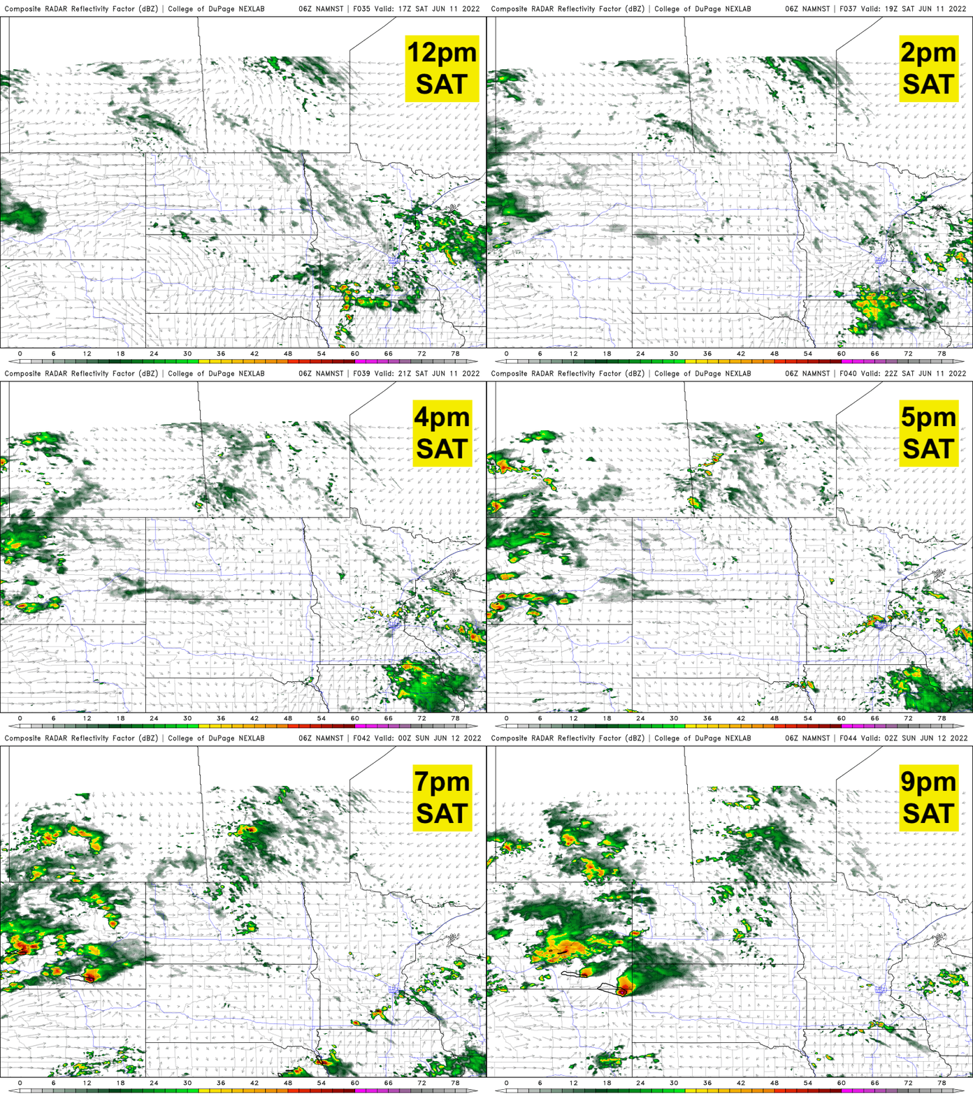
The afternoon will then be mainly dry with even a few peeks of sun but this will destabilize the atmosphere and lead to some pop-up thunderstorms in the late afternoon and evening again.
Highs Friday will be in the 70s statewide.

Here comes the heat
The heat will be wafting in and building, and it’s sticking around for the foreseeable future.
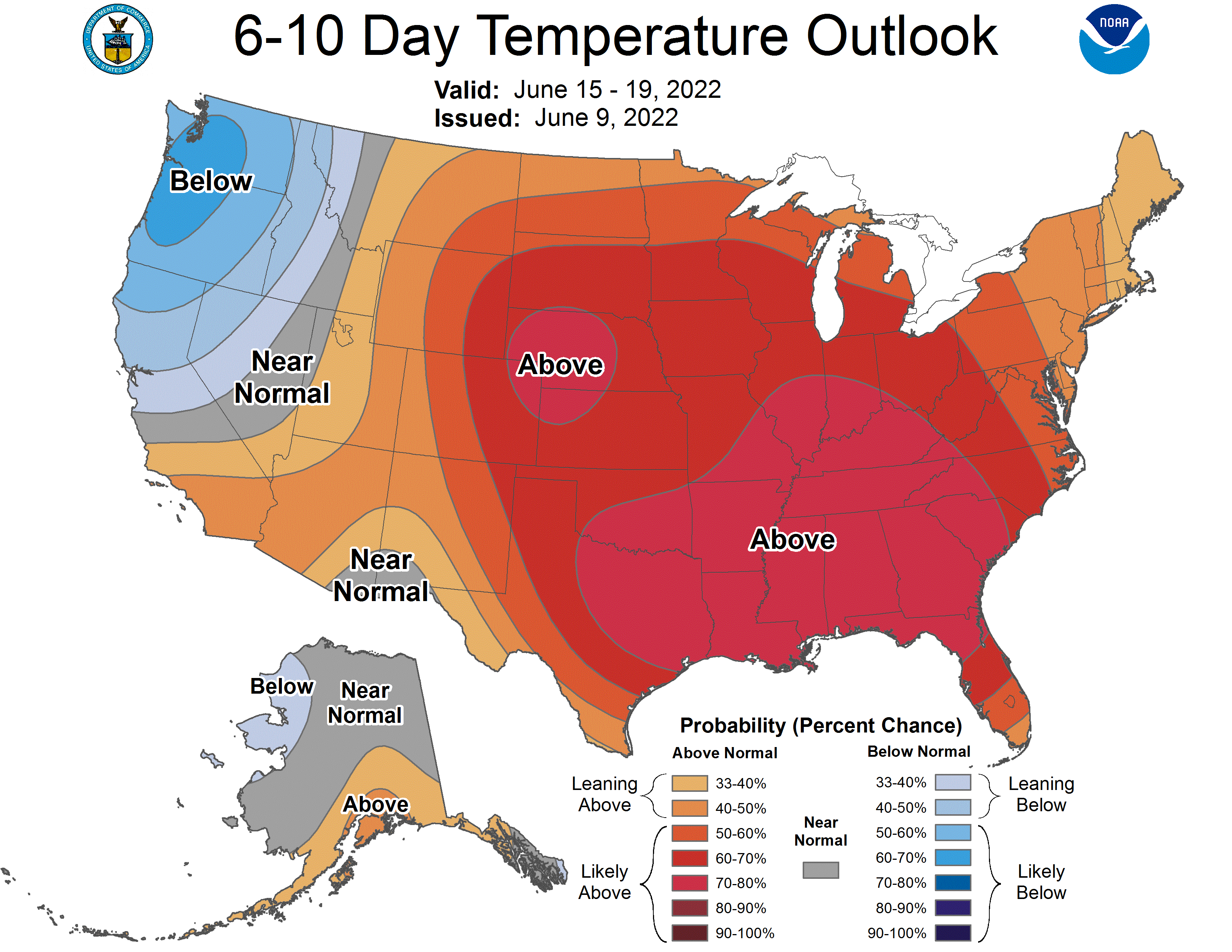
Our first day in the 90s in this latest stretch comes Tuesday. Dew points will be in the 60s making it sticky.

After that we’re likely to be a bit cooler with some thunderstorms Wednesday but the heat isn’t going anywhere. We’re likely to be back in the 90s late next week.

