
Sunday rain chances highest to the north; strong storms possible early Monday
Hot temps on Tuesday

Go Deeper.
Create an account or log in to save stories.
Like this?
Thanks for liking this story! We have added it to a list of your favorite stories.


We’ve had summery temps and dew points the past couple of days, and Sunday will bring us more of the same.
Temperature trends
The Saturday afternoon high temp at Minneapolis-St. Paul International Airport was 81 degrees. That’s a bit above our average June 11 high of 78.
Some spots in the Twin Cities metro area will touch 80 degrees on Sunday, with highs topping 80 in southwestern and south-central Minnesota and a lot of highs in the 70s elsewhere:
Turn Up Your Support
MPR News helps you turn down the noise and build shared understanding. Turn up your support for this public resource and keep trusted journalism accessible to all.

Highs in the 60s are expected near Lake Superior.
Sunday afternoon dew points in central and southern Minnesota plus western Wisconsin will feel summery, in the upper 50s to lower 60s:

Back to high temperatures, Twin Cities metro area highs are projected to reach the lower 80s on Monday, followed by mid 90s Tuesday. Our highs then retreat to the mid 80s on Wednesday and lower 80s Thursday, followed by mid 80s Friday.
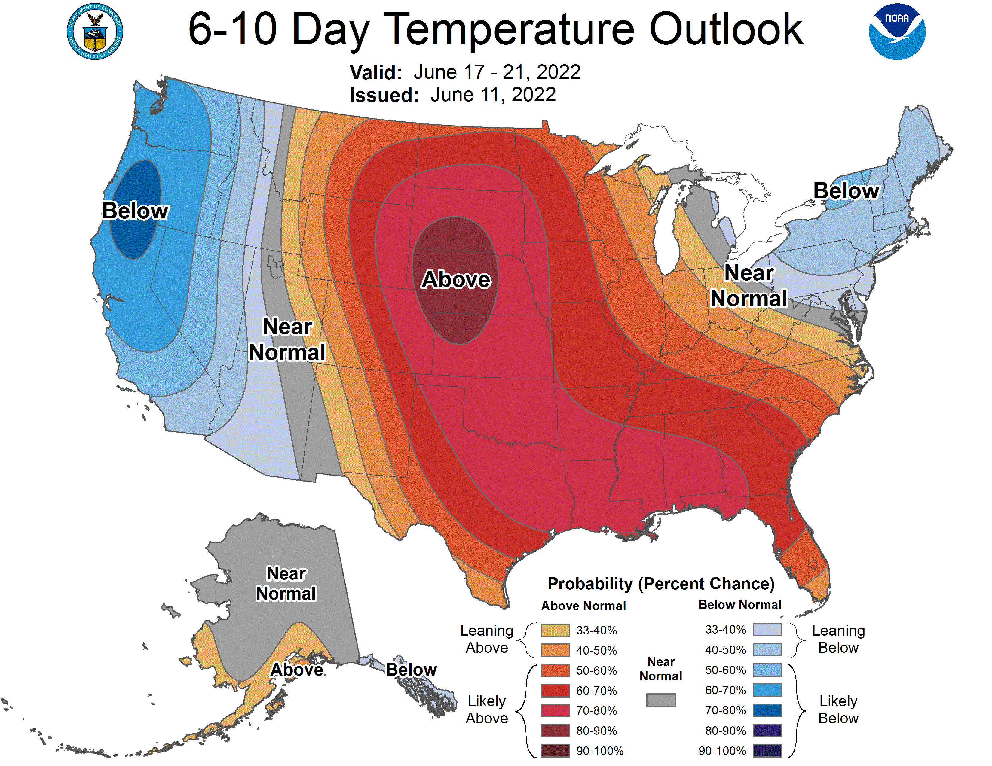
The NWS Climate Prediction Center shows a tendency for above-normal temperatures in the upper Midwest next weekend and into the start of the following week:
Rain chances and severe weather potential
A few scattered showers and thunderstorms are possible in Minnesota and western Wisconsin Saturday evening and overnight Saturday night.
You can hear updated weather information for Minnesota and western Wisconsin on the Minnesota Public Radio News network, and you can see updated weather info on the MPR News live weather blog.
The Storm Prediction Center of the National Weather Service shows a marginal risk (shaded darker green) of severe weather in portions of southwestern and south-central Minnesota Saturday evening and overnight Saturday night:
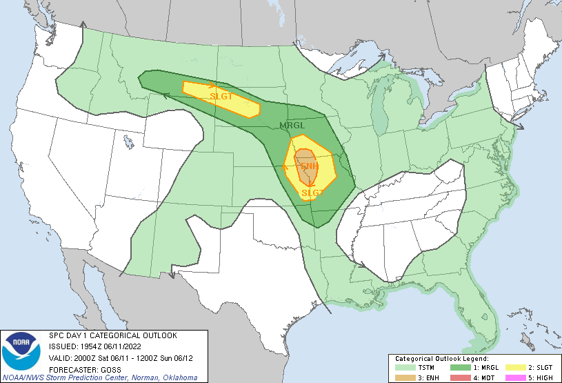
Marginal risk means that an isolated severe thunderstorm is possible. Portions of South Dakota, Nebraska, Iowa, Kansas and Missouri have better chances of severe weather Saturday evening and overnight.
The Storm Prediction Center updates the severe weather outlook every few hours.
The best chance of showers and thunderstorms Sunday morning will be in northwestern Minnesota and parts of southwestern Minnesota. A few scattered showers and thunderstorms could pop up anywhere in Minnesota and western Wisconsin as we go through Sunday afternoon and evening.
Some strong to severe thunderstorms could spread across Minnesota and parts of western Wisconsin later Sunday night into early Monday. The NWS Storm Prediction Center shows a marginal risk of severe weather (darker green) for much of our region, with a slight risk (yellow) in the far west:

Slight risk means that scattered severe thunderstorms are possible, marginal risk means that an isolated severe thunderstorm is possible. The explanation of storm timing and potential severe hazards in the graphic above is from the NWS Twin Cities office.
Check forecast updates.
Weather nugget
June is on average the rainiest month of meteorological summer in the Twin Cities, with 4.58 inches:

August is the next rainiest and July is our least rainy month of meteorological summer. The water content of any snowfall is included in the average monthly precipitation totals that are listed in the graphic.
Programming note
You can hear my live weather updates on MPR News at 7:35 a.m., 9:35 a.m. and 4:39 p.m. each Saturday and Sunday.

