
Weekend weather: Warm Saturday, hot on Sunday
Excessive heat watch
Go Deeper.
Create an account or log in to save stories.
Like this?
Thanks for liking this story! We have added it to a list of your favorite stories.


Our Saturday weather will be summery, which is appropriate because we’re in meteorological summer (June through August).
Our average June 18 Twin Cities high temp is 80 degrees. Metro area high temps are forecast to reach the lower 80s on Saturday. High temps Saturday afternoon will range from the lower 90s in portions of western Minnesota to mainly 70s in northeastern Minnesota and western Wisconsin:

Areas near Lake Superior will have highs in the 60s.
Saturday dew points will be in the 50s in many locations, with sticky 60s creeping into southwestern Minnesota:
Turn Up Your Support
MPR News helps you turn down the noise and build shared understanding. Turn up your support for this public resource and keep trusted journalism accessible to all.

Lower dew points (drier air) will linger over northeastern Minnesota and northwestern Wisconsin.
High temperatures really ramp up on Sunday, with triple-digit highs in parts of western Minnesota and many 90s in the east:

Northeastern Minnesota will be in the 70s, with a few 60s up along portions of the North Shore of Lake Superior.
Sunday afternoon dew points will be in the sticky 60s in many areas:

Excessive heat watch starts on Sunday
The National Weather Service has issued an excessive heat watch for much of the Twin Cities metro area that starts at noon on Sunday and continues into Monday night. An excessive heat watch starts at 10 a.m. Sunday and continues through Monday night for counties to the west:

An excessive heat watch begins at 10 a.m. Sunday and continues through the overnight hours of Sunday night for several northwestern Minnesota counties:

Here are details of the excessive heat watch that includes most of the Twin Cities metro area:
URGENT - WEATHER MESSAGE National Weather Service Twin Cities/Chanhassen MN 1023 AM CDT Fri Jun 17 2022 MNZ059>062-068>070-172330- /O.NEW.KMPX.EH.A.0001.220619T1700Z-220621T0600Z/ Wright-Hennepin-Anoka-Ramsey-Carver-Scott-Dakota- Including the cities of Monticello, Minneapolis, Blaine, St Paul, Chanhassen, Chaska, Victoria, Shakopee, and Hastings 1023 AM CDT Fri Jun 17 2022 ...EXCESSIVE HEAT WATCH IN EFFECT FROM SUNDAY AFTERNOON THROUGH LATE MONDAY NIGHT... * WHAT...Dangerously hot conditions with heat index values up to 103 possible. * WHERE...The Twin Cities Metro, including Wright, Hennepin, Anoka, Ramsey, Carver, Scott and Dakota Counties. * WHEN...From Sunday afternoon through late Monday night. * IMPACTS...Extreme heat and humidity will significantly increase the potential for heat related illnesses, particularly for those working or participating in outdoor activities. * ADDITIONAL DETAILS...Vulnerable groups, such as those with chronic illness or taking certain medications, elderly, and children are most at risk. For information on cooling shelters in Hennepin and Ramsey Counties, see our web page: weather.gov/mpx. PRECAUTIONARY/PREPAREDNESS ACTIONS... Monitor the latest forecasts and warnings for updates on this situation. Be prepared to drink plenty of fluids, stay in an air- conditioned room, stay out of the sun, and check up on relatives and neighbors. Young children and pets should never be left unattended in vehicles under any circumstances. Particularly in hot temperatures, when car interiors can reach lethal temperatures in a matter of minutes.
You can hear updated weather information for Minnesota and western Wisconsin on the Minnesota Public Radio News network, and you can see updated weather info on the MPR News live weather blog.
Weekend rain chances?
A few scattered showers and thunderstorms are possible in northern and central Minnesota and parts of western Wisconsin on Saturday.
The National Oceanic and Atmospheric Administration’s North American Mesoscale forecast model shows the potential rain pattern from 4 a.m. Saturday to 9 p.m. Saturday:
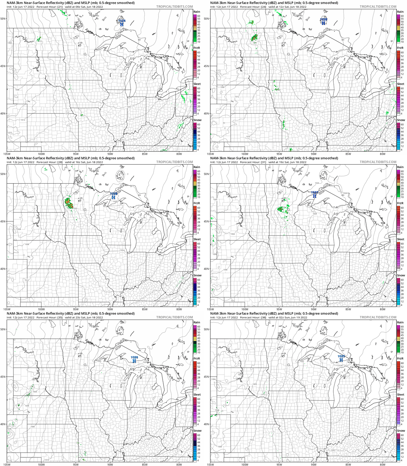
At this point, it looks like many spots will have a dry Saturday, with just a few minutes of rain in the spots that do see some rain. Check forecast updates.
Programming note
You can hear my live weather updates on MPR News at 7:35 a.m., 9:35 a.m. and 4:39 p.m. each Saturday and Sunday.

