
Warmer and more humid on Sunday; thunderstorm chances ramp up
Severe weather will be possible Sunday and Sunday evening

Go Deeper.
Create an account or log in to save stories.
Like this?
Thanks for liking this story! We have added it to a list of your favorite stories.


Our Saturday weather was great for outdoor activities. We enjoyed plenty of sunshine, along with reasonable dew points.
The Saturday afternoon high temp at Minneapolis-St. Paul International Airport was 85 degrees. Our average July 9 high is 84 in the Twin Cities. Sunday’s highs will be a few degrees warmer, and dew points will be on the rise.
Temperature trends
Highs will be in the upper 80s to around 90 degrees across much of central and southern Minnesota on Sunday:
Turn Up Your Support
MPR News helps you turn down the noise and build shared understanding. Turn up your support for this public resource and keep trusted journalism accessible to all.

There’ll be some low-to-mid 90s in portions of southwestern and west-central Minnesota and lower 80s in far northern Minnesota.
Dew points could reach about 70 degrees in parts of central and southern Minnesota Sunday afternoon:

It’ll feel steamy Sunday afternoon.
Looking ahead to next week, Twin Cities metro area highs are projected to reach the mid 80s on Monday, followed by lower 80s Tuesday. Metro area highs will return to the mid 80s on Wednesday, then hit around 90 on Thursday and lower 90s Friday.
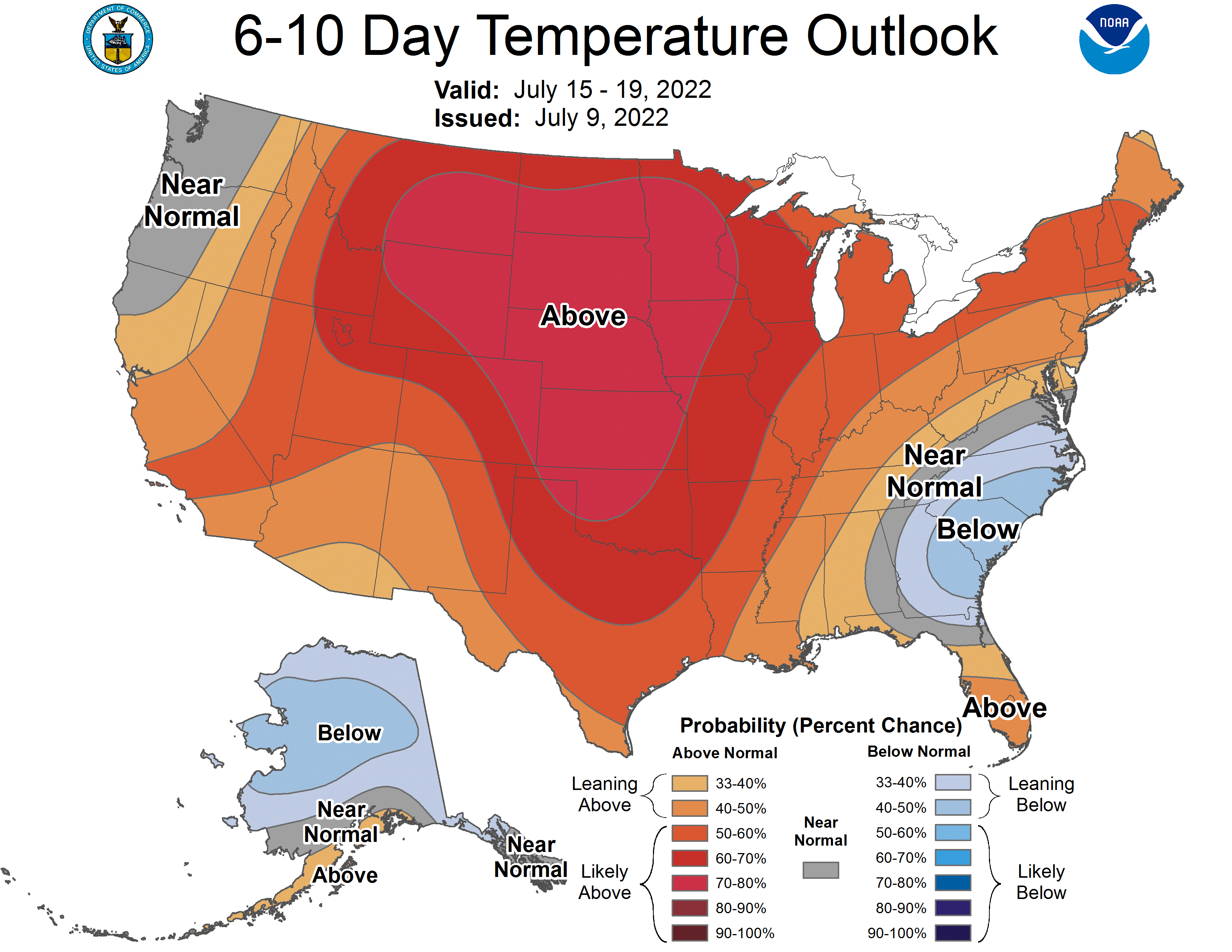
Above-normal temps may linger through next weekend and the beginning of the following week. The NWS Climate Prediction Center shows a strong signal for above-normal temps in the upper Midwest from July 15 through July 19:
Thunderstorm chances
An upper level disturbance could spread scattered thunderstorms into west-central and northwestern Minnesota overnight Saturday night. Scattered showers and thunderstorms will be possible anywhere in Minnesota and western Wisconsin Sunday morning and early Sunday afternoon.
An advancing cool front is expected to ignite additional thunderstorms in Minnesota and western Wisconsin as we go through the late afternoon and evening hours of Sunday.
You can hear updated weather information for Minnesota and western Wisconsin on the Minnesota Public Radio News network, and you can see updated weather info on the MPR News live weather blog.
Severe weather outlook
The NWS Storm Prediction Center shows a slight risk (shaded yellow) of severe weather Sunday and Sunday night for most of Minnesota and parts of west-central and northwestern Wisconsin:

Notes on thunderstorm timing and impacts are from the Twin Cities NWS office.
The Twin Cities metro area is included in that slight risk area, which indicates that scattered severe t-storms are possible. The best chance of severe weather in the Twin Cities metro area would tend to be late Sunday afternoon and Sunday evening, with an isolated severe thunderstorm possible earlier in the day.
Weather nugget
Our average Twin Cities high temperature stays at 84 degrees until July 23, when it drops to 83. The Twin Cities average high doesn’t drop below 80 degrees until August 25.
Programming note
You can hear my live weather updates on MPR News at 7:35 a.m., 9:35 a.m. and 4:39 p.m. each Saturday and Sunday.

