
Few storms Tuesday; heat late week
Breezy with pop-up storms Tuesday

Go Deeper.
Create an account or log in to save stories.
Like this?
Thanks for liking this story! We have added it to a list of your favorite stories.


A few showers and thunderstorms are possible late Tuesday afternoon and evening. Wednesday will be sunnier but it becomes hot by the end of the week and weekend.
Lingering instability Tuesday yields a few storms
After the passage of Monday’s cool front, the air aloft is cooler but we still have some lingering moisture and strong July sunshine.
That combination will lead to clouds developing this afternoon and some isolated thunderstorms. The better chance is north and east of the Twin Cities.
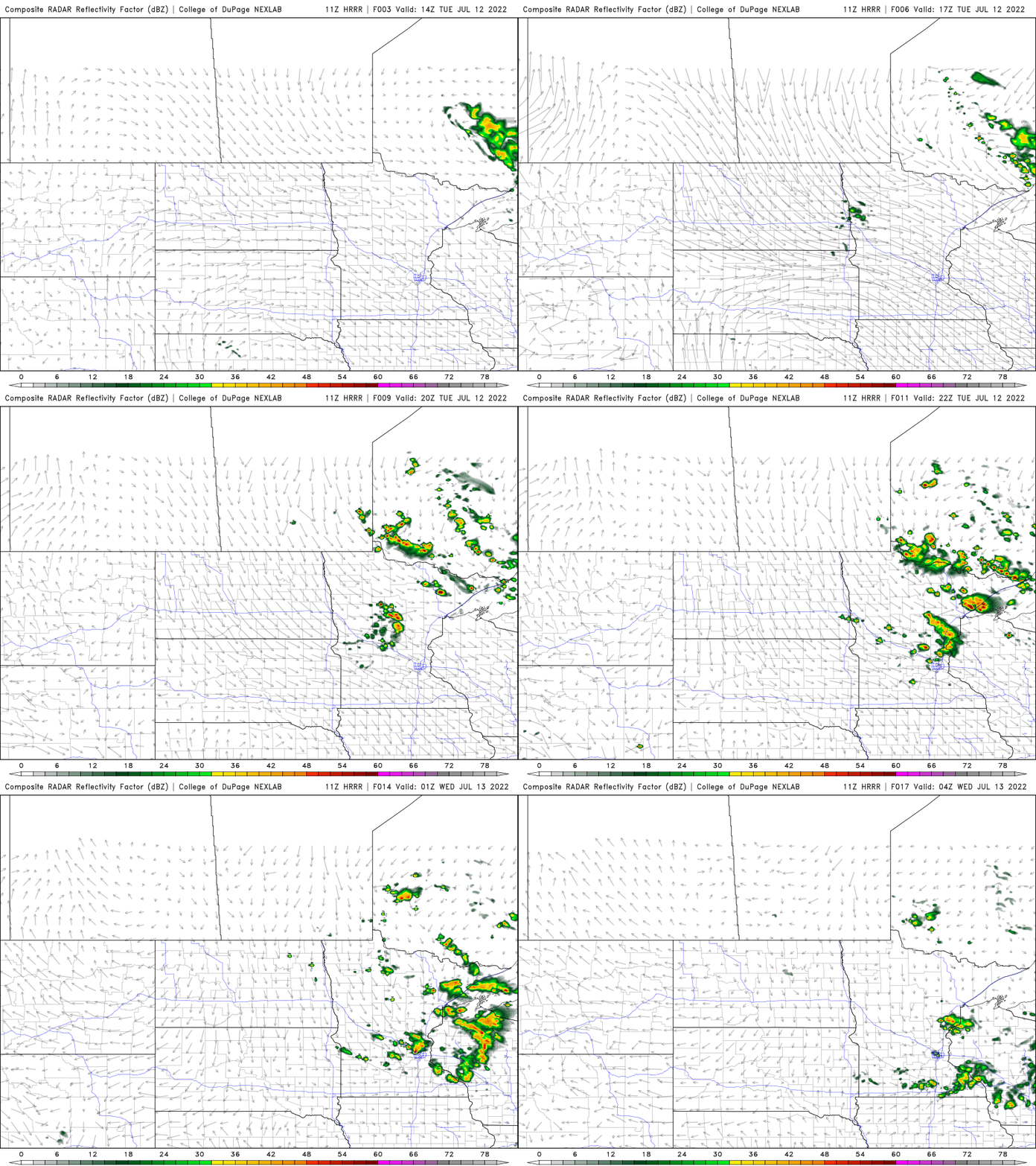
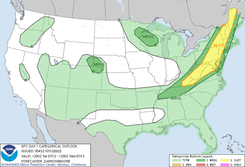
A few storms could produce large hail and some high wind gusts in northeastern Minnesota and northwestern Wisconsin. There’s a marginal risk (level 1 out of 5) of severe weather later Tuesday afternoon.
Turn Up Your Support
MPR News helps you turn down the noise and build shared understanding. Turn up your support for this public resource and keep trusted journalism accessible to all.
It will still be breezy Tuesday, although not as windy as Monday. Wind gusts will be between 20 and 30 mph.

Heat and humidity return late in the week
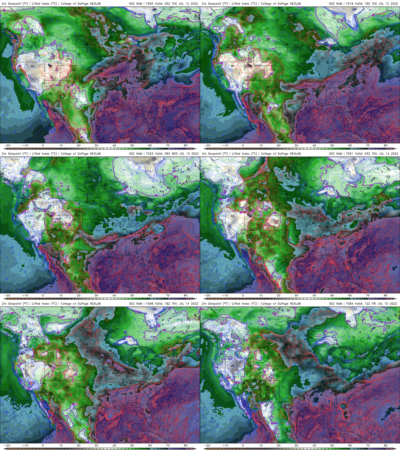
Enjoy the break from the muggy air and hottest temperatures Tuesday and Wednesday. Muggy air returns Thursday and temperatures will be warmer, in the upper 80s with 90s already popping up in western and far southern Minnesota.
The next chance of showers and thunderstorms develops Friday and Saturday.
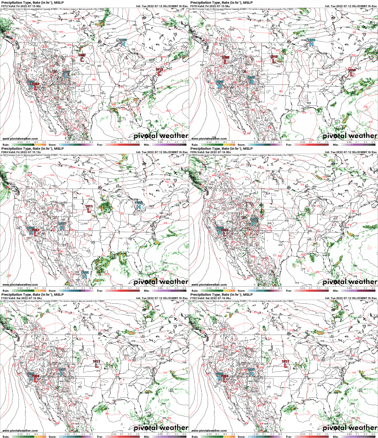
With the possibility of a few thunderstorms and some cloud debris around, that may keep some of us just below 90 until Sunday.


