
Pop-up storms possible Tuesday; heat wave ahead
Comfortable for a couple days before heat, humidity return

Go Deeper.
Create an account or log in to save stories.
Like this?
Thanks for liking this story! We have added it to a list of your favorite stories.


Sunshine will give way to afternoon pop-up showers and thunderstorms for some Tuesday afternoon. Wednesday will be calmer and brighter. The humid air returns late in the week ahead of a heat wave.
Pop-up showers, storms possible Tuesday afternoon
We’ll have sunshine to start but with that cool air overhead, the heating of the sun and just enough moisture left over will create some instability, pop-up showers and thunderstorms Tuesday afternoon.
The best chances will be just north and east of the Twin Cities, but a few could rumble through the metro area.
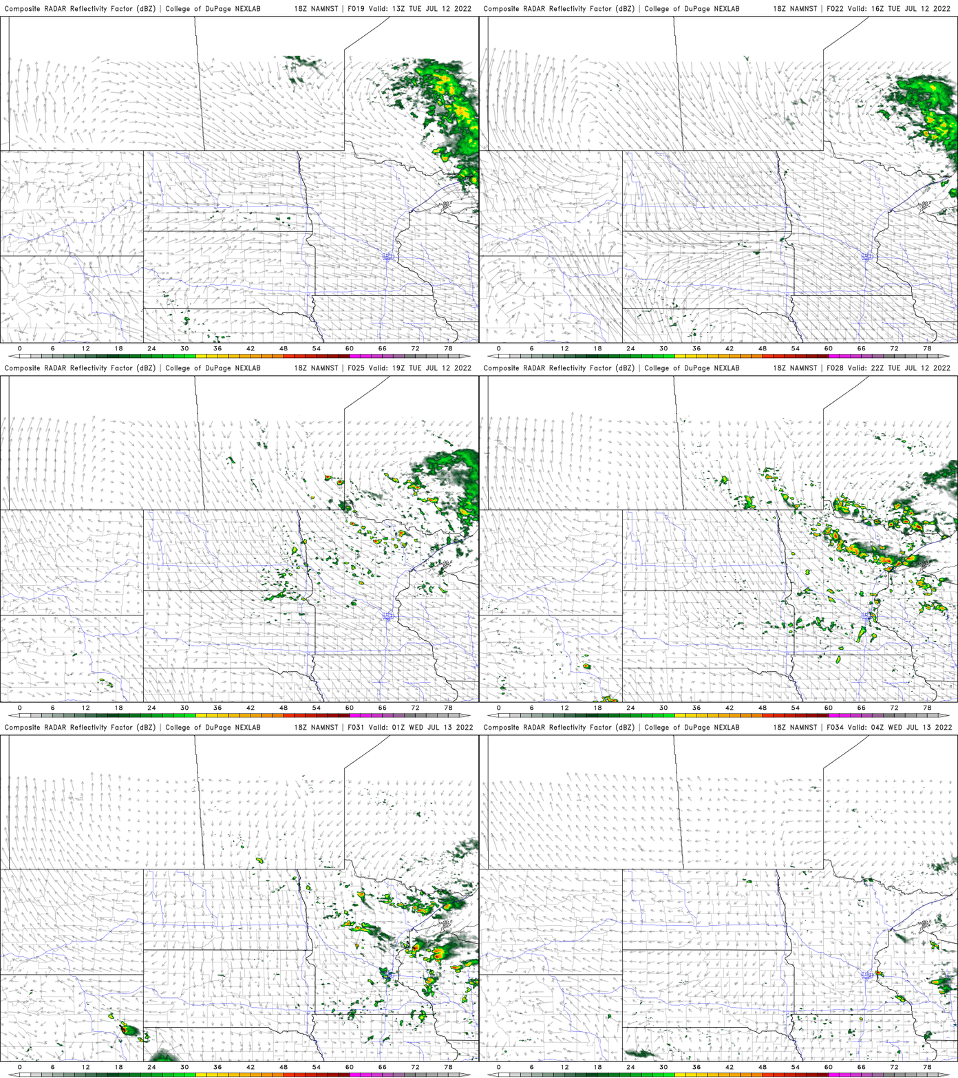
Wednesday will be calmer, brighter and still pleasant with lower dew points. The heat builds in for the end of the week into the weekend and next week. A heat wave is looking likely.
Turn Up Your Support
MPR News helps you turn down the noise and build shared understanding. Turn up your support for this public resource and keep trusted journalism accessible to all.

We also have our next spotty thunder chance Friday and Saturday which could also keep us just below the 90-degree mark if there are enough lingering clouds.
86 years ago: Twin Cities’ worst heat wave
In July of 1936 on this date, we were in the throws of the worst heat wave in Twin Cities recorded history. This was in the middle of the Dust Bowl years that devastated crops and brought intense heat, including high temperature records that still stand.

From July 10 to the 14, 1936 the high temperature each day was between 105 and 108 (which is still our hottest recorded temperature). July 1936 ended up being — and still is — our hottest July on record. It may surprise some, however, that our more recent summers beat any in the 1930s. Summer 2021 was the hottest recorded summer, beating out 1988.
While the 1930s brought some intense heat extremes, the average temperature wasn’t as hot as some recent summers. Take the summer of 1936 for example. While July was intensely hot, June was actually a chilly month that year and August cooled back down significantly.
Similar scenarios of one or two hot months, but not all three, were typical in the summers of the 1930s.
If we look at the top 15 hottest summers in Twin Cities history, three are from the 1930s and three are from the most recent decade (2011-2021). The average of the three hottest summers from this decade are warmer than the average of the three hottest from the 1930s.
This is a prime example of climate change’s fingerprints; consistent heat rather than intense bursts. The heat of the 1930s was regional and certainly not global, where as today we see months and seasons of warmth that span large swaths of the globe and for longer periods.
Recent research has also shown that human-caused climate change actually played at least some role (though not as large of one as modern times) in the heat of the 1930s.
The Industrial Revolution had been well underway but also our land use and agricultural practices leading up to that decade helped create the scenario where normal, cyclical, large-scale weather patterns were exacerbated by changing the vegetation on the landscape, creating more intense heat over larger areas.
It’s easy to forget how, in just a matter of a few decades, we completely tilled and changed the surface of the Great Plains.

