
Humid air returns late Thursday; thunderstorms overnight
After some rainfall, hot several days ahead

Go Deeper.
Create an account or log in to save stories.
Like this?
Thanks for liking this story! We have added it to a list of your favorite stories.


Temperatures will be warmer Thursday and humid air will start to return to southwestern Minnesota and spread east overnight into Friday, touching off scattered thunderstorms.
A cool morning early Thursday; more sunshine
Clear skies and drier air led to a cool early morning Thursday. Lows were in the 40s in northeastern Minnesota. The low temperature was 41 in Hibbing, Grand Marais and Eveleth.

We’ll see more sunshine Thursday with highs well into the 80s south with some places near 90 degrees in southwestern Minnesota. Temperatures will remain in the 70s in northeastern Minnesota.

Humid air returns, thunderstorms possible Thursday night
Muggy dew points again return to Minnesota by Thursday afternoon in the southwest and then spread east overnight Thursday night.
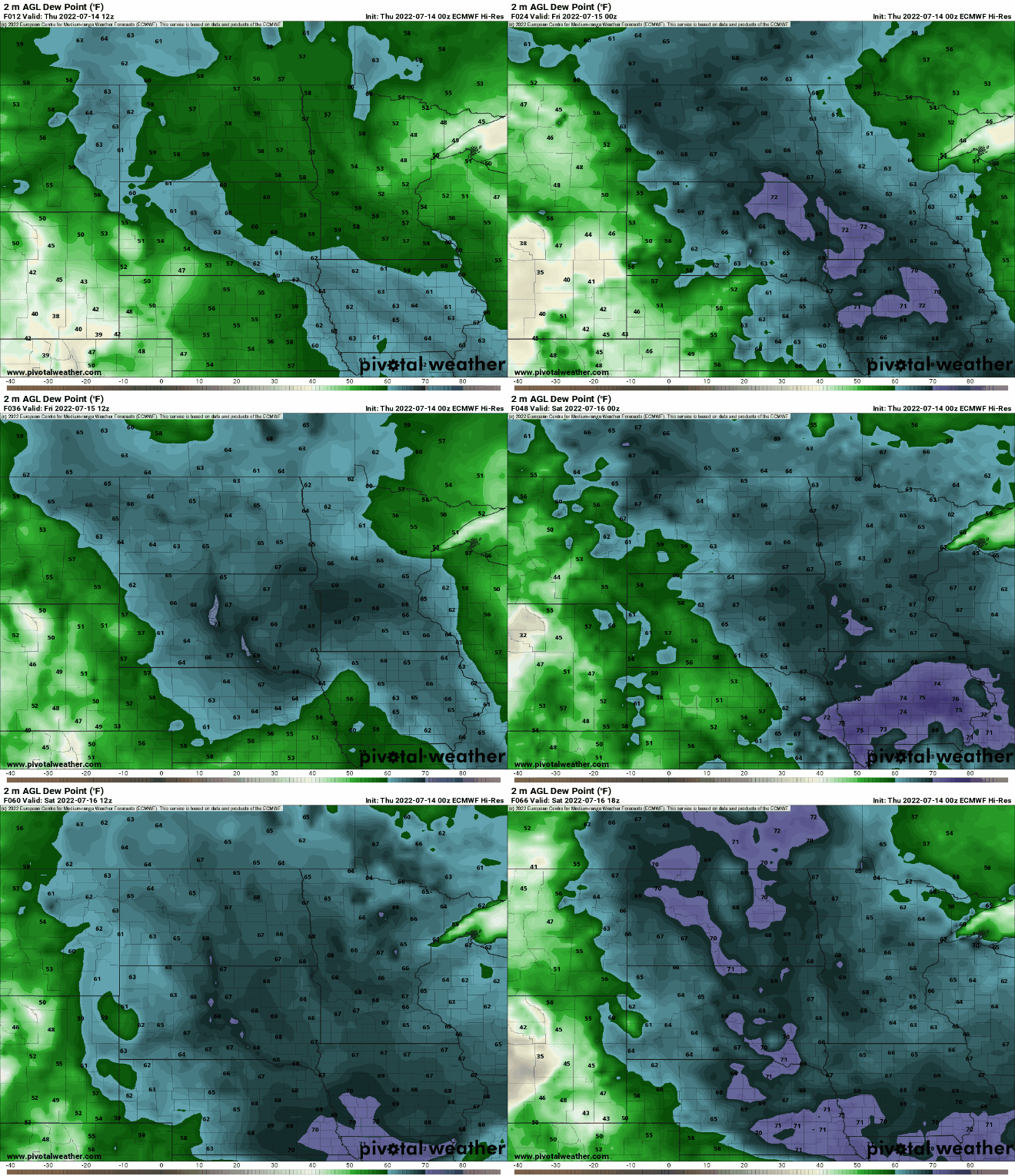
The return of warmer, more humid air will touch off thunderstorms across the region into the overnight and early Friday.
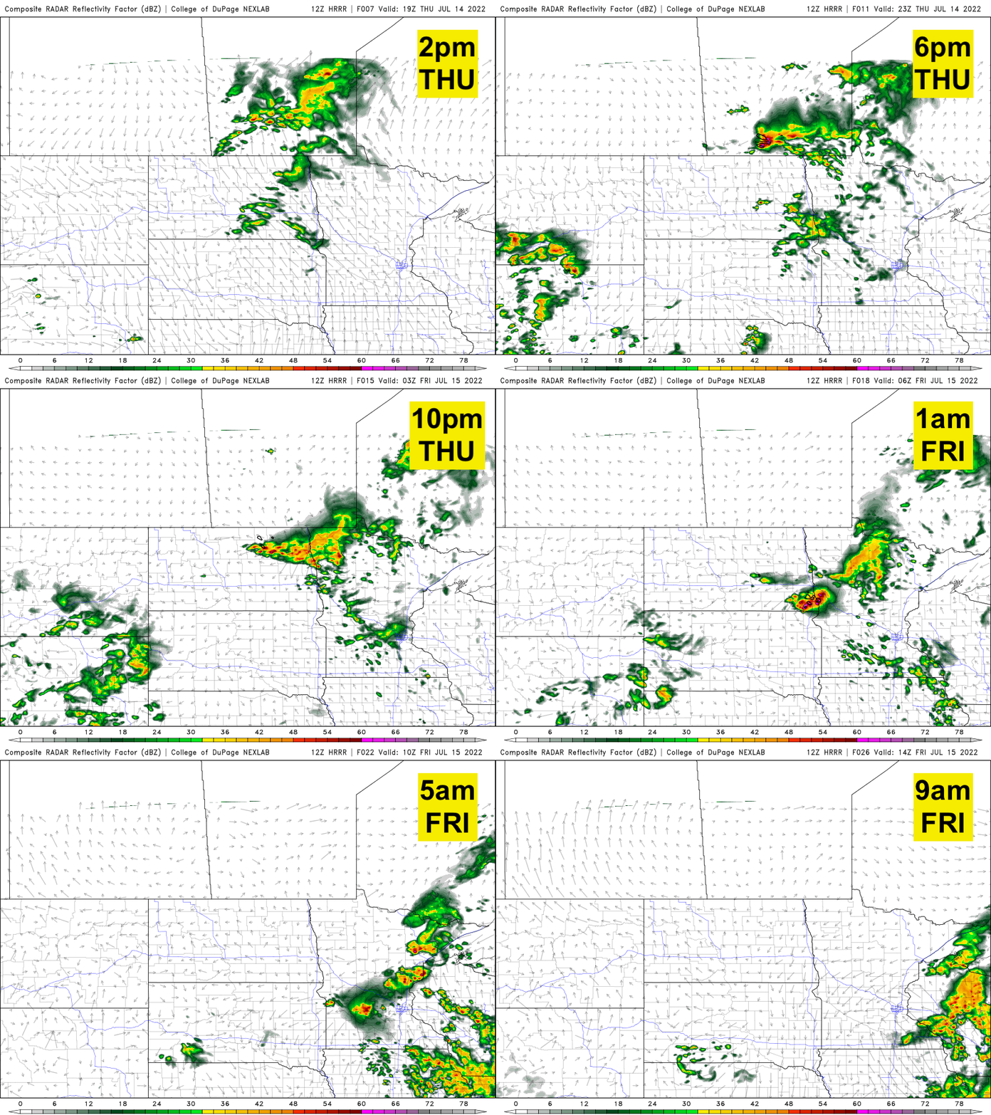
Some storms could be strong to severe, especially in western Minnesota where a slight risk (level 2 out of 5) of severe weather is forecast.

A hot stretch of weather develops
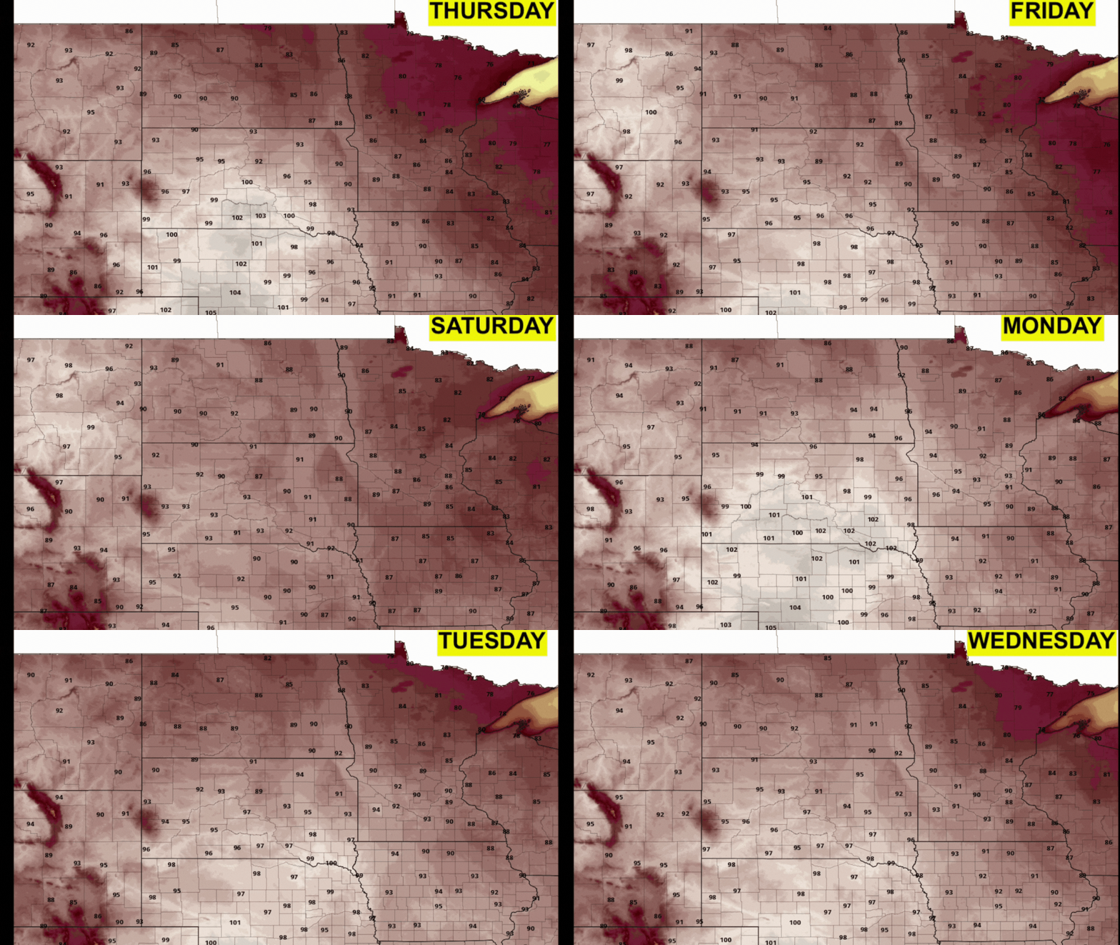
After that chance of some thunder, things get hot and it’s sticking around. Highs will be near or above 90 for much of southern and western Minnesota this weekend into next week.
Turn Up Your Support
MPR News helps you turn down the noise and build shared understanding. Turn up your support for this public resource and keep trusted journalism accessible to all.

