
Clearing, becoming hot Tuesday; some storms
Showers early; more storms late for some
Go Deeper.
Create an account or log in to save stories.
Like this?
Thanks for liking this story! We have added it to a list of your favorite stories.


A few scattered showers early then clearing and hot midday Tuesday. A few isolated storms are possible again late, mainly in northeastern Minnesota and northwestern Wisconsin.
Another hot one Tuesday with a few showers
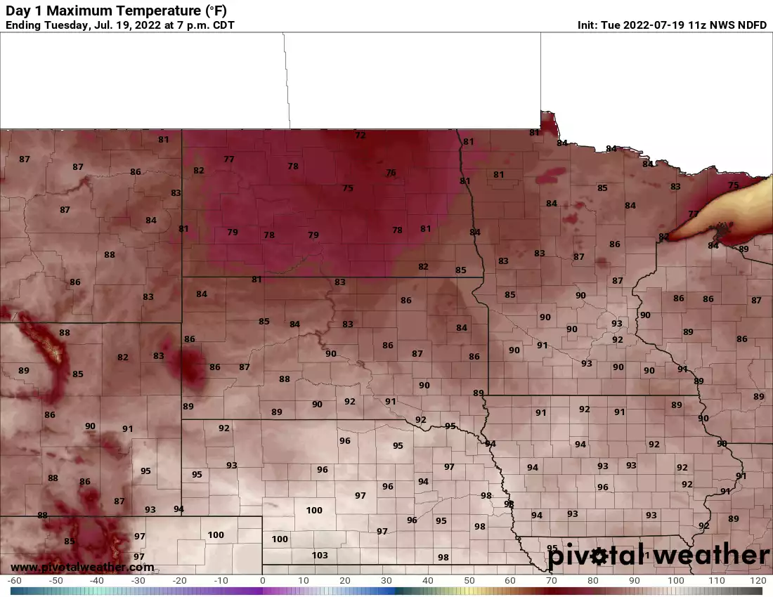
After a few scattered showers early, skies will clear Tuesday and be hot again. Highs will be well into the 90s for much of central and southeast Minnesota into western Wisconsin.
We have two possible rounds of moisture Tuesday. The first, as discussed are some scattered showers early Tuesday morning that are leftovers from storms that developed overnight in South Dakota.
The second round will be much more isolated to spotty and mainly affect northeastern Minnesota into western Wisconsin late Tuesday.
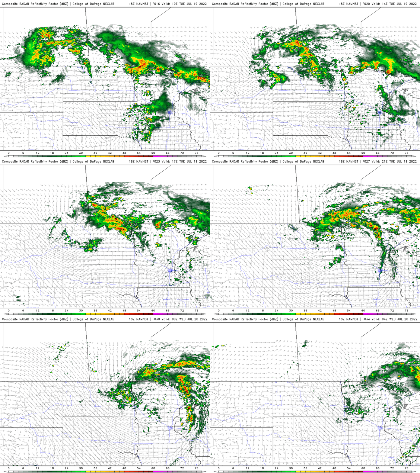
What storms do develop late Tuesday afternoon into Tuesday evening could be severe.

Slightly cooler Wednesday
Behind the cool front, we’ll see some slightly less muggy air and temperatures that will be just a little bit cooler for Wednesday. However, many places in southern Minnesota will still be very close to 90 degrees.

Turn Up Your Support
MPR News helps you turn down the noise and build shared understanding. Turn up your support for this public resource and keep trusted journalism accessible to all.

