
Lots of sun Thursday; hotter Friday; storms Saturday
Comfortable yet Thursday; muggy Friday into Saturday

Go Deeper.
Create an account or log in to save stories.
Like this?
Thanks for liking this story! We have added it to a list of your favorite stories.


Thursday will be comfortable but very warm still. Dew points increase Friday and Saturday along with temperatures heating up. There’ll be a few showers overnight Thursday night with a better chance of scattered storms Saturday.
Hopeful rain, thunder chances ahead
We had a couple of isolated showers and thunderstorms overnight into Thursday across western and southern Minnesota. A similar scenario could play out again late Thursday night into early Friday.
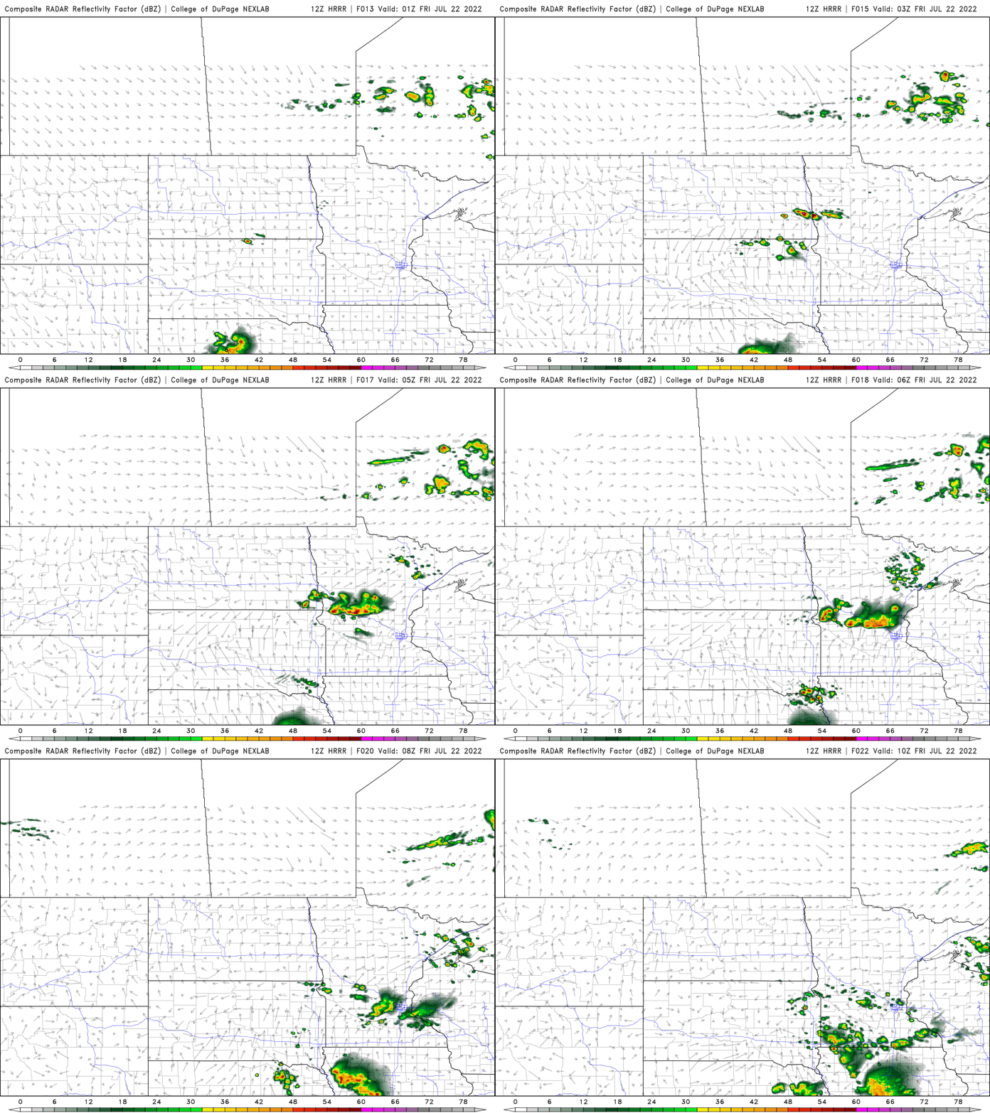
This activity is forming along the leading edge of hotter and more humid air moving back in. That air mass will play into a better chance of rainfall Saturday. It’s not a guaranteed, widespread soaking, but we have a decent chance of scattered showers and thunderstorms coming Saturday.
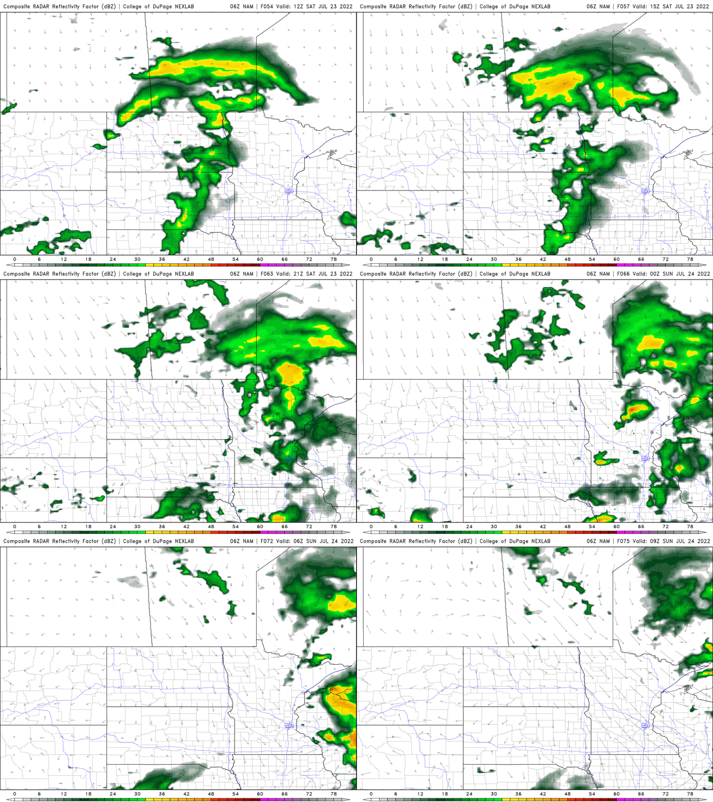
Forecasting rainfall amounts with thunderstorms is very difficult, but the potential exists for some heavy rainfall amounts in localized areas. The following are four different computer model scenarios, that, as you can see vary greatly.

Heating up then a prolonged break
Thursday will be comfortable with lower dew points and temperatures just under 90 degrees, but Friday and Saturday will become steamy again. Highs Friday will be in the low to mid-90s across southern and western Minnesota.

Dew points will climb to near 70 degrees by Saturday and temperatures could hit 90 again ahead of afternoon thunderstorms.
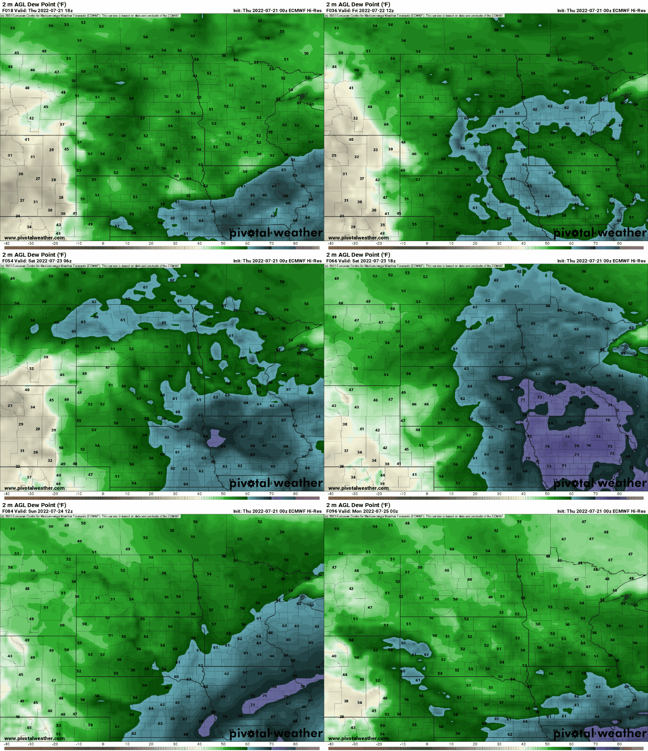

A cooler pattern sets in after Saturday with temperatures more seasonable and comfortable Sunday into much of next week. Highs should be in the low to mid-80s south and 70s north.
Turn Up Your Support
MPR News helps you turn down the noise and build shared understanding. Turn up your support for this public resource and keep trusted journalism accessible to all.

