
90s return Friday; storms Saturday
Muggy air moves back in for two days

Go Deeper.
Create an account or log in to save stories.
Like this?
Thanks for liking this story! We have added it to a list of your favorite stories.


Heat and humidity return Friday. Scattered storms develop Saturday along with a risk of severe weather. More comfortable and normal temperatures return Sunday.
Hot, humid Friday into Saturday
Conditions will become steamy again across southern and western Minnesota Friday. Highs will be back in the 90s for many, except northern Minnesota. Dew points will also increase to muggy readings in the 60s and 70s again, especially by Saturday.
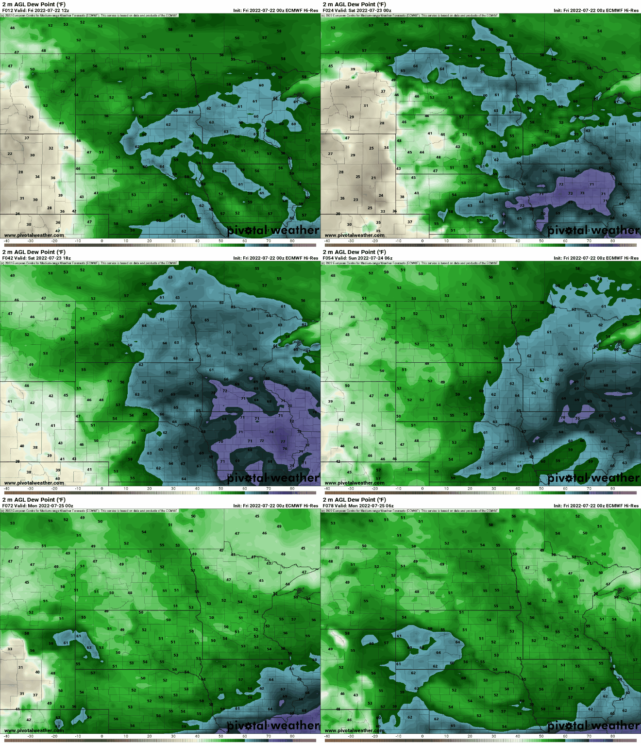
Saturday will again be near 90 ahead of the storm chance.

Storms with possible severe weather Saturday
Scattered storms will develop Saturday afternoon into Saturday night.
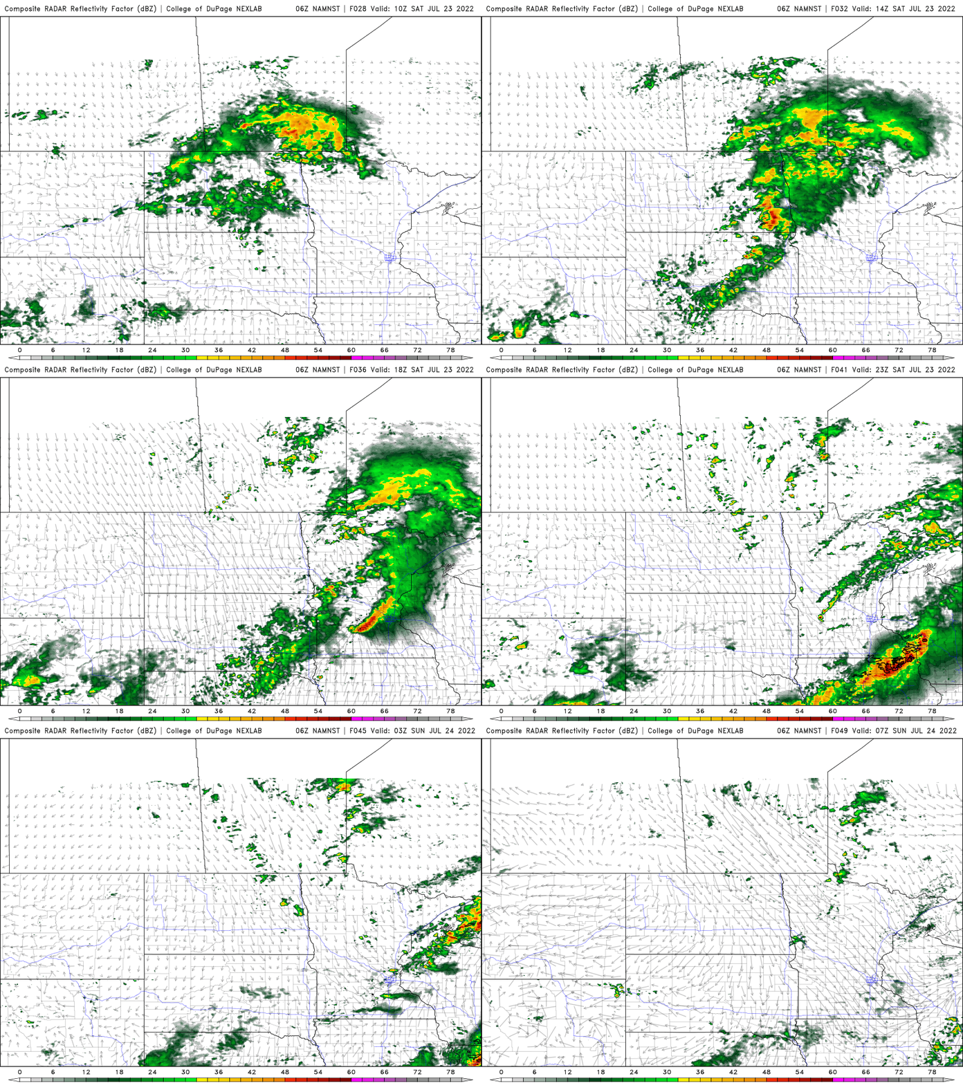
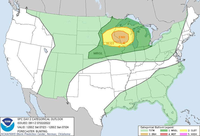
There’s an enhanced risk (level 3 out of 5) for severe storms Saturday from the Twin Cities east and southeast into southeast Minnesota and western, southwestern Wisconsin.
Seasonable, comfortable streak Sunday into next week
After Saturday, we’ll see a prolonged stretch of more normal temperatures in the low to mid 80s. In fact, the Climate Prediction Center’s 6 to 10 day outlook calls for perhaps even slightly below normal temperatures (though not by much).

Turn Up Your Support
MPR News helps you turn down the noise and build shared understanding. Turn up your support for this public resource and keep trusted journalism accessible to all.

