
Decreasing clouds Thursday with sun Friday; weekend storms possible
Muggy air departs as high pressure settles in

Go Deeper.
Create an account or log in to save stories.
Like this?
Thanks for liking this story! We have added it to a list of your favorite stories.


Highs mainly in the 70s Thursday with muggy air departing. Friday will be sunny but storms will be possible Friday night into the weekend.
Comfortable air, high pressure settling in
Muggy air is helping to lead to lingering cloud cover as cooler air moves in from the north. Dew points should drop through the day thanks to a north breeze.
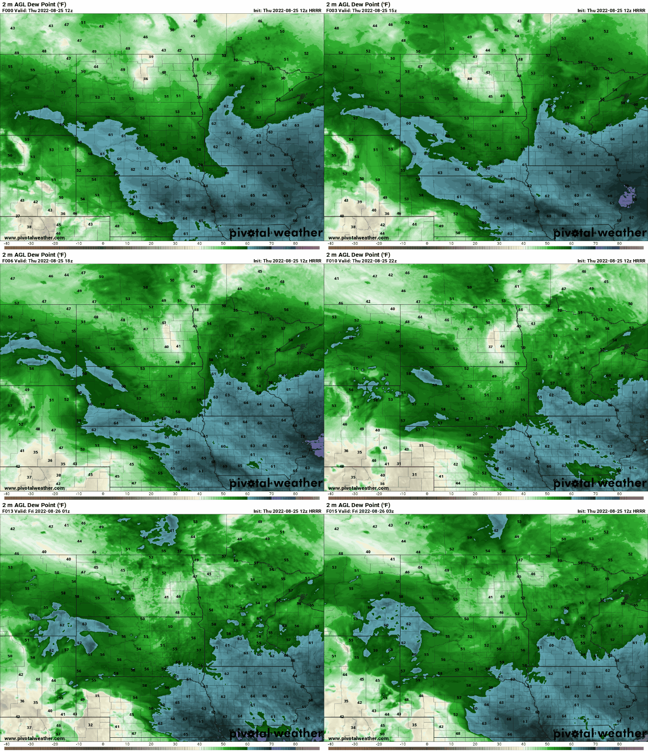
High pressure is moving in from the northwest, flushing out the low clouds too by afternoon and setting us up for a cool, comfortable night tonight and a sunny Friday. Highs Thursday will be cooler, mainly in the 70s statewide.

Highs will be near 80 in the south, and 70s north Friday afternoon.

Weekend storm chances and warmer
As humid air, once again, makes its way back into Minnesota Friday nigh, it will touch off showers and thunderstorms for some into early Saturday. The chance will be more spotty during the afternoon Saturday with a few more storms possible Sunday.
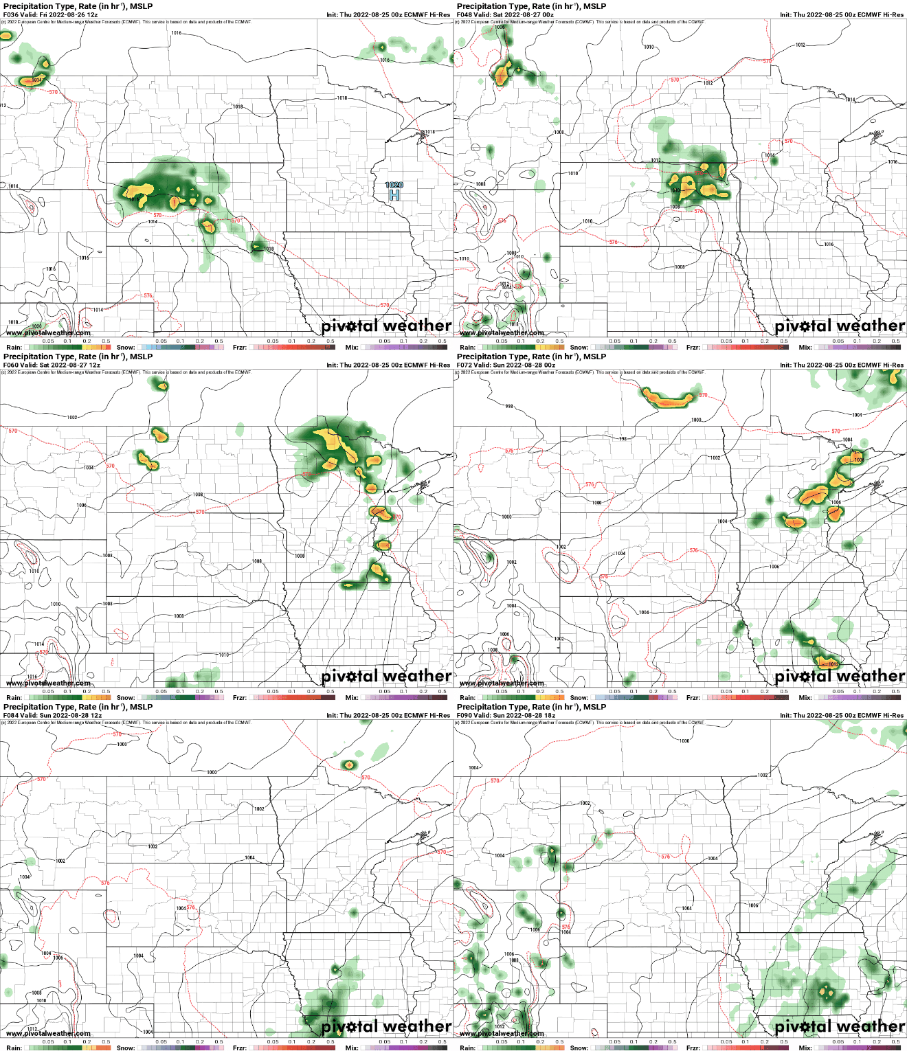
It will also become hotter heading into Sunday and Monday with highs in the mid to upper 80s, even near 90 potentially Monday.

Turn Up Your Support
MPR News helps you turn down the noise and build shared understanding. Turn up your support for this public resource and keep trusted journalism accessible to all.

