Mild temps continue until Thursday; Shower chances highest to the north on Sunday

Good weather for the Twin Cities Marathon
rt1001stp
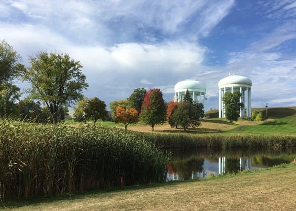
Highland National Golf Course St. Paul Oct.1, 2022
Deb Trenda

This is a great time of year to take a stroll. My wife spotted some emerging fall color today while she was walking along the north side of Highland National Golf Course in St. Paul.

Our Saturday high temperature at Minneapolis-St. Paul International Airport was 72 degrees. That’s six degrees warmer than our average Oct. 1 high in the Twin Cities. We’re likely to see warmer than average high temps for several more days.

Temperature trends

Temperatures will be in the 50s for the Sunday morning start of the Twin Cities Marathon, then temps will rise into the 60s by around 11 a.m. Sunday.

Create a More Connected Minnesota

MPR News is your trusted resource for the news you need. With your support, MPR News brings accessible, courageous journalism and authentic conversation to everyone - free of paywalls and barriers. Your gift makes a difference.

Sunday afternoon highs will top 70 degrees in the Twin Cities metro area and in roughly the southwestern half of Minnesota:

rt1002h4
Sunday forecast highs
National Weather Service

Parts of southwestern Minnesota will reach the upper 70s. There’ll be a lot of 60s in the northeastern half of Minnesota and in western Wisconsin. Some spots in northeastern Minnesota will see Sunday highs in the 50s.

Highs in the 70s will expand across more of Minnesota and into western Wisconsin on Monday:

rt1003h4
Monday forecast highs
National Weather Service

Twin Cities metro area highs are projected to reach the mid 70s on Tuesday, followed by lower 70s on Wednesday. Much cooler air arrives later in the week, with metro area highs in the lower 50s Thursday and around 50 on Friday.

Rain chances?

Scattered showers or sprinkles are possible in Minnesota and western Wisconsin Saturday evening and overnight Saturday night. During the daylight hours of Sunday, the best chance of occasional scattered showers is expected to be from the northern half of Minnesota into northwestern Wisconsin. An isolated shower/sprinkle will be possible elsewhere in Minnesota and in west-central Wisconsin.

There’s fairly dry air in the lowest part of atmosphere this weekend, so some of the rain that’s showing up on radar is evaporating before reaching the ground. You can check the MPR interactive radar here.

We have updated weather information for Minnesota and western Wisconsin on the Minnesota Public Radio News network, and on the MPR News live weather blog.

Fall color update

The Minnesota Department of Natural Resources fall color report for Minnesota State Parks and Trails looks like this:

rt1001fall5
Fall color report
Minnesota Department of Natural Resources

When you look at fall color maps, keep in mind that all deciduous trees are included. The maples can be peaking when the overall changeover to fall color is less than 50 percent in a given area.

I saw great fall colors ten days ago in Minnesota’s Arrowhead region along the Sawtooth Mountains, inland from Lutsen and Tofte. I’m sure that those fall colors have expanded to include many more areas since then.

The Wisconsin fall color report can be found here.

Craig Edwards update

Former MPR and National Weather Service meteorologist Craig Edwards lives in Fort Myers, Florida. You may have heard Paul Huttner’s Wednesday chat with Craig on Minnesota Now.

I talked with Craig today, and I was happy to learn that Craig and his wife Sue are doing well. They live in a part of Fort Myers that didn’t see the storm surge, and Craig said that there was no structural damage to their house; just damaged storm shutters.

You can read about, or listen to, Paul’s chat with Craig here.

Weather nugget

Our average Twin Cities high temperature drops from 66 degrees on Oct. 1 to 50 degrees on Oct. 31.

Programming note

You can hear my live weather updates on MPR News at 7:35 a.m., 9:35 a.m. and 4:39 p.m. Saturday and Sunday.