
Rain, wind, snow, cold Thursday, Friday; a warm weather encore may be near
Wind chills will be in the 30s and 20s through Friday

Go Deeper.
Create an account or log in to save stories.
Like this?
Thanks for liking this story! We have added it to a list of your favorite stories.


Very chilly conditions have set in. Highs will be mainly in the 40s Thursday and Friday with snow showers north Thursday with accumulations possible north Thursday night. Farther south morning snow showers are possible Friday.
The latest drought monitor is largely unchanged from last week.
Cold, breezy with snow for some
Thursday and Friday will remain very chilly with highs mostly in the 40s statewide. Parts of northern Minnesota won’t get out of the 30s.

There will be scattered rain and snow showers through the day Thursday in the northern half of the state with snow showers spreading south into Friday morning.
Turn Up Your Support
MPR News helps you turn down the noise and build shared understanding. Turn up your support for this public resource and keep trusted journalism accessible to all.
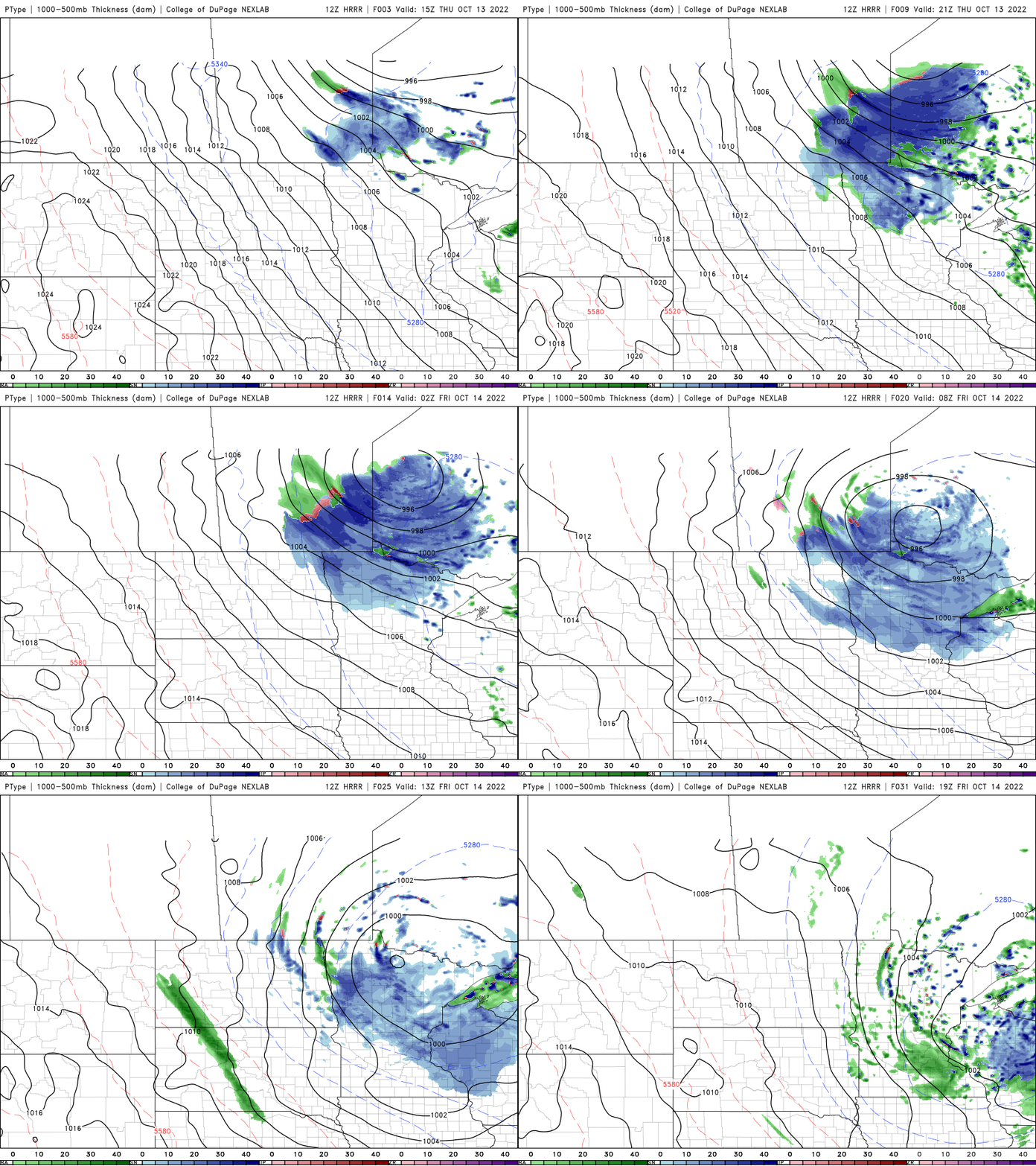
The snow will accumulate for portions of northern Minnesota Thursday night into early Friday. Some spots could see up to 1 to 2 inches.

Overnight low temperatures Thursday night will drop into the 30s statewide into the upper 20s in northern Minnesota.

A warmup eventually?
Don’t count out warm weather just yet. The models agree on a warmup late next week into next weekend. The European Centre for Medium Range Weather Forecasting computer model has us reaching 70 again by Saturday, Oct. 22.

It’s on the warmer end of possibilities at this point, but if you’re not ready for persistent cold, there’s a bit of hope.
Latest U.S. drought monitor
The latest drought monitor is largely unchanged from a week ago. Thirty-six percent of Minnesota is in drought, up 1 percent from a week ago. 12 percent of Minnesota is in severe drought and 4 percent of Minnesota is in extreme drought.

The Twin Cities is 8.82 inches of precipitation behind normal, year to date. That’s one third of our normal precipitation. For meteorological fall (since Sept. 1) we’ve only received 0.34 inches of a normal 4.19 inches.

