
Roller coaster temps; significant rain possible Sunday night
High temperatures Wednesday will be mainly in the 40s into the low to mid 50s

Go Deeper.
Create an account or log in to save stories.
Like this?
Thanks for liking this story! We have added it to a list of your favorite stories.


Wednesday will still be cool but warmer than the last two days with highs in the 40s to low 50s. We’re still on track to see 60s by Friday and 70s this weekend in southern Minnesota along with the potential for some decent rains Sunday night into Monday.
Roller coaster temps
Temperatures really start their climb today as highs could approach 50 degrees in the Twin Cities and across much of southern and western Minnesota. That’s still below normal, but we continue the rise.

Notably, winds will be lighter Wednesday, below 10 mph and remain light into Saturday.
Highs on Thursday will be widespread in the 50s for most of the state. Friday will see 60s spread across southern Minnesota and our warmth peaks over the weekend with high temperatures in southern Minnesota in the 70s Saturday and Sunday.
Turn Up Your Support
MPR News helps you turn down the noise and build shared understanding. Turn up your support for this public resource and keep trusted journalism accessible to all.


If you thought it’s been a wild ride on the temperature roller coaster, you’re not mistaken. Take a look at the high temperature swings over the past 30 days. We went from 80 on Tuesday last week down to 23 degrees Tuesday morning this week and will be back well into the 70s again this weekend.

Fall does bring wide swings in temperatures but this year is a little more than normal.
The normal difference (1991-2020 averages) between the highest and lowest temperature in September should be about 50 degrees, this year it was 55 degrees (highest: 92, lowest 38) in the Twin Cities.
So far this October, our swing has been 57 degrees (highest: 80, lowest: 23) and the normal is about 54 degrees.
Significant moisture potential early next week
In addition to temperatures about 20 degrees above normal this weekend, we’ll have dew points that will be unusually high for late October — and that’s a good thing. The surge, northward of higher dew points will help feed into the next storm system.
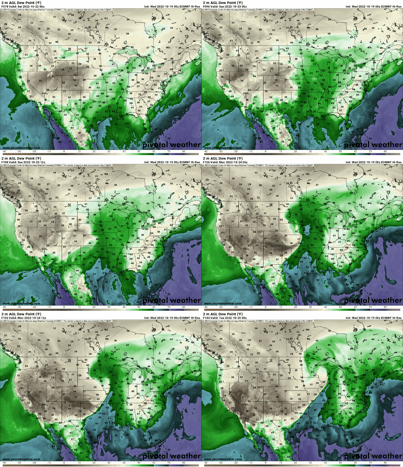
Scattered showers and thunderstorms develop southwest late Sunday evening and sweep across Minnesota into Monday giving us the best chance at a decent rain in some time.
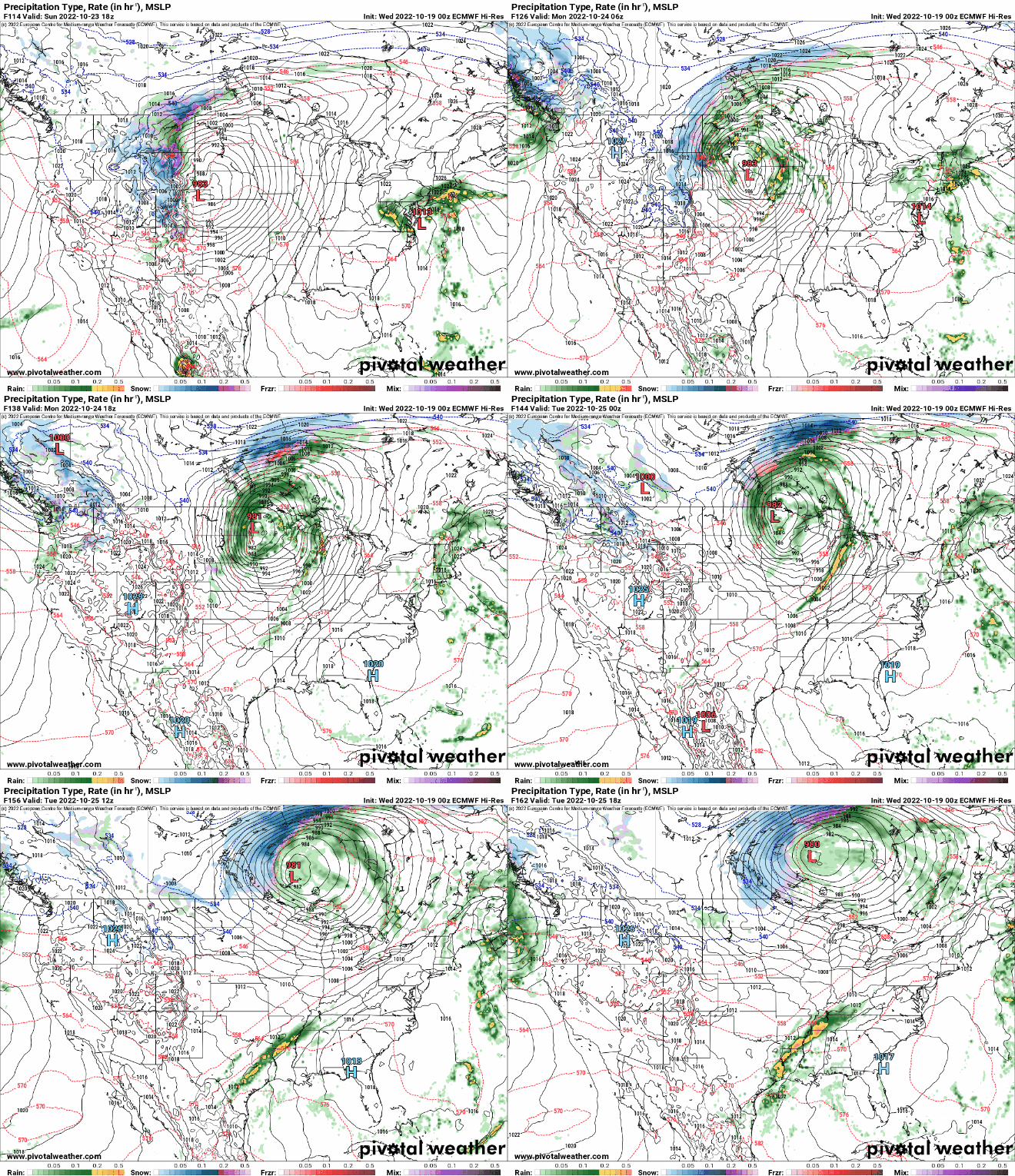
We haven’t had a single rainfall greater than 11 one-hundredths of an inch (.11) in the Twin Cities since Aug. 27. Could we finally get a soaking soon? It won’t break our drought but it will help.


