
Another mild day; Friday evening shower chance NW Minnesota
Fall color update for leaf-peepers
Go Deeper.
Create an account or log in to save stories.
Like this?
Thanks for liking this story! We have added it to a list of your favorite stories.


Thursday was mild and our Friday temps will continue the upward trend.
Our average Twin Cities high temp is 55 degrees this time of year. Metro area highs will reach the upper 60s Friday afternoon. We’ll share 60s with most of Minnesota and western Wisconsin:

North-central and northeastern Minnesota will see highs in the 50s.
Afternoon wind gusts will be in the 12 to 18 mph range in many areas, with higher gusts to the northwest:
Turn Up Your Support
MPR News helps you turn down the noise and build shared understanding. Turn up your support for this public resource and keep trusted journalism accessible to all.

Forecast wind gusts are in knots, with 12 knots equal to 13.8 mph.
Dry day
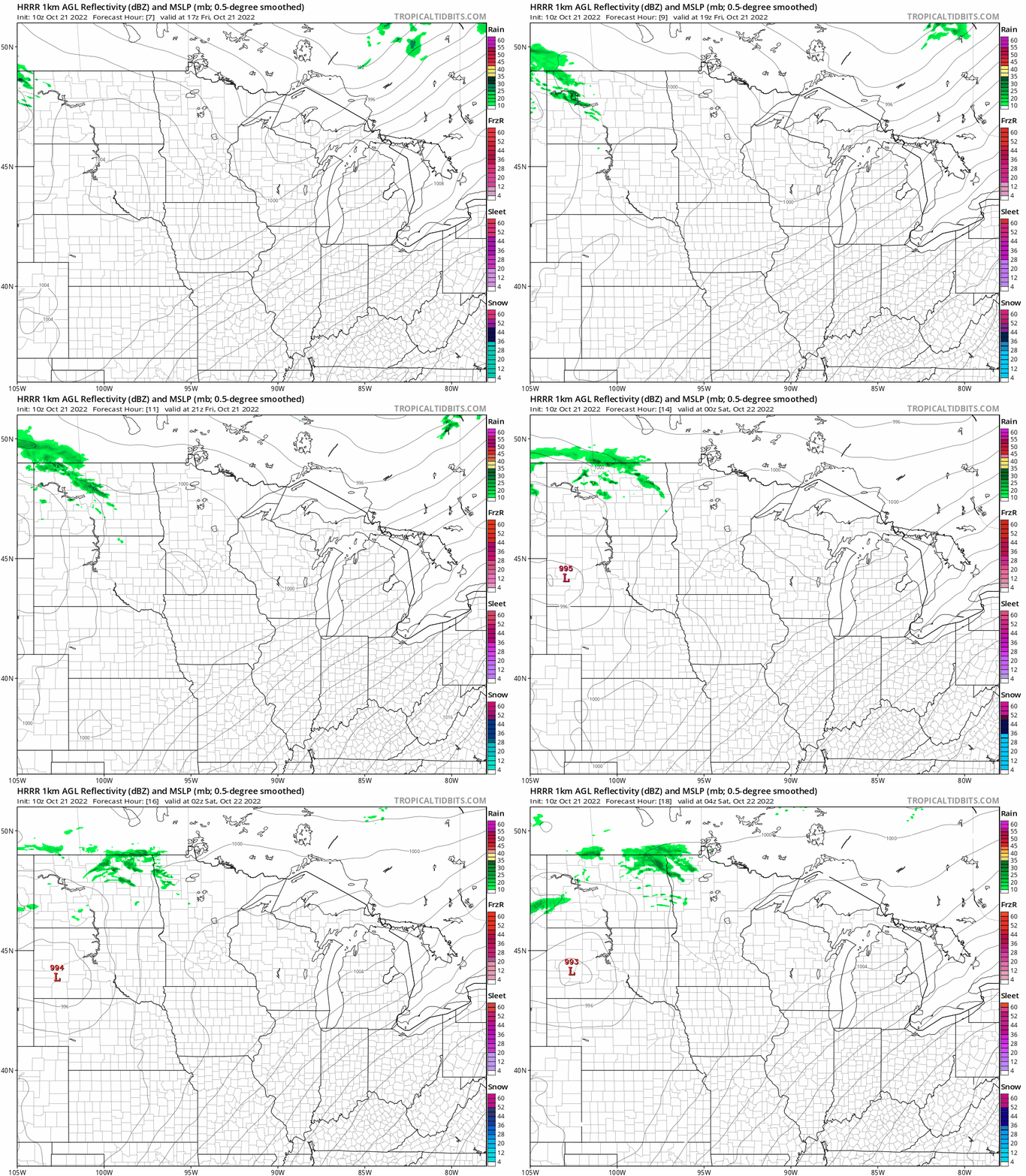
Most areas will see dry weather continue today. Far northwestern Minnesota could see scattered showers Friday evening. The National Oceanic and Atmospheric Administration’s High-Resolution Rapid-Refresh forecast model shows the potential precipitation pattern from noon Friday to 11 p.m. Friday:
Update
A new Updraft will be posted mid-morning and will include a look at the warm weekend highs; many areas will top 70.
Fall color update
Recent strong winds have taken a lot of leaves off of our trees, but there are still some pockets of good fall color in portions of southern and central Minnesota, including parts of the Twin Cities metro area.
The Minnesota Department of Natural Resources fall color report for Minnesota State Parks and Trails looks like this:

The Wisconsin fall color report can be found here.

