
Rainfall for some, dust for others; cooler air returns
Temperatures drop Monday; few showers

Go Deeper.
Create an account or log in to save stories.
Like this?
Thanks for liking this story! We have added it to a list of your favorite stories.


Rainfall amounts were hit and miss Sunday night and it left a layer of dust in the Twin Cities. A cold front is dropping temperatures from west to east Monday. We’ll have a few showers and a blustery west wind at 10-25 mph.
Monday night temperatures will drop into the 30s to near 40. Temperatures the remainder of the week will be near normal.
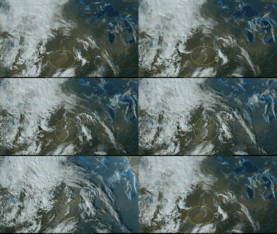
Dust, spotty rainfall overnight Sunday night
Consider yourself lucky if you have anything other than dust in your rain gauge. There were a few narrow swaths of heavier rainfall totals, but most of southern Minnesota was largely missed.

Twin Cities metro totals ranged from only a trace at Minneapolis-St. Paul International Airport to 4 one-hundredths (.04) of an inch South St. Paul. The showers and thunderstorms rained down dust that blew up all the way from Nebraska Sunday.
Turn Up Your Support
MPR News helps you turn down the noise and build shared understanding. Turn up your support for this public resource and keep trusted journalism accessible to all.
We could still see some scattered light rain showers Monday afternoon behind the cold front. Rainfall amounts will generally be light however, under one-tenth of an inch for most.

Cold front brings back October air
Temperatures will dip to more seasonable readings Monday night in the 30s to around 40 in the Twin Cities.

High temperatures Tuesday and Wednesday will also be near normal, mainly in the 50s with some 40s in northern Minnesota.

Mild end to October
By the end of the week into early next week, we’re looking at temperatures once again climbing above normal with low 60s in southern Minnesota to end the month of October.


