
Very mild Halloween, 70s midweek; rain possible late week
Temperatures will be about 20 degrees or more above normal through Thursday

Go Deeper.
Create an account or log in to save stories.
Like this?
Thanks for liking this story! We have added it to a list of your favorite stories.


Highs will be well into the 60s Monday for most of Minnesota with more sunshine. Highs will be near or exceed 70 degrees Tuesday through Thursday for southern Minnesota before a potential storm system develops late this week.
Warmest Halloween in 22 years
It’s been 14 years since we’ve even hit 60 degrees on Halloween and this year we’re headed for the mid-60s, making it the warmest since Halloween of 2000 when it was 71.

Halloween temperatures have been warming nearly 4 degrees since 1970.

Temperatures at trick-or-treat time Monday will be very mild, mainly in the 50s at sunset (6:02 p.m.) through 9 p.m.
Turn Up Your Support
MPR News helps you turn down the noise and build shared understanding. Turn up your support for this public resource and keep trusted journalism accessible to all.

70s for the start of November
The temperature keeps going up as we start November. Highs will be close to 70 degrees for much of southern Minnesota on Tuesday. High temperatures look to peak on Wednesday with much of southern and western Minnesota well into the 70s.

Thursday likely will pull of another 70 degree day in southern Minnesota.
Potential end of week storm
We are in desperate need of rainfall across southern Minnesota and the United States Department of Agriculture topsoil moisture map shows just how much of the country is dry right now. This measures soil moisture in the top 6 inches of soil.

A potential storm system is brewing for late in the week. We could see some rain showers Thursday night with a more significant round of moisture Friday night into the upcoming weekend.
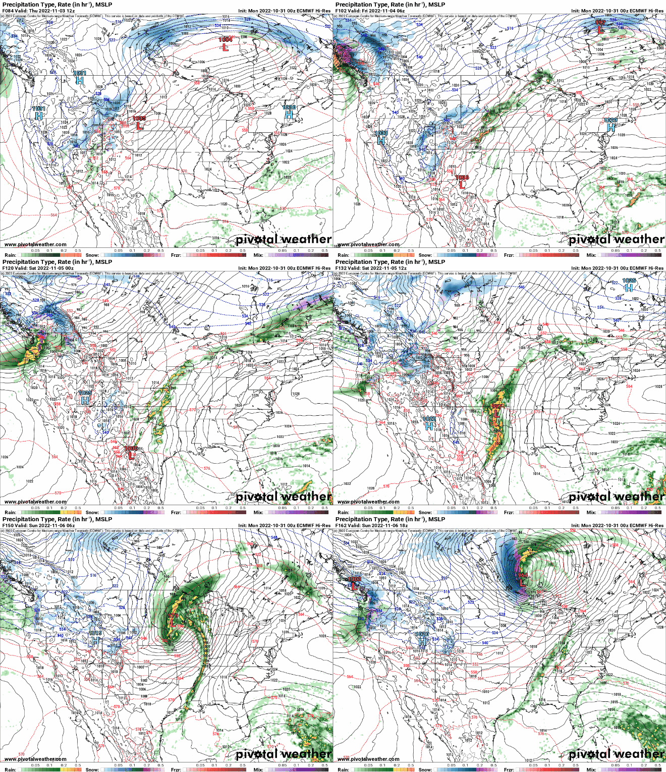
Models differ on where the heaviest precipitation will fall still but there’s real potential of soaking moisture in portions of the Midwest.

