
Seasonable Monday; stormy week develops
Near normal temperatures Monday then warmer air and showers arrive Tuesday

Go Deeper.
Create an account or log in to save stories.
Like this?
Thanks for liking this story! We have added it to a list of your favorite stories.


Monday will bring near-normal temperatures — mainly in the 40s south, 30s north — with much lighter winds today and partly cloudy skies. A stormy pattern develops with showers Tuesday into Thursday turning to snow Friday.
Quiet, seasonable Monday
After a very windy Sunday, it will be much quieter Monday. Wind gusts for parts of western Minnesota topped out at near 60 mph Sunday. Even in the Twin Cities we had gusts in the 50 to 56 mph range. North Dakota saw wind gusts as high as 60 to 70 mph.

Monday winds will be much calmer and we’ll have partly cloudy skies with near normal temperatures in the 40s and 30s.

Stormy mid to late week develops and colder
A very active and stormy pattern sets up Tuesday into Friday bringing desperately needed moisture. Showers will develop late Tuesday into Wednesday and Thursday, turning to snow from north to south Thursday night into Friday.
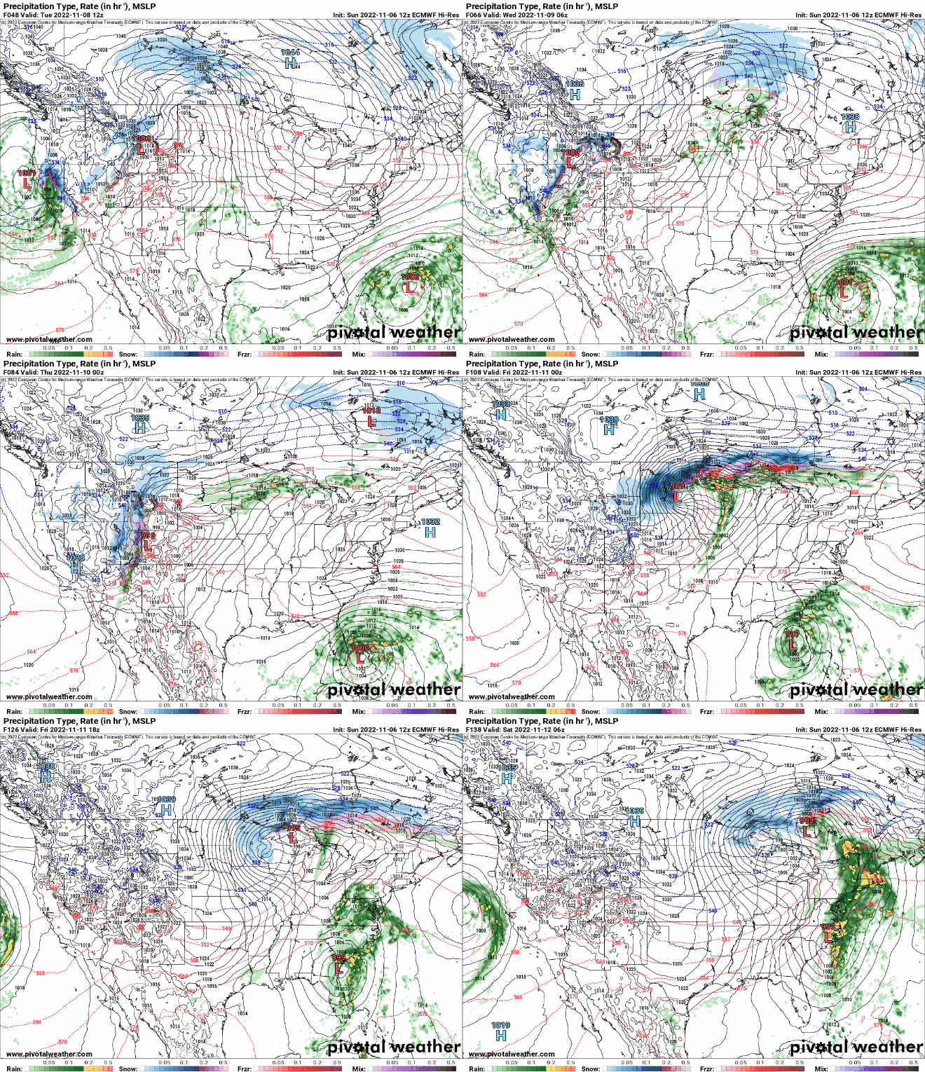
It appears increasingly that much of Minnesota is in for a coating of snow by the end of the week, especially north. Temperatures will be much colder as well, subfreezing by the weekend.
Turn Up Your Support
MPR News helps you turn down the noise and build shared understanding. Turn up your support for this public resource and keep trusted journalism accessible to all.

