
Waves of rain through Thursday; winter storm watch up north Thursday, Friday
Twin Cities could see 2 inches of rain through Friday
Go Deeper.
Create an account or log in to save stories.
Like this?
Thanks for liking this story! We have added it to a list of your favorite stories.


Milder air returns Tuesday with gusty south-southeast winds at 10-20 mph. Afternoon showers develop from west to east across Minnesota. Expect periods of rain through Thursday. Rain turns to significant snow in northern Minnesota Thursday with lighter amounts south.
First rains come Tuesday afternoon
Strong south and southeast winds blowing at 10-20 mph, with gusts up to 30 mph Tuesday are drawing in warmer air and moisture all part of a large, developing storm system. Highs will be in the low 50s south and 40s north.
The first showers will develop midday in southwest Minnesota and expand east through the afternoon into the evening and overnight hours.
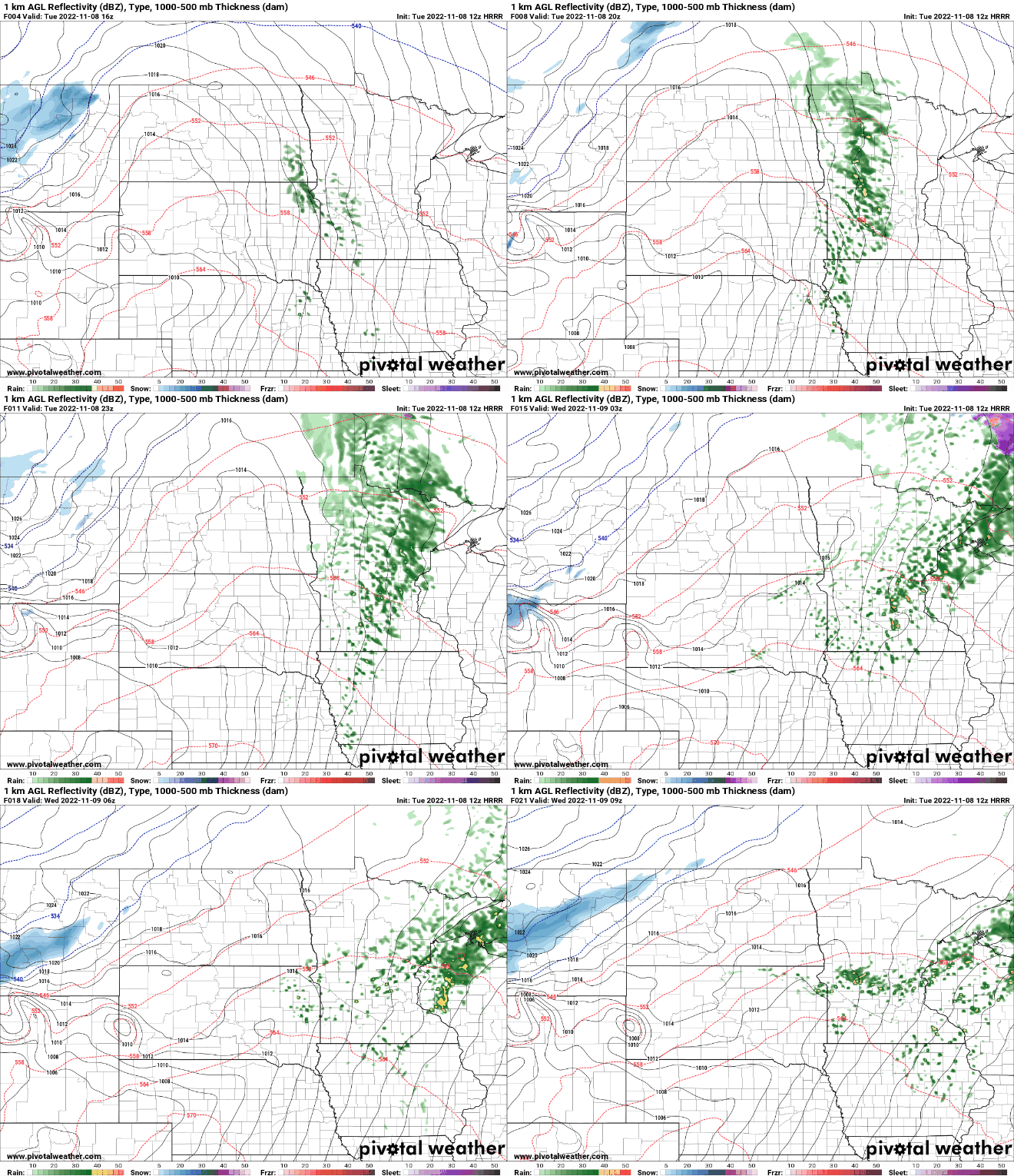
Significant rain through Thursday; winter storm watch north
Much of the shower activity will move into central and northern Minnesota into northwestern Wisconsin during the day Wednesday. Late Wednesday into Thursday more showers will fill in across much of central Minnesota, including the Twin Cities area.
Turn Up Your Support
MPR News helps you turn down the noise and build shared understanding. Turn up your support for this public resource and keep trusted journalism accessible to all.
During the day Thursday, rain will transition to heavy snow and a potential icy mix in northwestern Minnesota. Friday the showers will turn to snow showers in southern Minnesota as well.
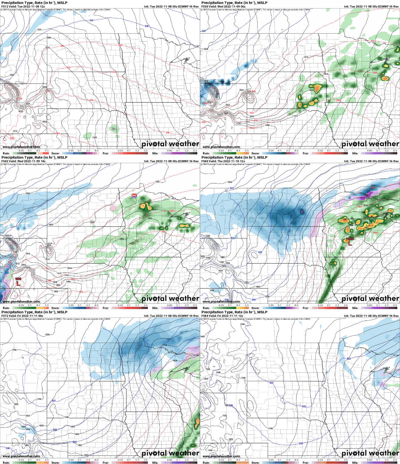
Thursday will be a very interesting setup. A winter storm watch will be in effect in northern Minnesota as heavy snow develops.

We also have the chance of severe weather in southern Minnesota as the cold front runs into mild, muggy air. There’s a slight risk (level 2 out of 5) of severe storms in far southern Minnesota Thursday afternoon.
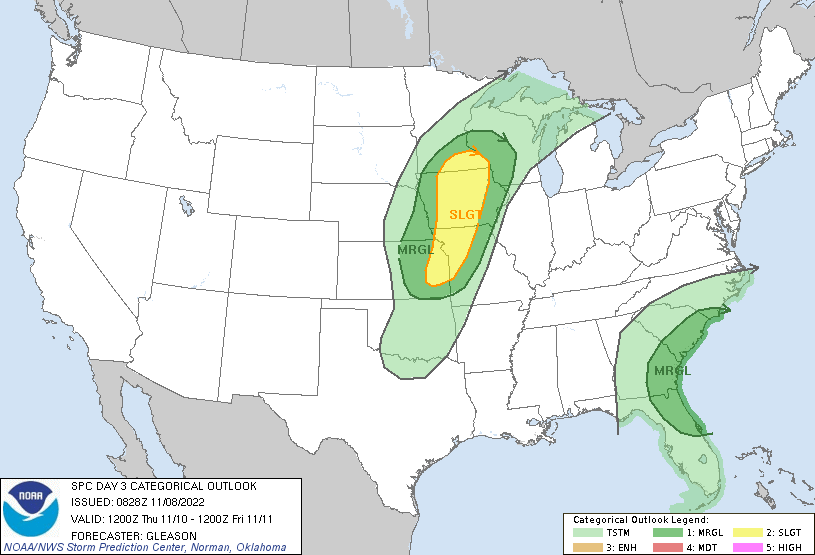
The best chances of heavy snow will be in northern Minnesota where more than 6 inches of snow is increasingly likely.

In southern Minnesota the risk of significant snow is low, but we could see a coating Friday into Friday night. By the time it’s cold enough in the Twin Cities, much of the moisture will be east.

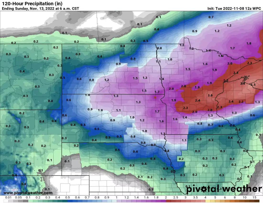
In total, we can expect significant precipitation amounts for much of Minnesota into western Wisconsin. The heaviest totals look to be just north of the Twin Cities area and just north of the worst drought areas.


