
Warmer Tuesday; rain develops late; stormy through Friday
Back above normal Tuesday
Go Deeper.
Create an account or log in to save stories.
Like this?
Thanks for liking this story! We have added it to a list of your favorite stories.


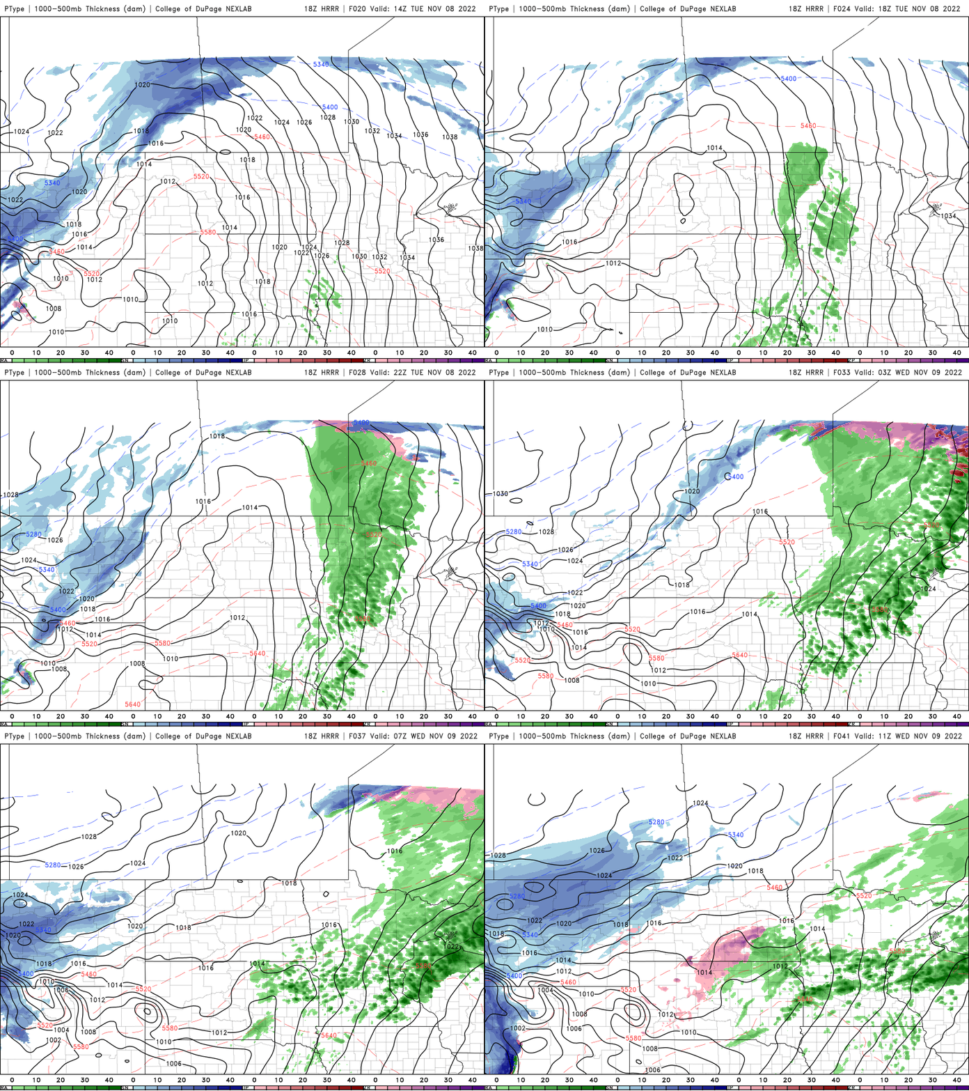
Tuesday will be warmer and windy with highs in the 50s and 40s. Showers develop west to east late in the day. It’ll be the first of several rounds of rain through Thursday before transitioning to snow in the north Thursday and south Friday.
Warmer, windy Tuesday with showers developing
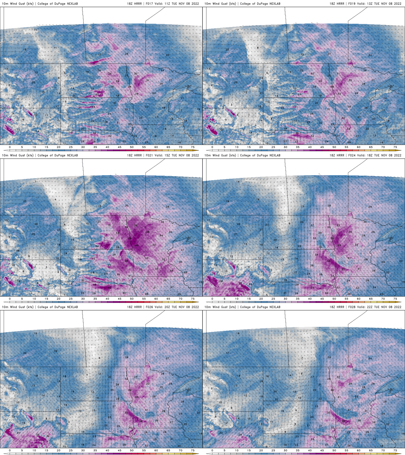
We’re in for some warmer temperatures Tuesday through Thursday, but with the milder air will come wind and rain. Blustery south, southeast winds will develop at 10-20 mph with gusts of 25-30 mph.
Highs will be in 50s across southern Minnesota and in the 40s north.

The first rain showers will develop later in the afternoon in the west and move east into the evening and overnight.
More rain, then snow developing
Tuesday night’s rain will be just the first wave of several areas of showers we’ll see late Tuesday into Thursday.
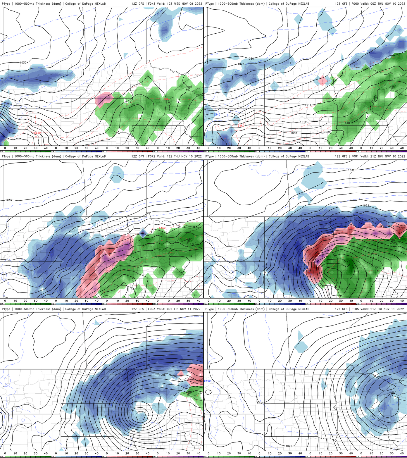
By Thursday, the rain transitions to heavy snow in northern Minnesota and eventually in southern Minnesota we’ll see snow showers as well. Significant snowfall totals can be expected in northwest and northern Minnesota with some lighter accumulations south as well.
Turn Up Your Support
MPR News helps you turn down the noise and build shared understanding. Turn up your support for this public resource and keep trusted journalism accessible to all.

