
Dry Monday; wintry mix Monday night into Tuesday
Ice accumulation possible in southwestern Minnesota

Go Deeper.
Create an account or log in to save stories.
Like this?
Thanks for liking this story! We have added it to a list of your favorite stories.


Winter storm watches go into effect starting at 12 a.m. Tuesday in southwestern Minnesota to 6 p.m. Tuesday along the North Shore of Lake Superior.
A wintry mix of light snow and freezing rain is possible Monday night into Tuesday morning in southwestern Minnesota. The wintry mix develops east through Tuesday.
Dry, mild Monday
Monday will bring another day of mostly cloudy skies but it will be mild and dry. Highs will be in the 30s for most of the state.

A winter storm watch is posted for many parts of Minnesota and goes into effect by 12 a.m. Tuesday in southwestern Minnesota, 12 p.m. Tuesday in central Minnesota and by 6 p.m. for northeastern Minnesota.
Turn Up Your Support
MPR News helps you turn down the noise and build shared understanding. Turn up your support for this public resource and keep trusted journalism accessible to all.

Wintry mix, ice possible Monday night into Tuesday
A wintry mix develops in southwestern Minnesota by late Monday night into early Tuesday. Light snow and a mix of rain and snow will spread east through the day Tuesday.
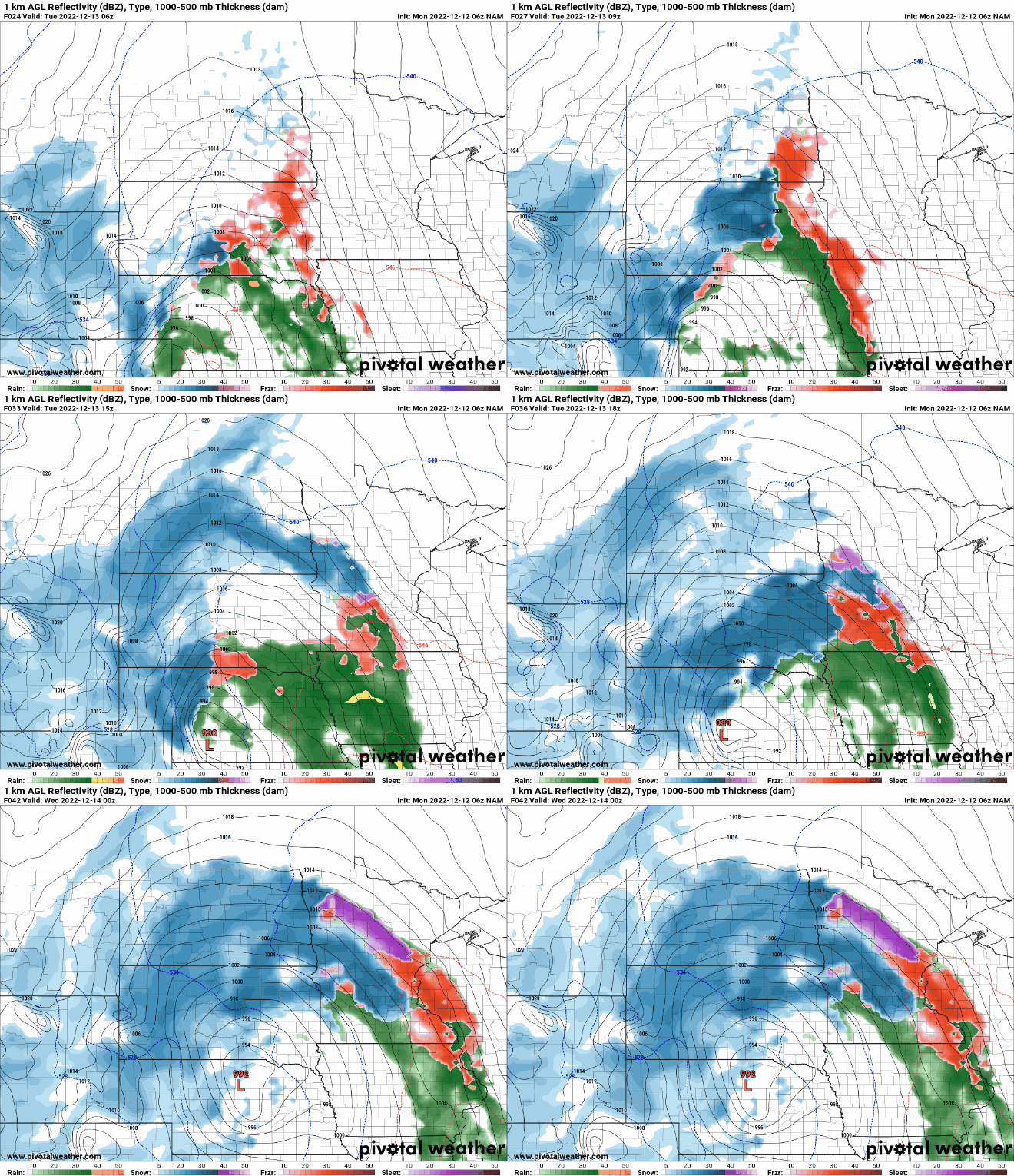
There’s a potential for ice accumulation in southwestern Minnesota, with two-tenths to four-tenths of an inch possible for Pipestone, Worthington and Windom into early Tuesday.

In addition to moisture, winds increase Tuesday with gusty winds.

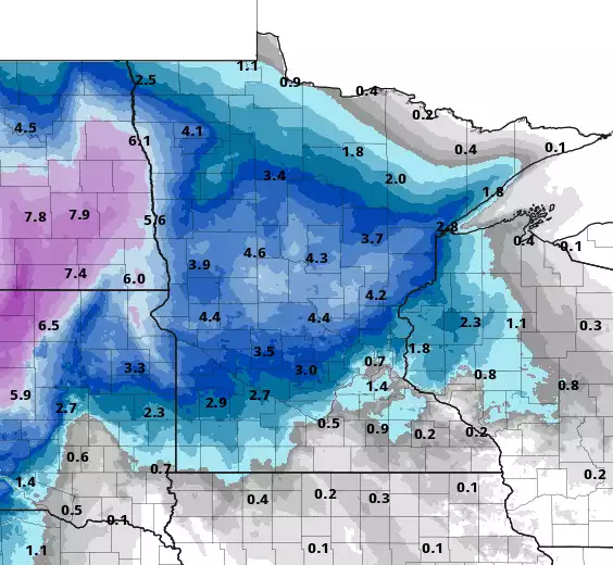
Most snowfall Tuesday into early Wednesday will be across central and north central portions of Minnesota.
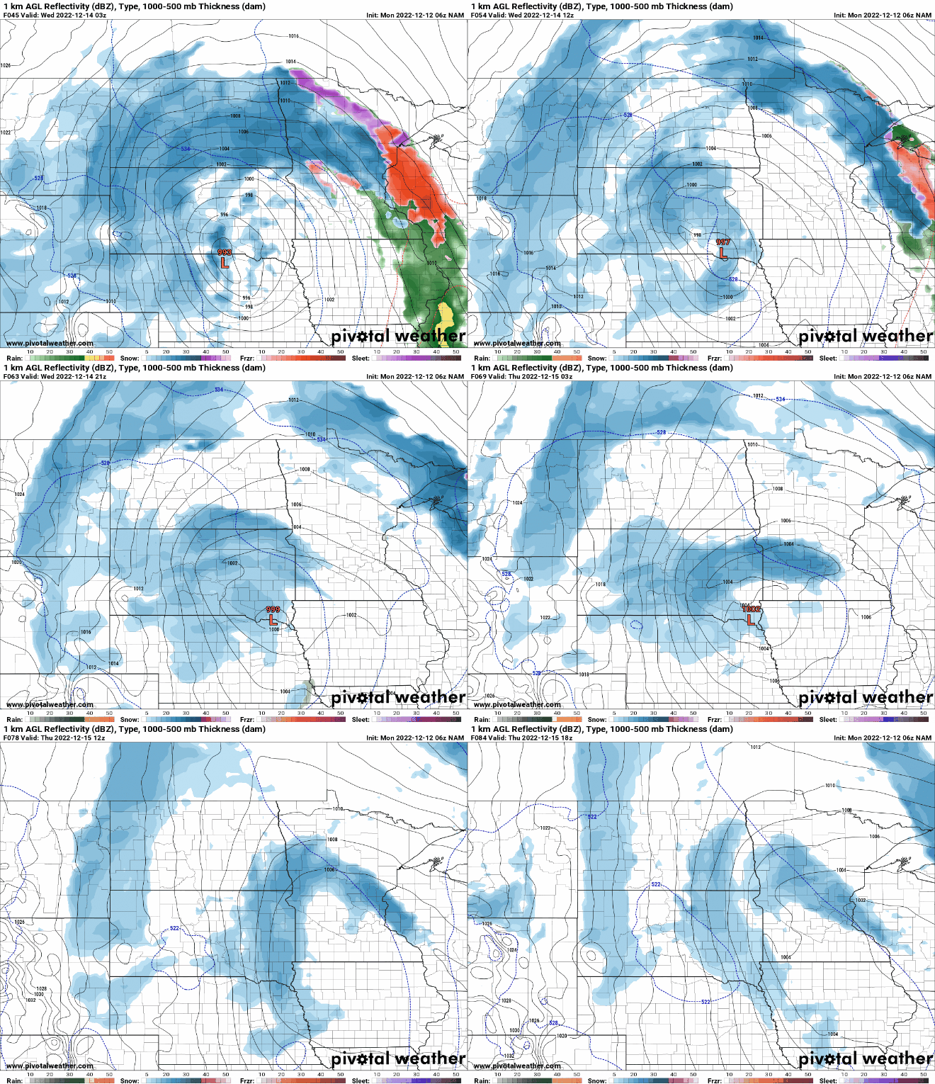
Slow-moving, rotating snow through weekend
Most of the moisture lifts north Wednesday as we enter a dry slot between precipitation bands Wednesday in southern Minnesota. As colder air works into the system most precipitation will fall as snow by Thursday and Friday into the weekend.
The snow really cranks up for northeastern Minnesota and the North Shore Wednesday into Thursday. Many spots along the shore can expect a foot or more of snowfall.
Here’s a look at four computer model possibilities through 12 p.m. Thursday:

We can expect additional snowfall accumulations into the weekend.
Coldest air of the season so far moves in
The slow-moving storm system will create almost a vacuum in its wake, allowing very cold air to move in from northern Canada by early next week. Temperatures will be well below normal and likely bring our coldest temperatures of the season so far.


