
Slow moving winter storm to impact Minnesota most of the week
Dry, mild Monday; rain, snow and ice develops Monday night into Tuesday

Go Deeper.
Create an account or log in to save stories.
Like this?
Thanks for liking this story! We have added it to a list of your favorite stories.


Mild, mostly cloudy and dry Monday with highs in the 30s statewide. Rain, snow and freezing rain develop southwest Monday night and move northeast Tuesday. Rain and snow will continue on and off Wednesday with heavy snow developing near Lake Superior. Periods of all snow will continue Thursday into the weekend.
Calm before the storm Monday
Monday will be mainly dry, mostly cloudy and mild. Highs will be in the 30s nearly statewide.

Ice potential southwest Minnesota Monday night into early Tuesday
Rain, snow and freezing rain develops in southwest Minnesota Monday night into early Tuesday.
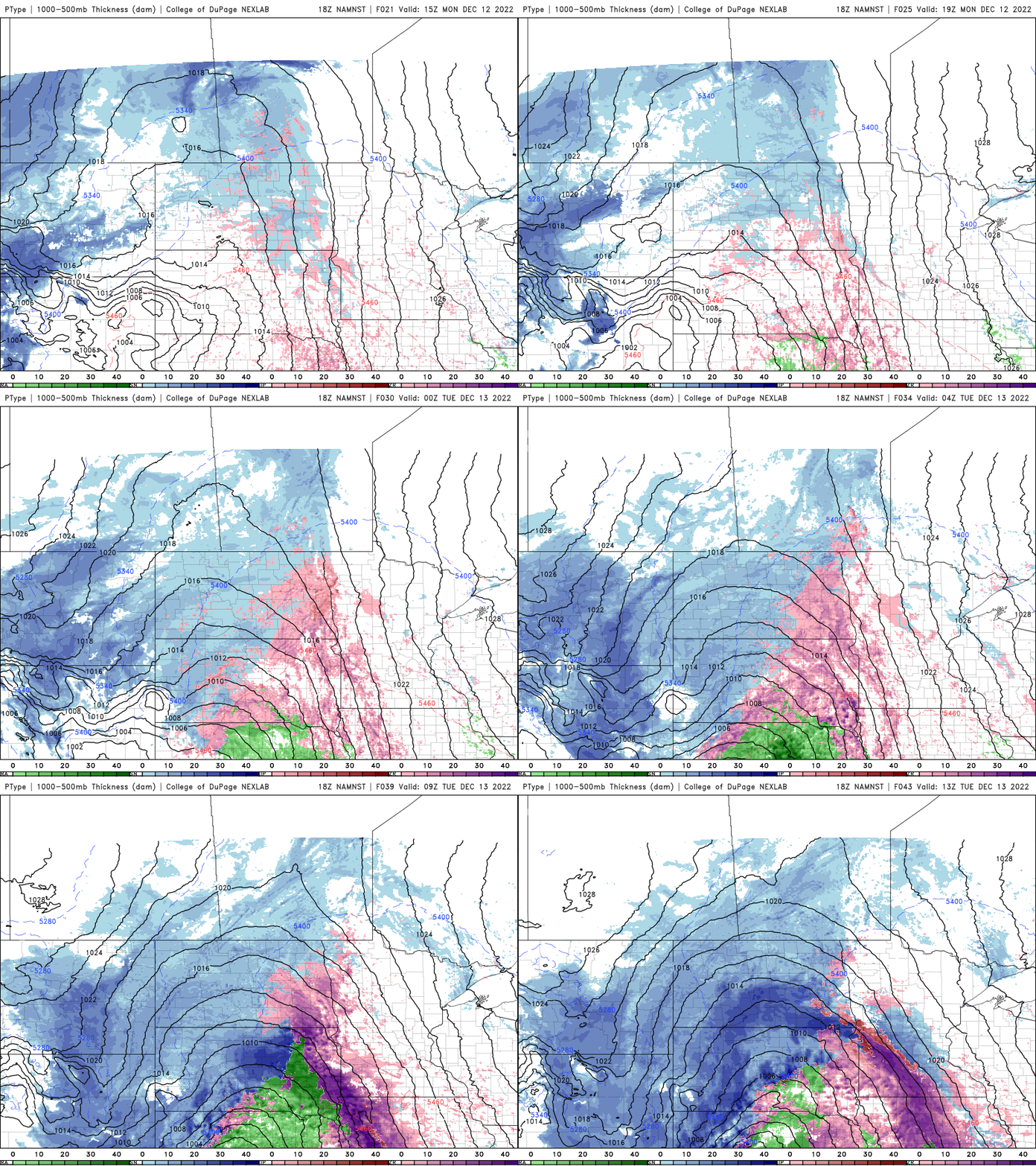
Ice accumulation is possible across much of southwest Minnesota.

Rain and snow spreads across the state for the rest of the week
Rain and snow showers spread east and north through Tuesday into Wednesday.
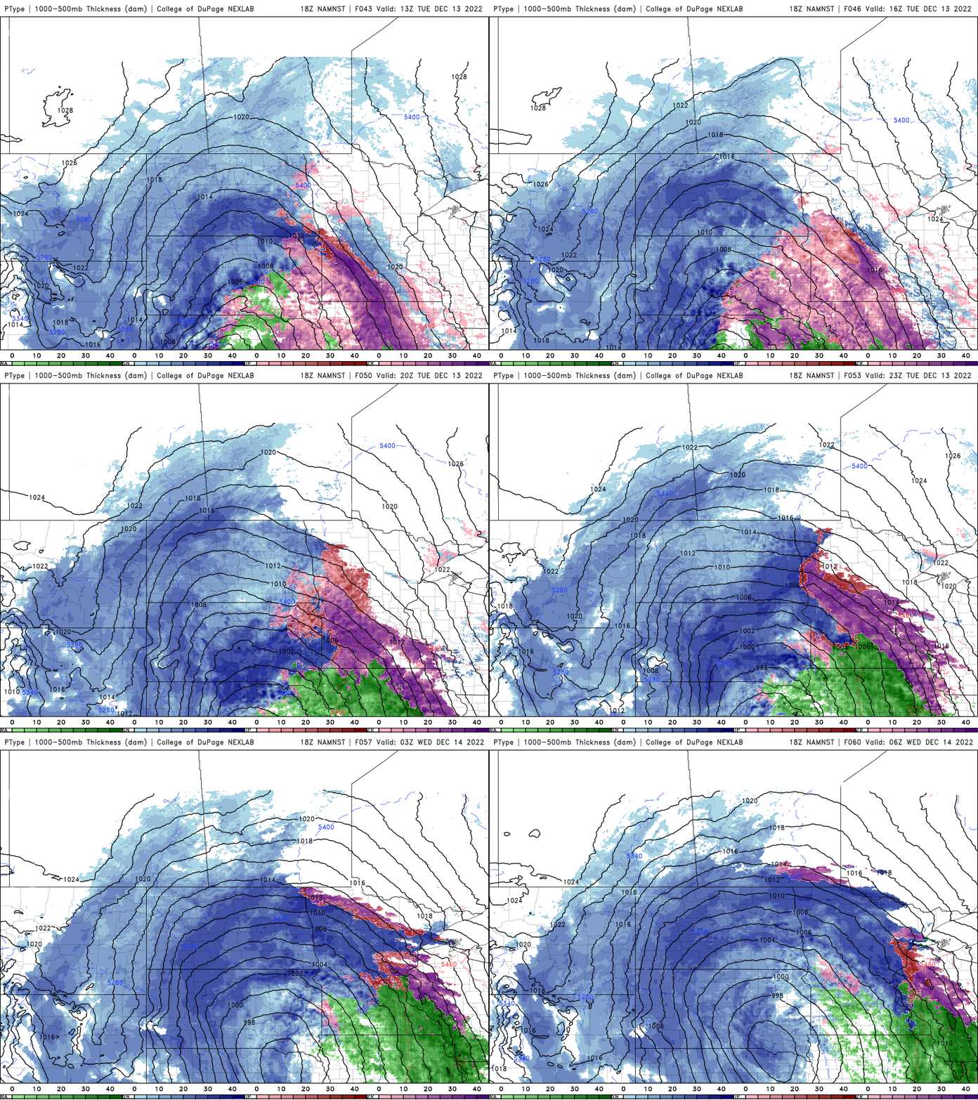
Most snowfall will accumulate across central and western Minnesota into early Wednesday.

The impacts from this storm will continue into the weekend with additional rain and snow accumulation followed by our coldest air of the season potentially next week.
Turn Up Your Support
MPR News helps you turn down the noise and build shared understanding. Turn up your support for this public resource and keep trusted journalism accessible to all.

