
Two snowfalls and lots of cold air ahead
Snow showers develop Monday afternoon

Go Deeper.
Create an account or log in to save stories.
Like this?
Thanks for liking this story! We have added it to a list of your favorite stories.


Monday will be another chilly day with highs in the teens and single digits. Snow showers develop Monday afternoon into the night. Wednesday and Thursday bring another, potentially more significant snowfall for southern Minnesota.
Cold with snow showers developing Monday
Monday will be another cold day with well below normal temperatures. Highs will mainly be in the teens after starting subzero for most places.

Snow showers will develop Monday afternoon across much of northern and southeastern Minnesota into the first half of Monday night.
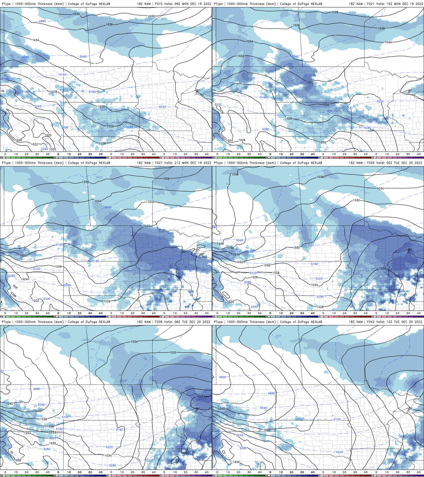
For southern Minnesota, snow totals will generally be lighter, around one inch or less but northern Minnesota could see several inches in some spots.

More snow and cold
A potentially more significant system brings more snow to the southern half of Minnesota and much of Wisconsin Wednesday into Thursday during a busy travel period.
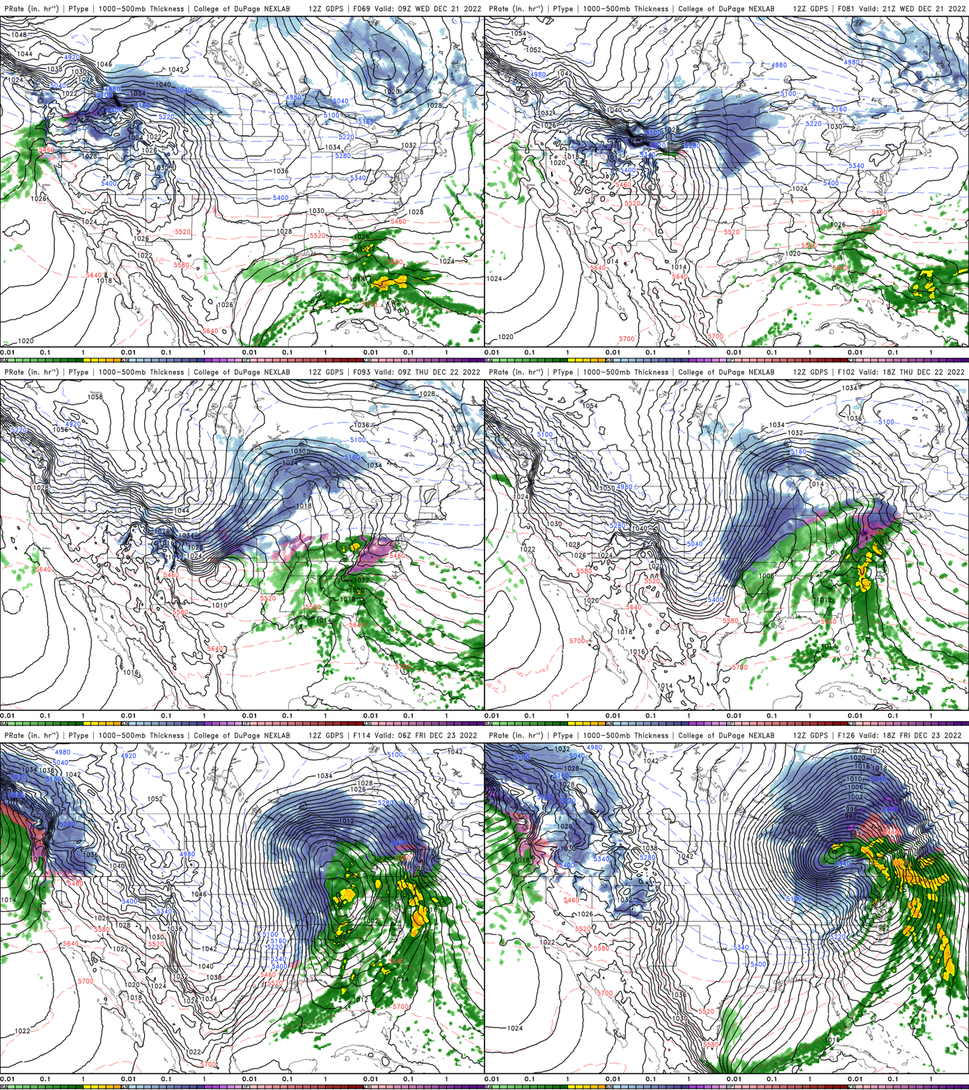
Snow totals could be more than several inches for much of southeast Minnesota and southern Wisconsin, into Iowa and northern Illinois. More cold follows the second round of snow. There will be lots of wind creating blowing snow also into Friday.
We’ll be in for several subzero nights combined with wind to create brutal wind chills by Friday morning. Some places could see wind chills near or exceeding minus 40 early Friday morning.

Turn Up Your Support
MPR News helps you turn down the noise and build shared understanding. Turn up your support for this public resource and keep trusted journalism accessible to all.

