
Wintry mix Thursday and next week; mild air returns this weekend
Winter precipitation eases drought conditions

Go Deeper.
Create an account or log in to save stories.
Like this?
Thanks for liking this story! We have added it to a list of your favorite stories.


Rain and snow showers will develop in southwest Minnesota and move northeast across Minnesota Thursday. High will be mild, in the 30s southeast but colder northwest, in the low 20s.
Wintry mix moves across Minnesota Thursday
Freezing rain, rain and snow showers will develop in southwestern Minnesota and spread northeast across central Minnesota up along the North Shore into the evening hours Thursday.
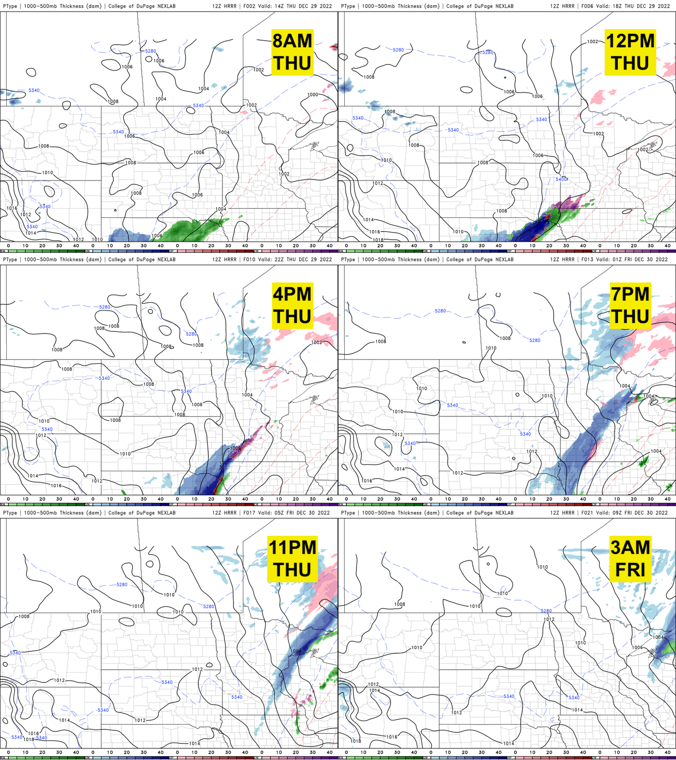
There will be a narrow area of snowfall accumulations in this southwest-to-northeast axis:
Temperatures will be divided by a cold front from the low 20s in northwestern Minnesota to the mid-30s in southeastern Minnesota.
Turn Up Your Support
MPR News helps you turn down the noise and build shared understanding. Turn up your support for this public resource and keep trusted journalism accessible to all.

Behind the front, everyone will be colder Thursday night with subzero lows temporarily sneaking into northwestern Minnesota. We’ll see teens and single digits elsewhere.

Friday will be cooler too but near normal highs.

Mild air returns this weekend; uncertain bigger storm next week
The milder temperatures return for southern Minnesota this weekend with mostly 30s for high temperatures into early next week.

The next storm system will likely develop as rain and snow Monday but there is still a substantial difference in the track of the low between models.
Where a heavy swath of snow develops and mostly rain could really vary from northern and southern Minnesota into Wednesday.

Latest drought monitor and snowfall
It should come as no surprise we’ve had a snowy start to the winter season. In fact, in the Twin Cities, our seasonal snowfall is already ranking 10th highest.

Statewide, snowfall is above normal by double or even triple normal values for December, especially along the North Shore.

The latest drought monitor is unchanged from last week, but the extreme category of drought has been dropped from Minnesota due to the higher-than-normal amounts of precipitation through November and December.


