
Weekend weather: Quiet, mild; plenty of snow for outdoor fun
Go Deeper.
Create an account or log in to save stories.
Like this?
Thanks for liking this story! We have added it to a list of your favorite stories.


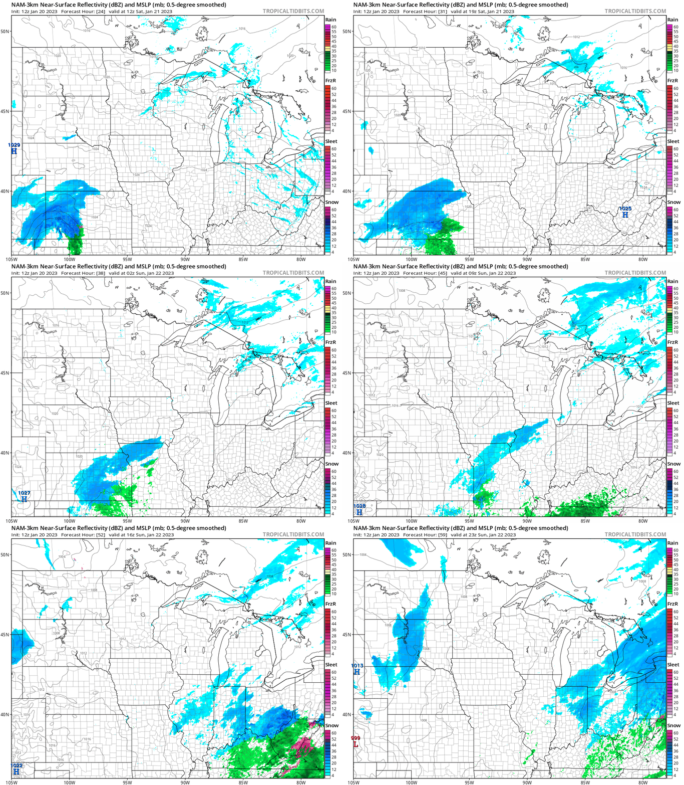
We’ll be able to give our shoveling muscles a rest this weekend. A few stray flurries are possible in Minnesota and western Wisconsin Friday and Saturday, but most locations won’t see any flakes.
The National Oceanic and Atmospheric Administration’s North American Mesoscale (NAM) forecast model shows the potential precipitation pattern from 6 a.m. Saturday to 5 p.m. Sunday:
Snow depth update
If sledding, snowboarding or cross-country skiing are in your weekend plans, you’ll be happy to know that there’s plenty of snow on the ground across most of Minnesota:

The official Twin Cities snow depth is 11 inches right now, but some spots in the north metro have snow depths of 15 inches or higher.
Turn Up Your Support
MPR News helps you turn down the noise and build shared understanding. Turn up your support for this public resource and keep trusted journalism accessible to all.
The purple areas on the snow depth map indicate 18 inches or more of snow cover from Carlton County up through northeastern Minnesota.
The light purple areas (including much of Lake County and Cook County of northeastern Minnesota) have 24 inches or more of snow on the ground.
Some spots in far southern Minnesota have between 4 and 8 inches of snow cover.
You can get info on the groomed trails in Minnesota State Parks here.
Weekend temps
Most of Minnesota will have Friday highs in the 20s, with a few upper teens in northwestern Minnesota. Highs in the upper 20s are expected in the Twin Cities metro area on Friday and Saturday. Our average Twin Cities high temp is 23 degrees this time of year.
Saturday highs will be mainly in the 20s across Minnesota and western Wisconsin:

Saturday winds will be fairly light, so afternoon wind chill temperatures will be mainly in the teens above zero:

Sunday forecast highs will be mainly in the 20s, with a few teens in west-central Minnesota:

Sunday afternoon wind chills will be mainly in the teens, with a few single-digit wind chills in west-central and northwestern Minnesota::

Temperature trends
Twin Cities metro area highs are projected to be around 30 degrees on Monday, followed by upper 20s Tuesday then lower 20s Wednesday and Thursday and around 20 on Friday.
Anniversary of a big snowstorm
Friday is the anniversary of one of the biggest snowfalls in Twin Cities weather records.
The Twin Cities snowfall total at Minneapolis-St. Paul International Airport was 17.4 inches on Jan. 20 into Jan. 21, 1982. Another storm started on Jan. 22 and lingered into Jan. 23, 1982, delivering 20 inches of snow to the Twin Cities.
Those two storms are ranked third and fourth on the list of the top 24 snowfalls in Twin Cities weather records:

Details on the two snowstorms can be found here.
Programming note
You can hear my live weather updates on MPR News at 7:35 a.m., 9:35 a.m. and 4:39 p.m. Saturday and Sunday.

