Two snowfalls, falling temps; deep freeze weekend
Colder temperatures Wednesday night and especially this weekend

Go Deeper.
Create an account or log in to save stories.
Like this?
Thanks for liking this story! We have added it to a list of your favorite stories.


We’ll have on and off snow showers Wednesday with winds increasing to 10-20 mph from the northwest. Wednesday night will be colder with temps dropping into the single digits and subzero north.
Multiple snow chances ahead of bitter cold air
We’ll have snow showers on and off through the day Wednesday with the most intense snow midday into the afternoon for the Twin Cities area and much of eastern Minnesota. A winter weather advisory is posted through 4 p.m. Wednesday for the North Shore.
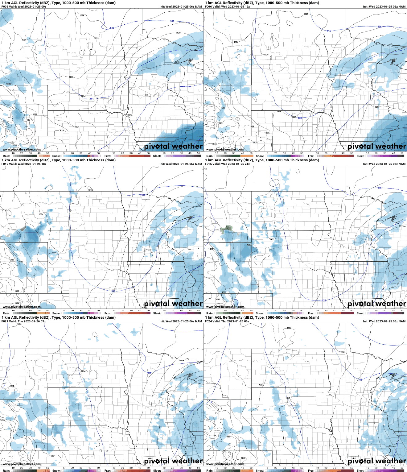
Most of us can expect about 1 inch, but some places will see 2 inches.
It’ll be colder Wednesday night into Thursday behind this first clipper. Low temperatures will be subzero for northern Minnesota and in the single digits south Wednesday night.
Turn Up Your Support
MPR News helps you turn down the noise and build shared understanding. Turn up your support for this public resource and keep trusted journalism accessible to all.

High temperatures Thursday will be slightly below normal, mainly in the teens to around 20.

We should also see some sunshine Thursday. Another clipper system already will push snow showers into northwestern Minnesota late Thursday afternoon and spread southeast overnight Thursday night.
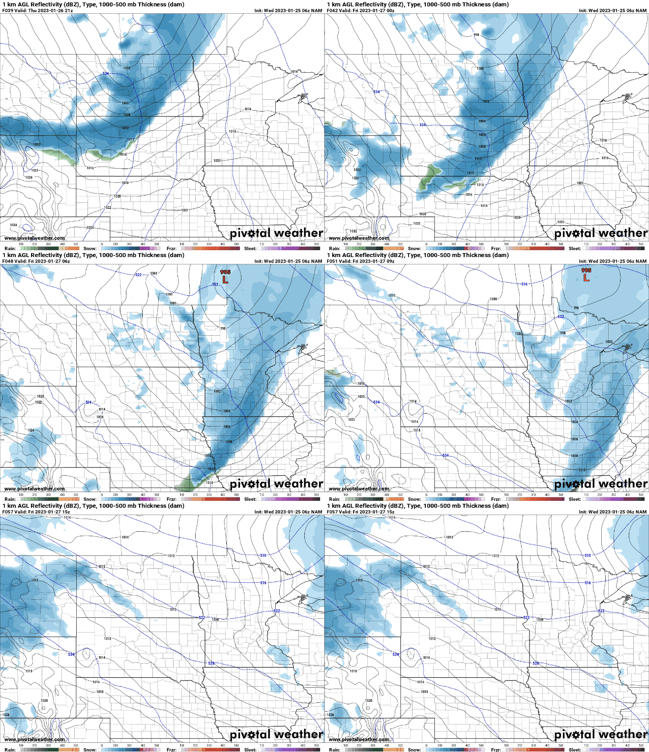
We can expect another 1 to 2 inches of snow into Friday morning for much of Minnesota.

Coldest air arrives late Friday into next week
Behind that second clipper system will come the coldest air since mid-December. Temperatures will drop below zero for most of Minnesota Friday night into early Saturday morning.

High temperatures over the weekend will stay below zero up north and in just the single digits in southern Minnesota.

Wind chill values will range from 20 below zero to 40 below zero Sunday morning.

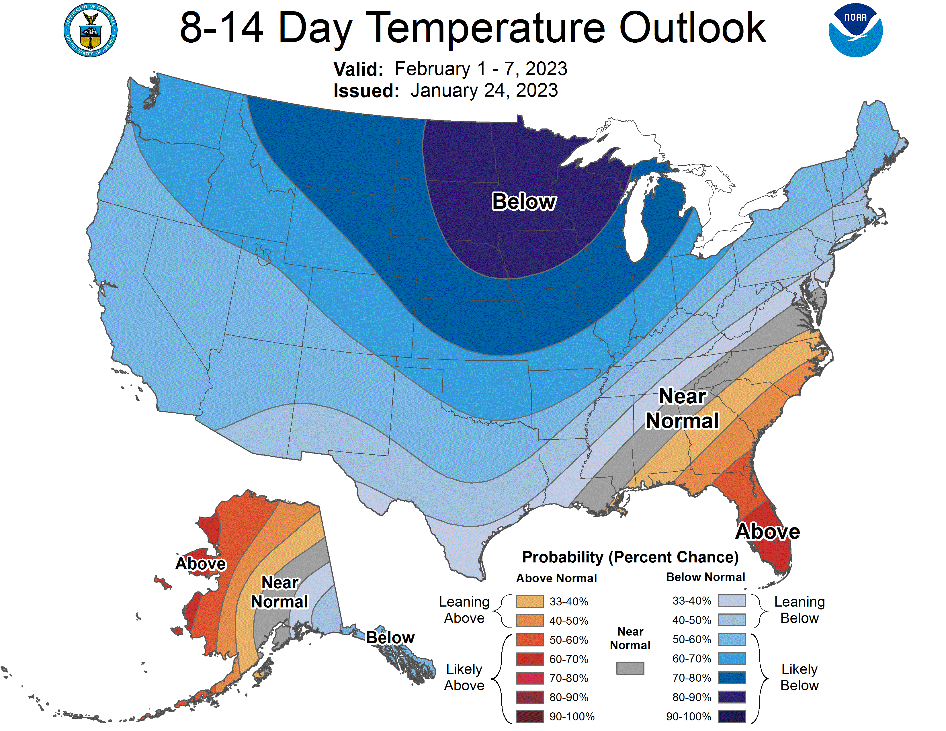
Get used to the cold. The eight to 14-day outlook shows a strong likelihood for temperatures to remain well below normal.
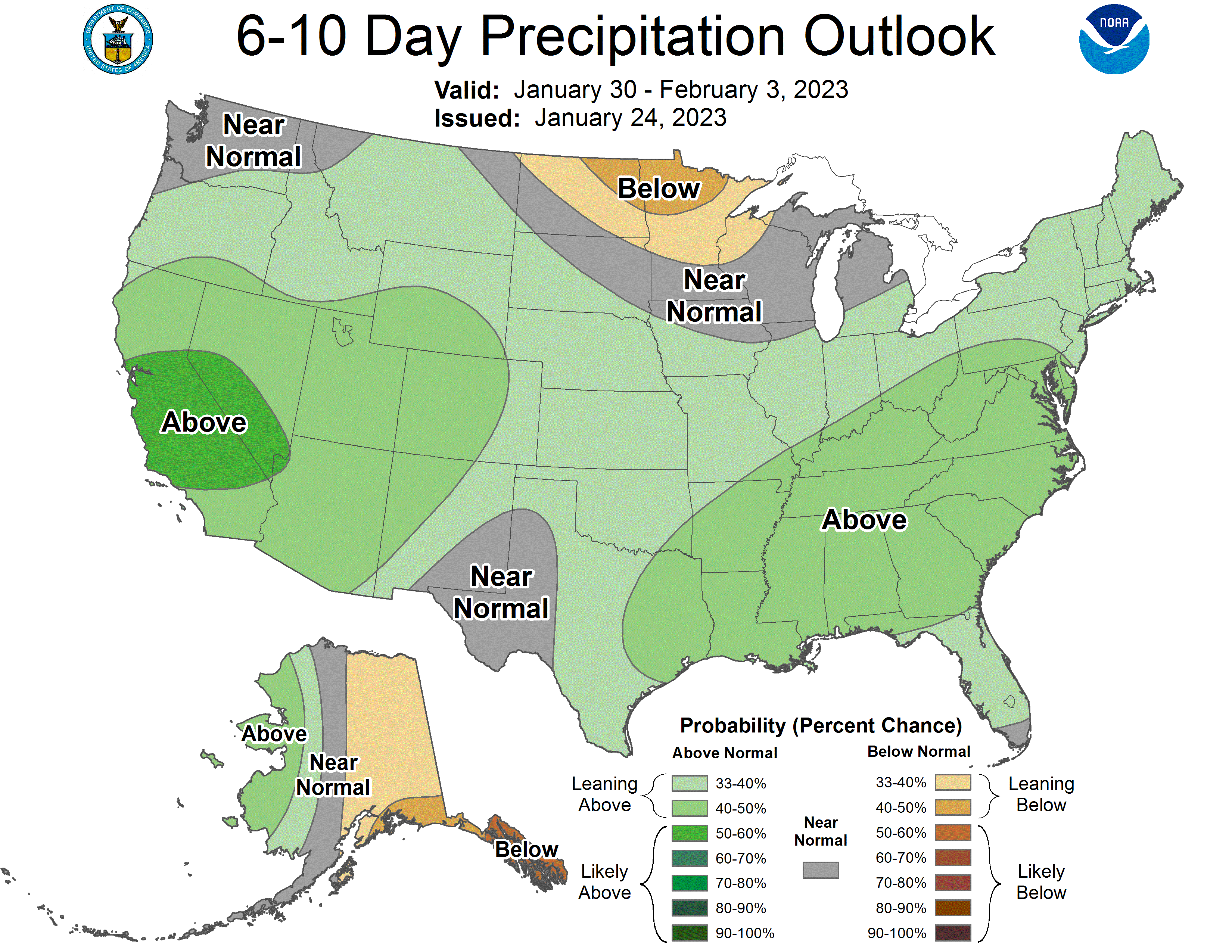
The cold will also generally keep the largest storm systems to our south so below-normal precipitation also looks likely.