Above normal by the weekend; Minnesota cold not what it used to be
Dry for most with a warming trend this week
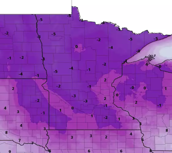
Wind chill warnings continue through noon in northwest Minnesota. Monday will barely warm above zero in southern Minnesota with subzero highs north. Wind chills will remain in the teens and 20s below zero Monday afternoon.
Cold high pressure brings sun, frigid temps
We’ll continue to have sunshine Monday thanks to a very cold area of high pressure parked over the Upper Midwest.
No surprise, this air originated from the arctic and northern Siberia just five days ago. Modeled trajectories show the path of this air mass since the middle of last week:
The cold, clear skies led to frigid temperatures again early Monday morning. The cold spot was 35 degrees below zero in Eveleth on Minnesota’s Iron Range.
Create a More Connected Minnesota
MPR News is your trusted resource for the news you need. With your support, MPR News brings accessible, courageous journalism and authentic conversation to everyone - free of paywalls and barriers. Your gift makes a difference.
The Twin Cities dropped to 8 below zero, the coldest in this recent cold snap but not quite the 12 below zero we had in December.
High temperatures Monday will struggle to get barely above zero in southern Minnesota. Most of northern Minnesota will stay subzero. We’ll see lows again Monday night into early Tuesday drop well below zero statewide.
High temperatures Tuesday should crack 10 degrees however across southern Minnesota by afternoon.
Climate change signal in our coldest temps
While it is indeed cold out there, it’s not what it used to be. If we look at the coldest winter temperatures, they’ve warmed by about 12 degrees in the Twin Cities since 1970.
I did a further analysis of several of our longer term, reliable weather stations in Minnesota and found a similar trend of anywhere from 3 (International Falls) to as much as 12.5 degrees warming for places like Brainerd and St. Cloud.
The frequency of cold extremes (defined by 35 below zero for northern Minnesota and 25 below zero south) are also much less than they used to be.
According to the Minnesota Department of Natural Resources State Climatology Office, the frequency of these extremes has dropped by as much as 90 percent.
Dry for most with a warming trend
We’ll remain mostly dry this week except for the potential of a few light snow showers in northern Minnesota late Tuesday into early Wednesday.
Temperatures should reach the 20s for much of Minnesota by the weekend, back into slightly above-normal territory.