
Windy, cooler; 30s, near 40 return for the weekend
Winter season so far is Twin Cities' fifth snowiest
Go Deeper.
Create an account or log in to save stories.
Like this?
Thanks for liking this story! We have added it to a list of your favorite stories.


Colder air is briefly moving across Minnesota increasing winds and bringing clouds and flurries back Thursday. Temperatures will dive into the single digits south to subzero north Thursday night.
Windy, cooler before weekend warmup
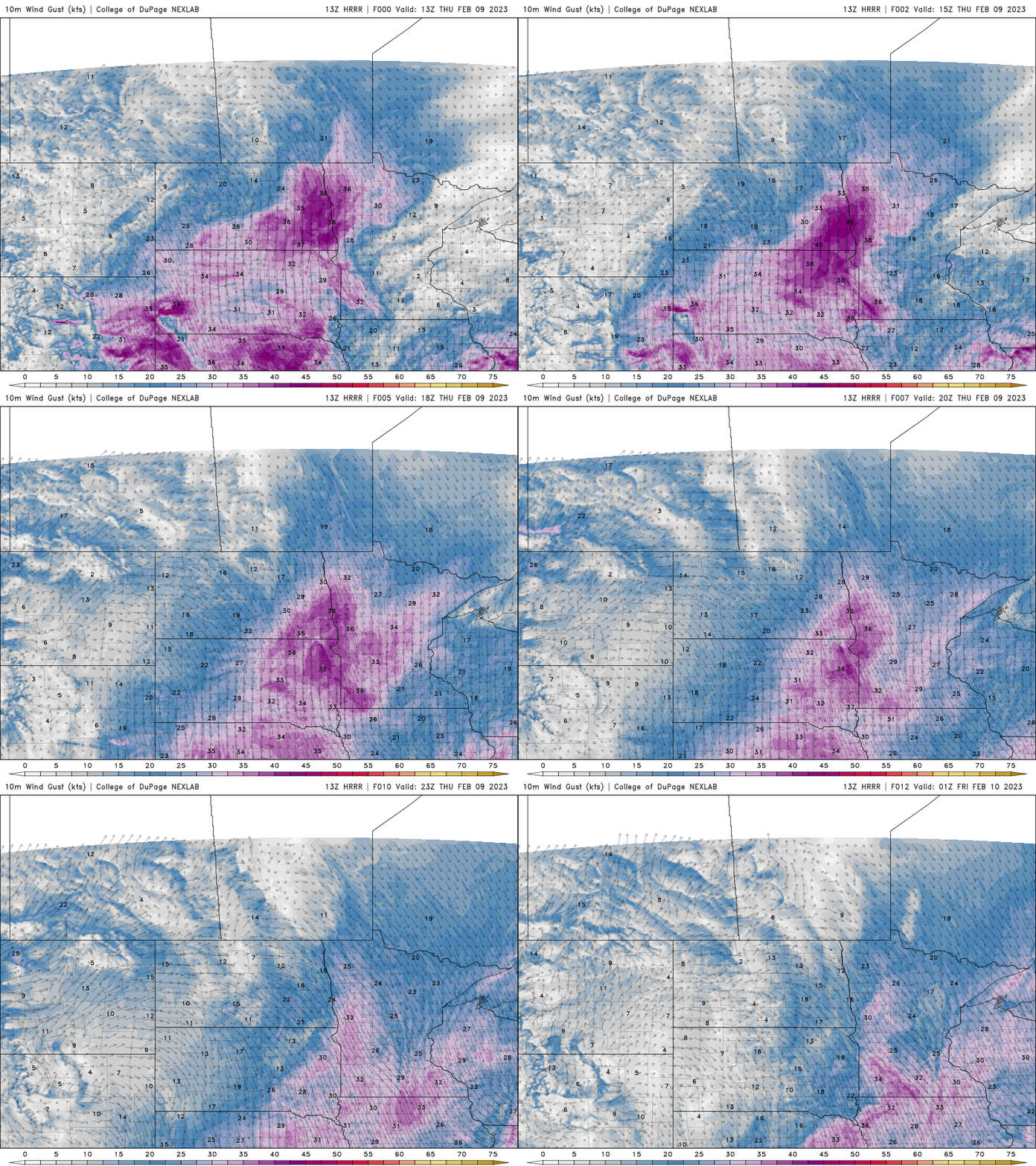
A clipper system and cold front is dropping temperatures across northern Minnesota Thursday and creating wind for everyone. We’ll see mild temperatures still in southeastern Minnesota, including the Twin Cities, mainly in the 30s.

Wind gusts will be up to 45 mph in western Minnesota and around 30 to 35 mph east. Sustained wind speeds will be 15-30 mph from the north and northwest.
We’re also missing a more significant rain and snow event to the southeast in Iowa, Illinois and Wisconsin. Some places will pick up several inches or more of snow.
Turn Up Your Support
MPR News helps you turn down the noise and build shared understanding. Turn up your support for this public resource and keep trusted journalism accessible to all.

Overnight temperatures will be briefly chilly with subzero readings in northern Minnesota to the single digits above zero south. The Twin Cities may stay just around 10 degrees.

High temperatures Friday will put a pause on the thaw with highs in the 20s statewide, closer to normal.

Temperatures pop right back up into the 30s, even possibly near 40 Saturday and Sunday.

Analyzing season’s snowfall, temp swings
Most of Minnesota saw the warmest readings since November on Wednesday afternoon, including widespread 40s and even at least one 50-degree temperature in Waskish, on the eastern shore of Upper Red Lake.

In the Twin Cities, it was a gap of 72 days since our last 40 on Nov. 28. That’s an unusually long wait between 40-degree readings.
January was very mild, but it was consistent warmth rather than warm extremes. The normal (1991-2020 average) number of days between 40s is about 38 days. Historically it was about 51 days.
Many places surpassed 40 and reached the mid-40s.
Here’s a look at the normal first 45-degree reading for some statewide reporting stations. They range from as early as Feb. 2 in Marshall and as late as Feb. 25 in Park Rapids. For most places it came a bit early this year.

Snowfall this season has been well above average. A succession of storms from late November into early January made this the third snowiest winter going into 2023. The lack of significant snow the past five weeks has allowed the season to slip to fifth snowiest.
If we don’t get a lot of snow in February’s second half or in March, we’ll continue to drop.


