
Milder again Friday into the weekend; rain, snow Sunday and Monday
Highs will be in the 30s statewide Friday into Saturday

Go Deeper.
Create an account or log in to save stories.
Like this?
Thanks for liking this story! We have added it to a list of your favorite stories.


After a briefly cooler day Thursday, milder readings are back Friday into the weekend with lots of highs in the 30s to near 40. A mix of rain and snow develops Sunday into Monday with the next storm system.
Warming up again Friday into the weekend
Temperatures will be back near or above normal Friday with partly cloudy skies and light winds.

We’ll see similar readings Saturday and Sunday with seasonable to even mild high temperatures.

Wintry mix develops Sunday into Monday
After a mini stretch of dry weather the next storm system delivers rain and snow Sunday afternoon into Monday across a large area of Minnesota.
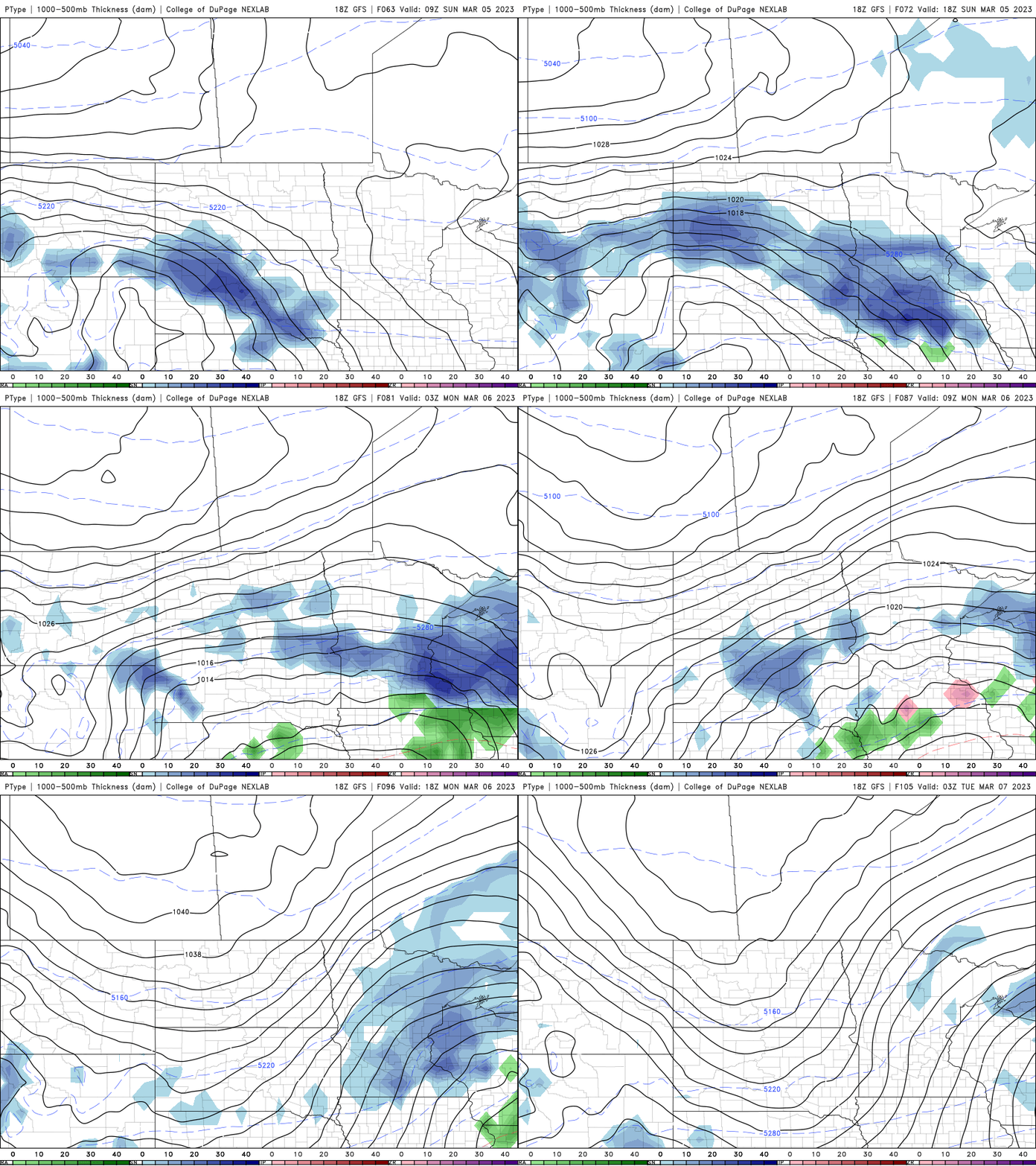
Getting snow to stick during the daylight hours this time of year requires heavy snow showers, so forecasting accumulations can be tricky. Temperatures will be above freezing for many areas.
Temperatures cool late next week into the 20s and low 30s, which will be nearly 10 degrees below normal for most places.
Turn Up Your Support
MPR News helps you turn down the noise and build shared understanding. Turn up your support for this public resource and keep trusted journalism accessible to all.

