
Snow showers expand east Wednesday; significant snow develops late Thursday
Another round of snow is possible late Saturday

Go Deeper.
Create an account or log in to save stories.
Like this?
Thanks for liking this story! We have added it to a list of your favorite stories.


The first wave of less significant, scattered snow showers will expand east Wednesday across Minnesota. The potential heavier snowfall develops late Thursday through Thursday night. More snow is possible Saturday night.
Snow showers expand east Wednesday
Snow showers fell through the night in northwestern Minnesota. That area of snow showers will expand east some through the day Wednesday.
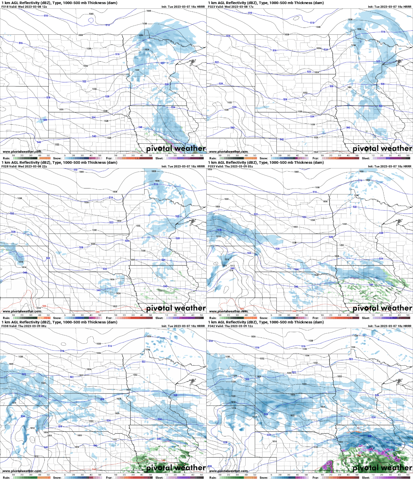
Expect additional snowfall accumulations on the lighter side through north-central and central Minnesota with some scattered snow showers into eastern Minnesota.

Temperatures will still be mild, in the 30s across southern and eastern Minnesota, while northwestern Minnesota will be colder, in the 20s.

Main snow late Thursday, more Saturday night
An upper-level wave is making its way east, originating from the west coast and that will provide a major boost of energy into the system. This will expand the snow and intensity across southern Minnesota late Thursday through Thursday night into early Friday.
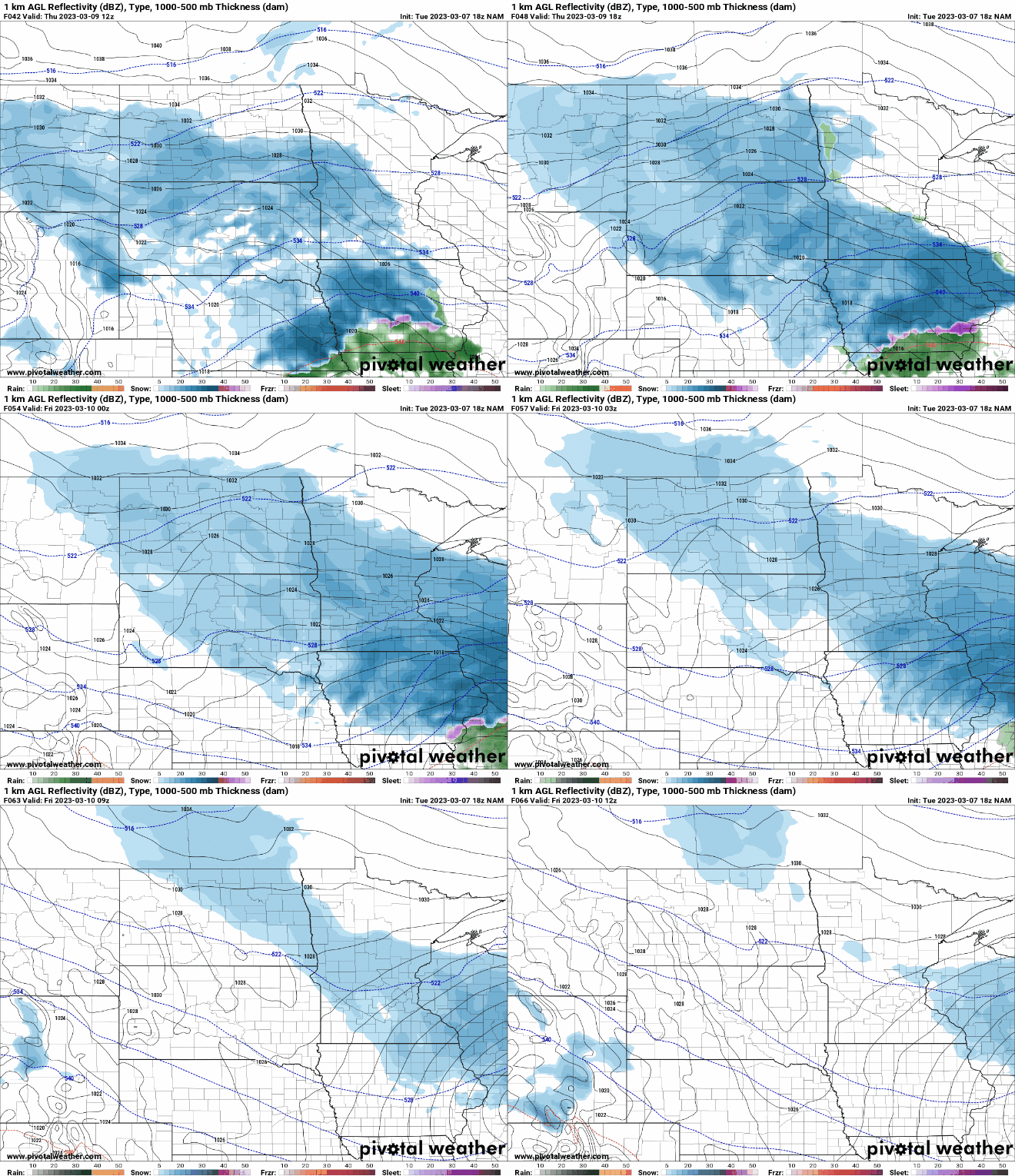
This is when the bulk of snow will fall for southern Minnesota with significant accumulations, especially in southeast Minnesota into northern Iowa and southwest Wisconsin.

We get about a 30-hour break before the next system brings more accumulating snowfall late Saturday into early Sunday. At least a couple of inches are possible to potentially several. The Saturday night system does not look as potent as Thursday night’s.
Turn Up Your Support
MPR News helps you turn down the noise and build shared understanding. Turn up your support for this public resource and keep trusted journalism accessible to all.

