
Temps dip Friday, dive over the weekend; Sunday snowflakes possible
Update on river levels
Go Deeper.
Create an account or log in to save stories.
Like this?
Thanks for liking this story! We have added it to a list of your favorite stories.


Another day, another record high temperature in the Twin Cities.
The record Twin Cities high temp for April 13 had been 84 degrees, which was set in 2006. The temps at Minneapolis-St. Paul International Airport shot right by that mark Thursday afternoon, hitting 87 degrees.
Most of southern Minnesota and parts of central Minnesota plus west-central and southwestern Wisconsin had Thursday afternoon highs in the 80s. St. Cloud set a new April 13 record high of 83.
With gusty winds and low relative humidity, the Twin Cities metro area and much of southern Minnesota and southern Wisconsin are under a red flag warning until 8 p.m. Thursday evening:
Turn Up Your Support
MPR News helps you turn down the noise and build shared understanding. Turn up your support for this public resource and keep trusted journalism accessible to all.

Outdoor burning is not recommended during the red flag warning because any fires that develop could spread rapidly.
Temperature trends
The average Twin Cities high temperature is 56 degrees on April 14. Friday highs are forecast to reach about 80 degrees in the metro area, with lower 80s in southeastern Minnesota:

Temperatures will be much cooler in northwestern and west-central Minnesota, with highs in the 40s and 50s.
Saturday highs will range from upper 30s in far northwestern Minnesota to 50s in the metro area and 60s in southeastern Minnesota:

Sunday highs will be mainly in the 40s:

Weekend rain chances
Western and northern Minnesota have the best chance of showers Friday morning and afternoon. Periods of rain then expand eastward to cover most of Minnesota and western Wisconsin Friday evening and Friday night. Some embedded thunderstorms are also possible.
Most areas will have periods of rain on Saturday, with some embedded thunderstorms at times. Snowflakes are also possible Saturday in northwestern Minnesota.
There will be a chance of rain showers or a mix of rain and snow in eastern Minnesota and western Wisconsin on Sunday.
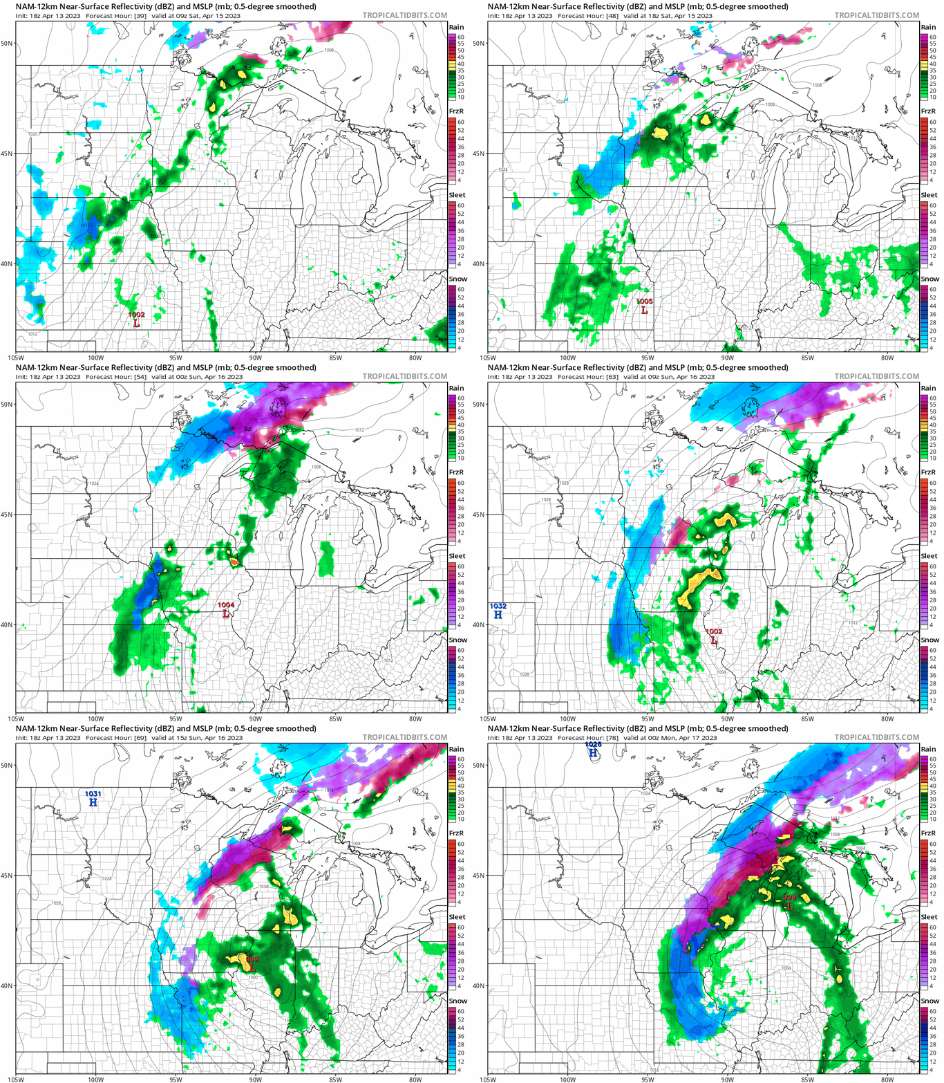
The National Oceanic and Atmospheric Administration’s North American Mesoscale (NAM) forecast model shows the potential precipitation pattern from 4 a.m. Saturday to 7 p.m. Sunday:
You can find updated weather information for Minnesota and western Wisconsin on the MPR News network.
River levels
Rivers have already reached flood stage in parts of Minnesota and northwestern Wisconsin. You can see the river levels at various locations in northern Minnesota and northwestern Wisconsin here.
This is how the linked map looked Thursday afternoon:

The Duluth National Weather Service office has this overview of the spring flood situation:
The risk of snowmelt flooding continues across the Northland. Flood watches and warnings are in effect for locations which will experience flooding in the next few days. Numerous low-elevation water crossings on back roads across northwest Wisconsin, and central and northeast Minnesota will likely experience flooding. Please refer to the latest flood products for your location for additional details.
You can find info on river levels at various locations in central and southern Minnesota here.
Here’s how the linked map looked Thursday afternoon:

You can zoom in on the linked map page and get detailed info on river levels at a specific location. Here’s the hydrograph of recent, current and forecast levels for the Mississippi River at St. Paul:

A rise of about 7 feet is expected at that location in the next seven days, with additional rises possible beyond that point.
Here are the results when various river levels occur at the St. Paul gauge:

Here’s the hydrograph of recent, current and forecast levels for the St. Croix River at Stillwater, Minnesota:

A rise of more than 6 feet is expected in the next four to five days, with the river reaching major flood stage of 89 feet.
Here are the results of various river levels at the Stillwater gauge:

I should mention that river levels are measured in relation to the height above a local benchmark. In some locations, river levels are listed in feet above sea level.
Here are the historic St. Croix River crests at the Stillwater gauge:

Programming note
You can hear my live weather updates on MPR News at 7:35 a.m., 9:35 a.m. and 4:39 p.m. each Saturday and Sunday.

