
From record heat to snow? Big changes developing over the weekend
Rain spreads across the state Friday night into Saturday with snow early Sunday

Go Deeper.
Create an account or log in to save stories.
Like this?
Thanks for liking this story! We have added it to a list of your favorite stories.


Friday highs will be back into the low 80s from the Twin Cities south and east. Showers will develop in western Minnesota. Showers are possible statewide Friday night into Saturday with snow possible early Sunday.
April heat wave ends Friday
We have one more incredibly warm day Friday across southeastern Minnesota. Highs will be in the low 80s from the Twin Cities and points south and southeast again. Northwestern Minnesota will only manage the low 40s.

It’s pretty incredible the records that were shattered the last couple of days. Two record highs were shattered and two record warm lows were also broken in the Twin Cities.
St. Cloud, Rochester, Brainerd, International Falls and Eau Claire, Wis., all broke records too.
Turn Up Your Support
MPR News helps you turn down the noise and build shared understanding. Turn up your support for this public resource and keep trusted journalism accessible to all.

There’s often a perception problem with understanding the scope of warmth around here. For example, as our winters become increasingly milder, we seem shocked when we have a chilly one (like last year).
This year, after a long, sloppy but slightly warmer-than-normal winter and a delayed start to spring, we almost feel we’re owed summer temperatures.
But this kind of heat this early is unprecedented. We have never had four 80 degree days prior to April 15 in the Twin Cities, let alone four consecutive. It is the equivalent of four 100-degree days in a row (only in July 1936 did this occur) in July or four days of near-60 degree temperatures in January (which has never happened).
The heat is making progress on our lake ice-outs, which not surprisingly are behind this year.

The median ice out dates for the southern half of the state are mostly before April 15.

Rain, snow then back to normal next week
Showers will mainly be confined to western Minnesota as a broad trough of low pressure continues to fill in. Cold rain showers reach nearly statewide during the overnight hours Friday night into Saturday and Saturday night.
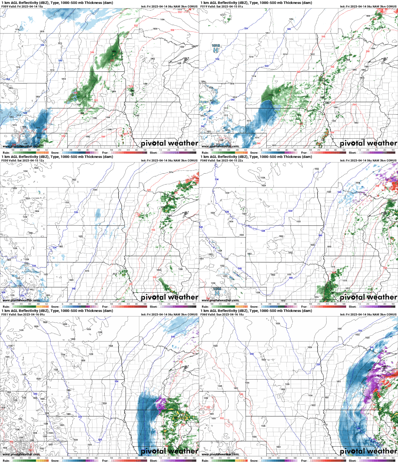
It’s possible to see snow late Saturday night into Sunday morning as much colder air works into the system. The best chance of accumulation will be in northeastern Minnesota, but a patchy coating of snow is also possible in southern Minnesota.
High temperatures Sunday will be downright chilly once again, in the 30s and 40s only.

We’re back into the 60s in southern Minnesota with 50s north by Tuesday into midweek.

We’ll need to watch not one, but two possible storm systems for the middle and end of next week.

