
Chilly weekend; Update on our rising river levels
Milder temps return Tuesday into Thursday

Go Deeper.
Create an account or log in to save stories.
Like this?
Thanks for liking this story! We have added it to a list of your favorite stories.


Our Friday afternoon temperatures were more typical of mid-March than the third week of April. Chilly weather will continue into this weekend.
Plenty of snow up north
Northern Minnesota saw plenty of snow from Thursday afternoon into Friday afternoon. You can find a plot of snow reports here.
This is how the snow report map looked at around 3 p.m. Friday:

Snow totals have been highest in northeastern Minnesota and parts of north-central Minnesota:
Turn Up Your Support
MPR News helps you turn down the noise and build shared understanding. Turn up your support for this public resource and keep trusted journalism accessible to all.
15 inches, Silver Bay and Hovland
11.2, Finland, Minnesota
10.2 inches, Castle Danger
8.5, inches, Ely
8.1 inches, International Falls
7.2 inches, Bemidji
Snow reports will be updated in many locations Friday evening.
Periods of snow continue Friday evening and overnight Friday night in Minnesota and into Wisconsin. Winter weather advisories continue into Friday evening in roughly the northern third of Minnesota, where an additional inch or so of snow is possible. Some locations in the north will see blowing snow and reduced visibilities.
The remainder of Minnesota and western Wisconsin will have snow showers at times Friday evening and overnight, with lighter snow accumulations possible and a chance of light rain and sleet as well.
You can find updated weather information for Minnesota and western Wisconsin on the MPR News network.
Saturday morning flake chance
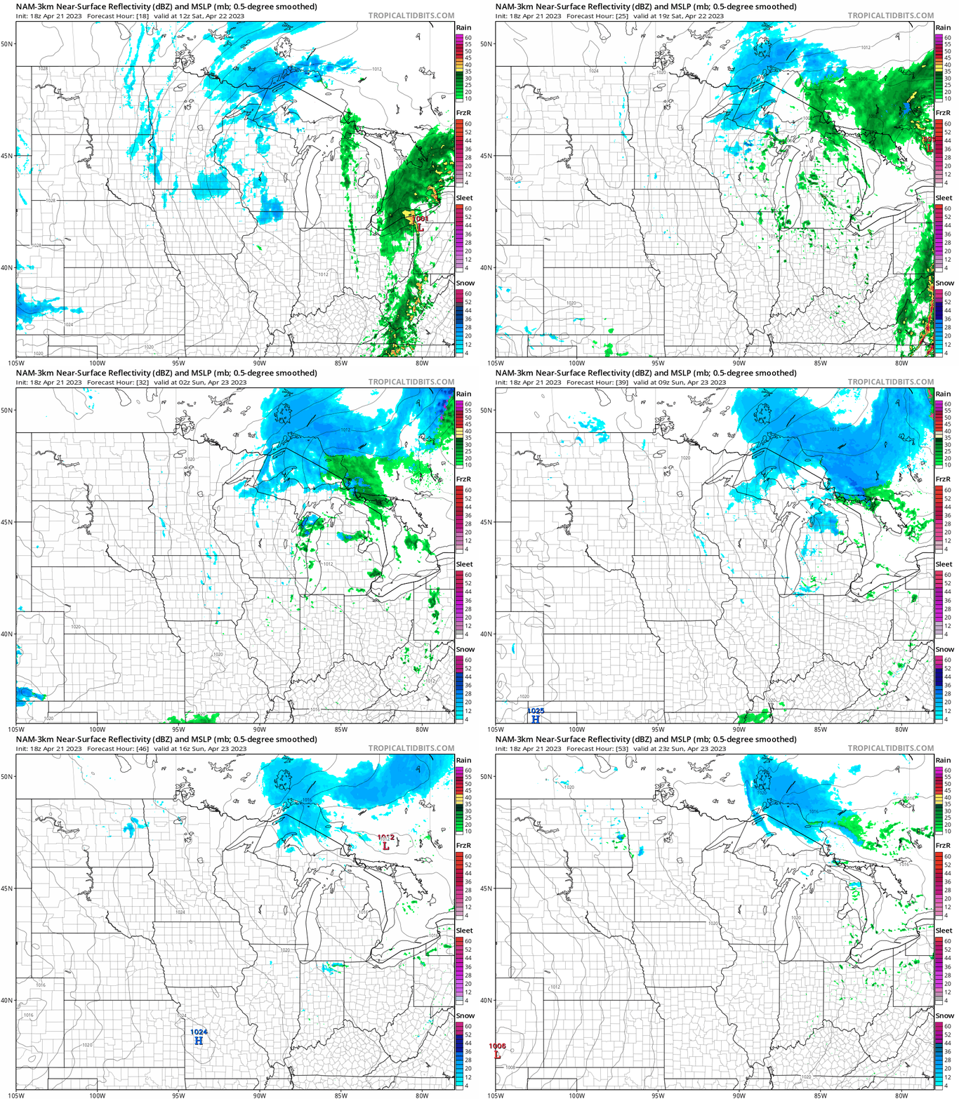
A few spotty light snow showers are possible Saturday morning, then the remainder of the weekend looks dry.
The National Oceanic and Atmospheric Administration’s North American Mesoscale (NAM) forecast model shows the potential precipitation pattern from 7 a.m. Saturday to 7 p.m. Sunday:
Temperature trends
The average April 22 Twin Cities high temperature is 60 degrees. Metro area highs will be around 40 degrees on Saturday.
Much of Minnesota will have Saturday highs in the 30s, with lower 40s in southeastern Minnesota and parts of western Wisconsin:

Saturday will be breezy, then winds lighten up on Sunday.
Sunday highs will be in the 40s in many areas, with some 30s in northwestern Minnesota and in far northeastern Minnesota:

Twin Cities metro area highs are projected to reach 50 degrees on Monday, followed by mid 50s Tuesday, upper 50s Wednesday, around 60 degrees Thursday and then lower 50s on Friday.
River levels

Rivers have already reached flood stage in many parts of Minnesota and western Wisconsin. Rivers will continue to rise in many locations this weekend and into next week.
You can check the river levels at various locations in northern Minnesota and northwestern Wisconsin here.
This is how the linked map looked Friday afternoon:

You can find info on river levels elsewhere in Minnesota and western Wisconsin here.
Here’s how the linked map looked Friday afternoon:

You can zoom in on the linked map page and get detailed info on river levels at a specific location.
I should mention that river levels are measured in relation to the height above a local benchmark. In some locations, river levels are listed in feet above sea level.
You can find info on river levels in eastern North Dakota and northwestern Minnesota here. Here’s how the linked map looked Friday afternoon:

Here’s the hydrograph of recent, current and forecast levels for the Mississippi River at St. Paul:

An additional rise of about 2 feet is expected at that location in the next seven days, reaching 18.8 feet next Friday.
Here are the results of various river levels at the St. Paul gauge:

Here’s the hydrograph of recent, current and forecast levels for the St. Croix River at Stillwater, Minnesota:

A rise of about 7/10ths of a foot is forecast over the next three days, with the river reaching 89.7 feet by Monday night.
Here are the results of various river levels at the Stillwater gauge:

Here are the historic St. Croix River crests at the Stillwater gauge:

Here’s the hydrograph of recent, current and forecast levels for the Red River at Fargo, North Dakota:

A rise of about one and one-half feet is expected at that location over the next couple of days. The river will enter major flood stage this weekend and it’s expected to crest at 31 feet on Sunday.
Programming note
You can hear my live weather updates on MPR News at 7:35 a.m., 9:35 a.m. and 4:39 p.m. each Saturday and Sunday.

