
Cool, bright Tuesday; warmer Wednesday and Thursday; more showers on the way
Partly cloudy skies Tuesday, but still below normal

Go Deeper.
Create an account or log in to save stories.
Like this?
Thanks for liking this story! We have added it to a list of your favorite stories.


We should see more sunshine Tuesday but it will still be cooler than normal. Highs will range form the mid-40s to the low 50s. We’ll be warmer Wednesday and Thursday ahead of more showers late Wednesday and to end the week.
Partly cloudy skies Tuesday with subtle warming trend
We won’t see a big shift in temperatures quite yet Tuesday but it will be brighter overall for most of us. Highs will range from the mid-40s north to the low 50s south which is still about 5 to 10 degrees cooler than normal. There could be yet a few popup, instability flurries or sprinkles in northeast Minnesota in the afternoon.

We’re still on track for warmer temperatures Wednesday and Thursday however. Highs will be in the low 60s for a few spots in southwest Minnesota Wednesday afternoon and we should see more widespread highs in the 60s across central and southern Minnesota Thursday.

Shower chances increase late Wednesday
The first wave of moisture arrives in northwest Minnesota first Wednesday afternoon, bringing rain showers and even snow showers overnight Wednesday night in northeast Minnesota. We’ll see scattered light rain showers south as well overnight Wednesday night. Thursday should bring a break from the showers for most of the state before more arrive in the evening into Friday.
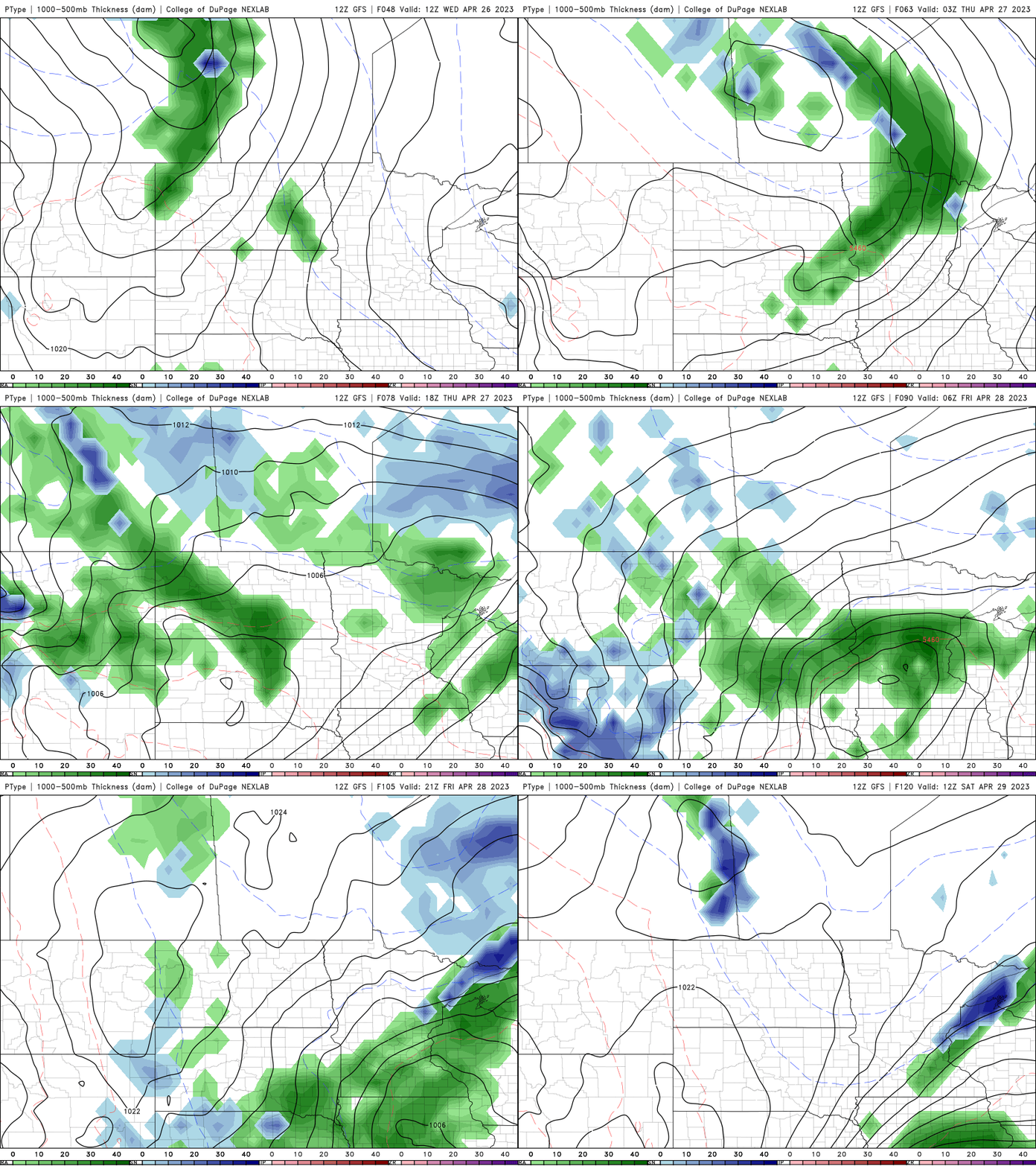
Look for several days of clouds as well, pushing temperatures back down Friday into the weekend.
Turn Up Your Support
MPR News helps you turn down the noise and build shared understanding. Turn up your support for this public resource and keep trusted journalism accessible to all.

