
50s to high 60s Thursday; showers on the way; cooler weekend
Warmer, drier shift next week
Go Deeper.
Create an account or log in to save stories.
Like this?
Thanks for liking this story! We have added it to a list of your favorite stories.


Temperatures will be above normal for a change Thursday. We’ll have a mix of clouds and sun with a spotty shower or two possible during the day. The better chance of showers develops Thursday evening into overnight again. Temperatures will be cooler this weekend.
50s, high 60s Thursday; shower chances later
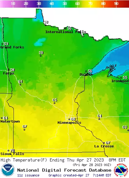
Thursday will be our warmest day of the week with highs in the mid to upper 60s across southern Minnesota and well into the 50s across northern Minnesota. These readings will range from about 5 to 10 degrees above normal as well.
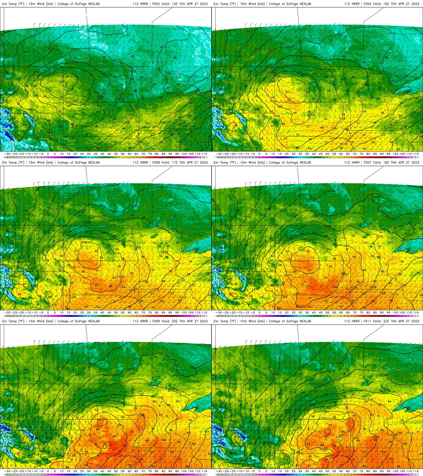
There will be a few spotty showers, especially across central Minnesota Thursday but that chance increases Thursday evening as activity fills in and more showers move in from the west into the overnight.
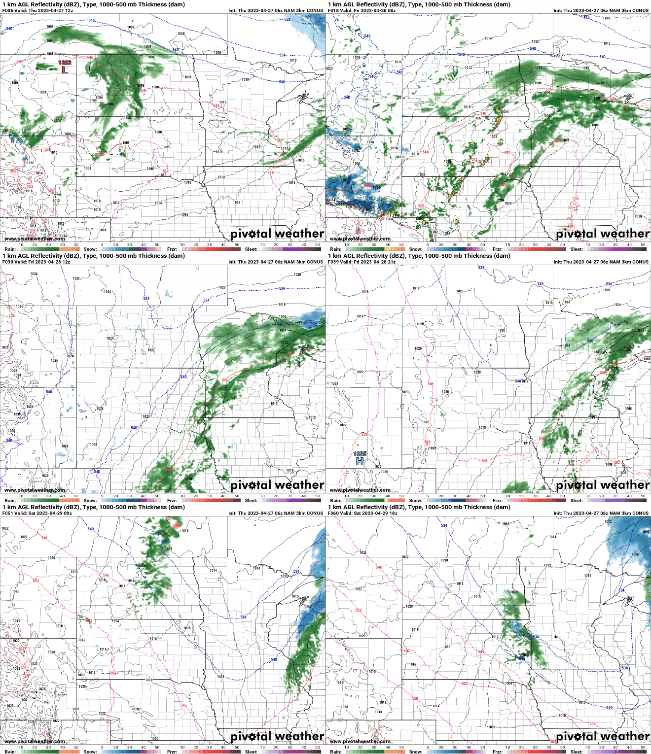
Scattered showers will linger into Friday and the weekend. But no one day will be a total washout, rather there will be occasional areas of scattered showers. Additional rainfall amounts will be heaviest in northeastern Minnesota and northern Wisconsin.
Turn Up Your Support
MPR News helps you turn down the noise and build shared understanding. Turn up your support for this public resource and keep trusted journalism accessible to all.

Temperatures will be dropping back down to cooler readings with highs in the low 50s over the weekend in southern Minnesota and just 40s north.


Warmer, drier shift next week
The familiar pattern of an upper-level trough or cut off low, keeping cold, damp conditions in place over the central United States finally breaks down and shifts east, stalling there next week.
This will allow an upper level ridge to set in bringing drier weather for most of next week. This is welcomed news with high river levels.
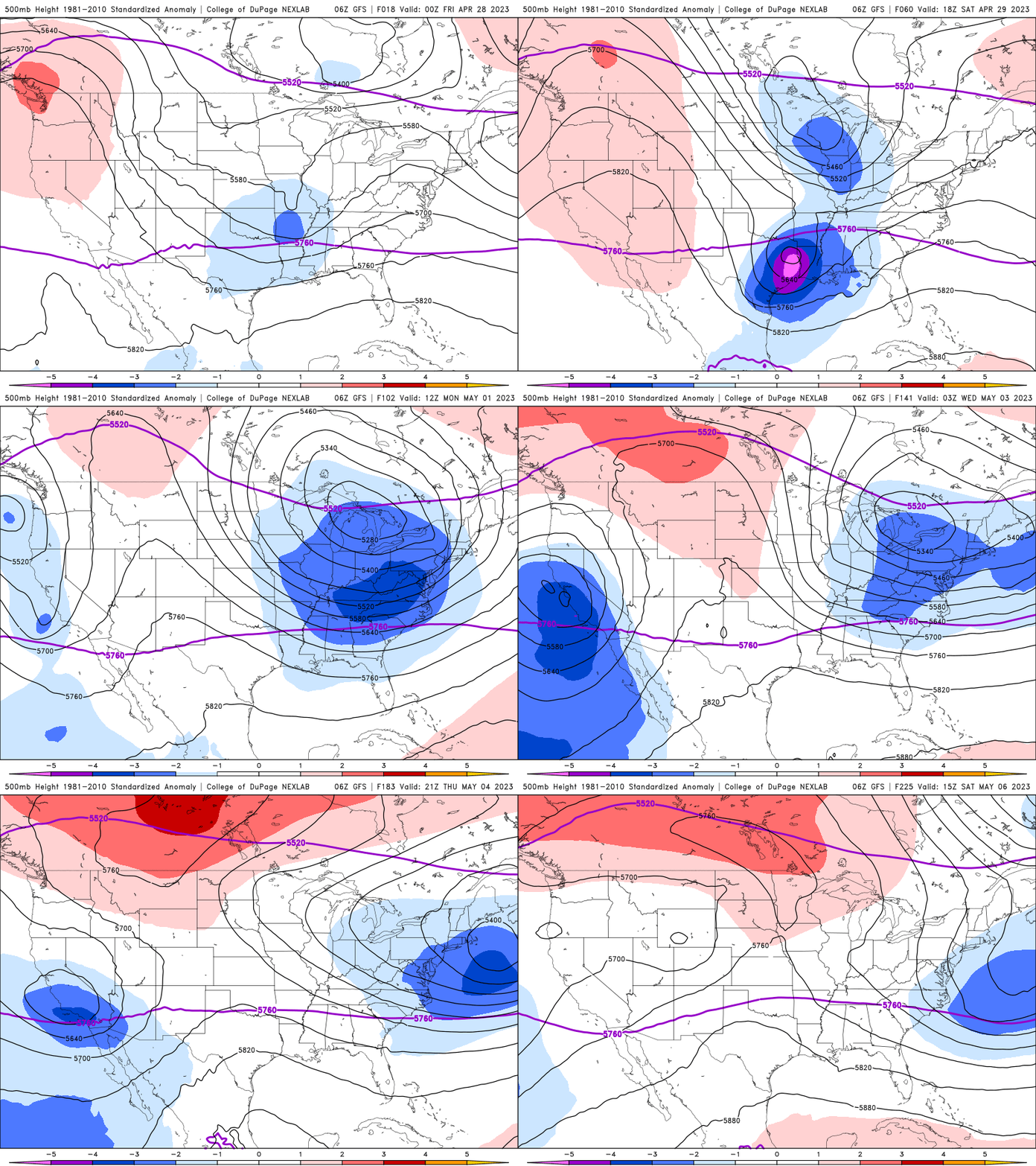
This will also allow temperatures to warm up. Highs could be near 70 by the middle or end of next week.


