
Saturday rain chances highest in afternoon/evening; Scattered t-storms are possible
Spotty morning rain shower chance
Go Deeper.
Create an account or log in to save stories.
Like this?
Thanks for liking this story! We have added it to a list of your favorite stories.


It’ll feel very spring-like today, with near-normal temps and dew points in the 50s.
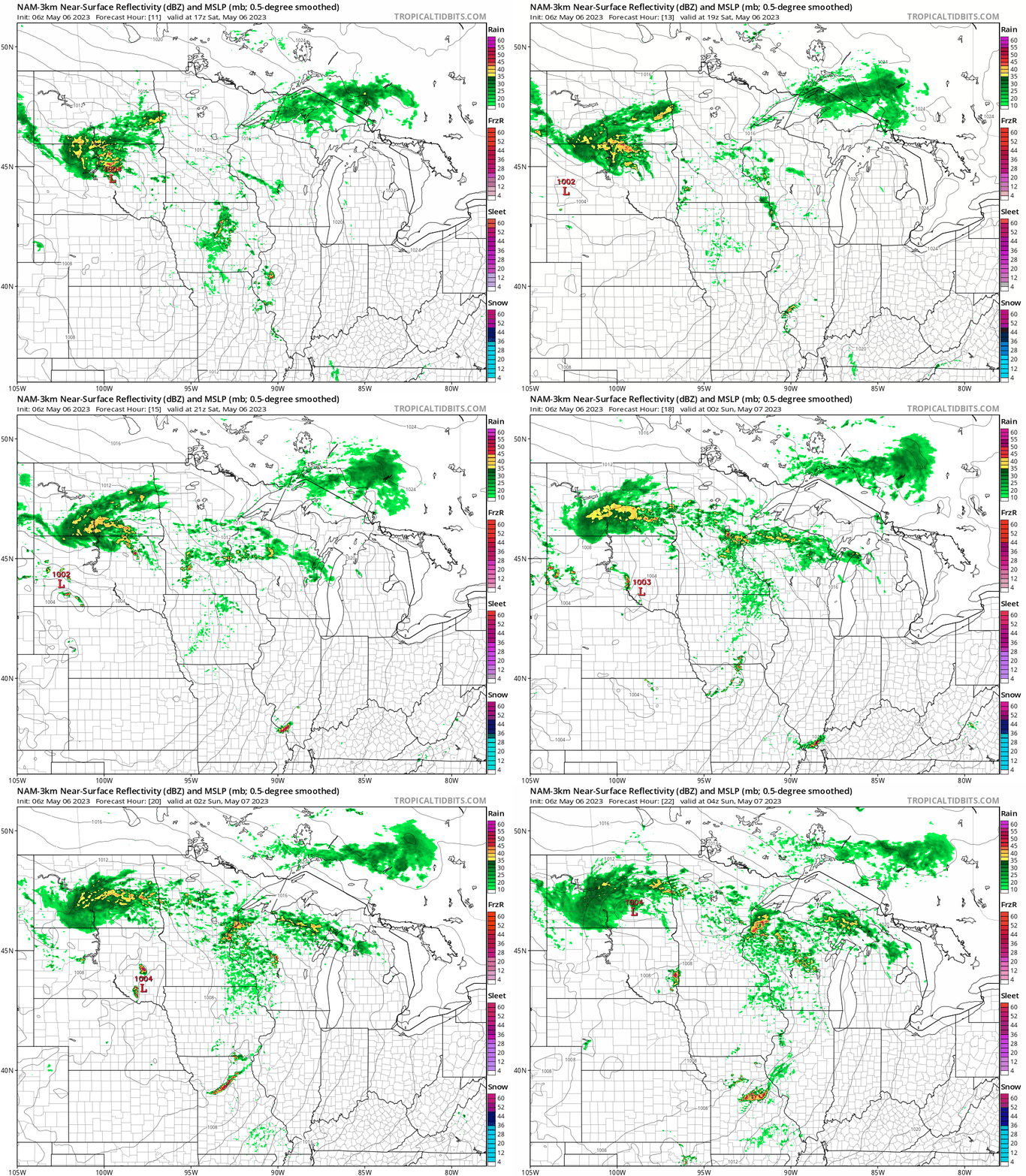
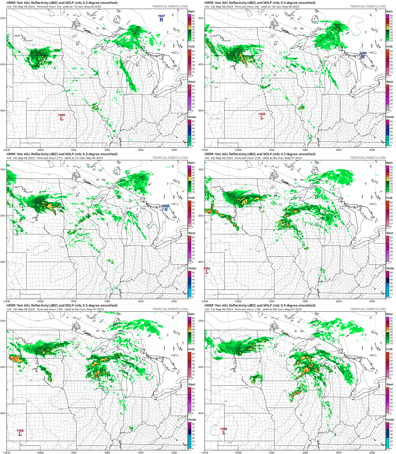
The best chance of rain will be mid afternoon into this evening, but a few very spotty showers are possible this morning.
The National Oceanic and Atmospheric Administration’s North American Mesoscale (NAM) forecast model shows the potential rain pattern from noon Saturday to 11 p.m. Saturday:
NOAA’s High-Resolution Rapid-Refresh model shows the following rain pattern for the same time period:
Turn Up Your Support
MPR News helps you turn down the noise and build shared understanding. Turn up your support for this public resource and keep trusted journalism accessible to all.
An isolated severe thunderstorm is possible this afternoon and evening from the south metro through southern Minnesota, per the latest severe weather outlook from the NWS Storm Prediction Center:

Here are the severe weather categories that area used by the NWS Storm Prediction Center:

You can find updated weather information for Minnesota and western Wisconsin on the MPR News network.
Dense fog advisory
A dense fog advisory continues until 10 a.m. this Saturday in southern St. Louis County plus Carlton County of northeastern Minnesota and Douglas County of northwestern Wisconsin:
URGENT - WEATHER MESSAGE National Weather Service Duluth MN 333 AM CDT Sat May 6 2023 MNZ037-WIZ001-061500- /O.CON.KDLH.FG.Y.0004.000000T0000Z-230506T1500Z/ Carlton and South St. Louis-Douglas- Including the cities of Duluth and Superior 333 AM CDT Sat May 6 2023 ...DENSE FOG ADVISORY REMAINS IN EFFECT UNTIL 10 AM CDT THIS MORNING... * WHAT...Visibility one quarter mile or less in dense fog. * WHERE...In Minnesota, Carlton and South St. Louis County. In Wisconsin, Douglas County. This includes the Tribal Lands of the Fond du Lac Band. * WHEN...Until 10 AM CDT this morning. * IMPACTS...Hazardous driving conditions due to low visibility. * ADDITIONAL DETAILS...Some improvement in visibility will occur late this morning but more dense fog is possible Saturday night. PRECAUTIONARY/PREPAREDNESS ACTIONS... If driving, slow down, use your headlights, and leave plenty of distance ahead of you.
Saturday highs
Saturday highs will be mainly in the 60s in southern Minnesota and west-central/southwestern Wisconsin:

A few spots in southwestern Minnesota could top 70. Much of northern Minnesota will have highs in the 50s, with a few lower 60s in the northwest. There will be some 40s near Lake Superior.
Update
A new Updraft will be posted around 10:30 a.m. today. It’ll include a look at Sunday and the week ahead.
Programming note
You can hear my live weather updates on MPR News at 7:35 a.m., 9:35 a.m. and 4:39 p.m. each Saturday and Sunday.

